Curated OER
50 States: New England States
Students discover where certain states are located and what the look like. They look for their information on a web site. Each student is assigned a state which they must research then present to the entire class.
Computer Science Unplugged
Treasure Hunt—Finite-State Automata
Introduce your class to the concept of finite-state automata with an activity that asks individuals to try to map their way to Treasure Island by taking different routes though an island chain. Each island has two ship sailing...
Curated OER
Texas Commemorative Maps: Honoring Our Past
To celebrate Texas, groups plan and create a commemorative map for a topic or theme in Texas history. The richly detailed plan and the approach could easily be adapted to any state. Samples are included.
Statistics Education Web
The United States of Obesity
Mississippi has both the highest obesity and poverty rate in the US. Does the rest of the data show a correlation between the poverty and obesity rate in a state? Learners tackle this question as they practice their skills of regression....
Curated OER
The Great Military: Map of Texas
The battle at the Alamo may be one of the most famous military campaigns in Texas history, but it is by no means the only one. As part of their study of the military history of Texas, class members research less-well-known sites, locate...
John F. Kennedy Presidential Library & Museum
Red States/Blue States: Mapping the Presidential Election
Young historians investigate how voting patterns have changed by comparing the outcome of the 1960 election to the outcome of the recent election. A creative final assessment has participants making a news show wherein they provide...
National History Day
Why Did the United States Enter World War I in 1917?
World War I was the first major conflict on a global scale. Using primary documents, learners determine why the United States chose to enter World War I when it did. After analytical writing and group research, the causes of America's...
Curated OER
Map Quiz 1
In this map quiz 1 worksheet, learners answer questions relating to geography, not interactively, then scroll down to see the answers.
Curated OER
State Your Business
Second graders conduct research on a selected state in the United States. They read a book and write down interesting facts, conduct Internet research, and create a brochure using Microsoft Office Publisher.
Curated OER
Introduction to the United States Map
Students identify the United States of America and it's states on a map. In this mapping lesson, students examine a globe and find the United States as well as a few land marks (Florida and the Great Lakes). Students then look at a...
Curated OER
Fossil Fuels (Part I), The Geology of Oil
Junior geologists work through three mini-lessons that familiarize them with the formation and location of fossil fuels. Part one involves reading about petroleum and where it comes from via a thorough set of handouts. A lab activity...
Curated OER
N is for Natural State
For any pupils who live in the state of Arkansas, this would be a fabulous educational experience to help them get to know their state better. Through the use of activities in literature, art, mathematics, science, social studies, and...
Curated OER
Mt. Whitney to Death Valley
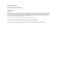
This is an intriguing problem that brings together real-world data, technology, and mathematical problem solving. If visibility wasn't an issue, could you see from the highest point in the lower 48 states, Mt. Whitney, to the lowest...
Curated OER
Understanding Latitude and Longitude
Teaching learners about latitude and longitude can get a little complicated. Present the concept by first representing it as a graph. Just like finding a location on a graph using the x and y-axis, learners will be able to locate items...
Curated OER
USA: Average Precipitation and Temperature Map
In this United States map worksheet, students make note of the average precipitation and temperature in regions of the country.
Curated OER
Capitals, Oceans, And Border States
Students investigate geography by completing games with classmates. In this United States of America lesson, students examine a map of North America and identify the borders of Mexico and Canada as well as the Pacific and Atlantic....
Curated OER
People Change the Landscape
Students examine ways in which humans have brought change to the natural environment. In this ecology and literacy lesson, students listen to the book Island Boy by Barbara Cooney. Students observe and define map-reading vocabulary as...
Curated OER
United States Capital Cities
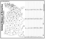
In this identifying the United States Capital cities worksheet, students use a United States map and a list of state abbreviations to write each state' s and the District of Columbia's capital city. Students write 51 answers.
Curated OER
United States Map- Rivers
Students learn about rivers. In this maps lesson, students describe rivers and what human activities take place in a river. Students use a map to locate the rivers in the United States.
Curated OER
The Gold Rush
Learners identify the routes involved in the Gold Rush on a map. In this map skills lesson, students use a United States map to locate the routes used to travel to California during the Gold Rush. Learners demonstrate how to use the map...
Ashbrook Center at Ashland University
The Constitutional Convention
Imagine sitting down with representatives of your school to write a new student handbook. What arguments would ensue? How would compromises be made to finish the project? Scholars research the Constitutional Convention using a directory...
University of Florida
Sailing to St. Augustine
Using a Florida map from 1597, young explorers consider the physical characteristics they would need in a site for a new colony and the resources they would need to survive. After selecting a site, class members research to discover the...
Center for Learning in Action
Density
Explore the concept of density within states of matter—gases, liquids, and solids—through a group experiment in which young scientists test objects' texture, color, weight, size, and ability to sink or float.
Wikipedia
Map of World War II Japanese American Internment Camps
Your learners may be surprised to view the extensive number of Japanese American Internment Camps that existed in the United States during World War II. This map details the area along the Pacific Coast from which people of Japanese...
Other popular searches
- Kansas State Map
- Delaware State Map
- Pennsylvania State Map
- Washington State Map
- New York State Map
- Map State of Washington
- Map of California State
- City State Map
- Louisiana State Map
- State Map of Iowa
- Border State Map
- State Map of Idaho


