Curated OER
Louisiana Outline Map
In this Louisiana outline map activity, students examine political boundaries of the state and the placement its capital city as well as its major cities. This map is not labeled.
Curated OER
Label the Southern States
During your study of the United States, challenge your class to label the seventeen Southern states. Can they do it without the key? The answer sheet is included.
Curated OER
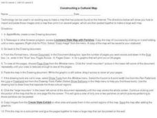
Constructing a Cultural Map
For this constructing a cultural map worksheet, students use cut and paste technology to make a map of Louisiana that has pictures from the Internet.
DocsTeach
Analyzing a Map of the Louisiana Purchase
With the stroke of a pen, Thomas Jefferson roughly doubled the size of the United States. The Louisiana Purchase not only grew the new country, but also it gave rise to the legends surrounding westward expansion and accelerated the...
Curated OER
Mapping America
While learning about the Louisiana Purchase, pupils practice map skills. This motivating lesson has them answer questions about the Louisiana Territory and the United States. It provides a quick and easy way review of skills and the...
Curated OER
Our States, My State
Here is a very nice instructional activity on the shape of the United States, and the shapes of the individual states for your young geographers. They utilize worksheets embedded in the plan to color in a variety of states and to become...
Curated OER
Survey of the Louisiana Purchase in 1815
Students explore the survey of the Louisiana Purchase by creating their own surveying and mapping techniques such as natural maps, pace maps, and orienting. Other students then try to follow the maps.
Curated OER
State to State Scavenger Hunt
In this states worksheet, students utilize the Internet to access one specific website to locate the answers to five fill in the blank statements about the states found on a United States map.
Curated OER
Name the States Worksheet 5
In this name the states worksheet, students examine 6 state map outlines and identify each of them by writing the state names and postal abbreviations.
Curated OER
Poverty Point: A Louisiana Treasure
A well-done and informative presentation, this resource could be used to pique interest in Lousiana's history. This presentation about Poverty Point, a mound created by Native Americans, is a fascinating exploration of this topic. What...
Curated OER
Louisiana State Map
In this map worksheet, students will study a map of the Louisiana. Students will use this map to label and/or familiarize themselves with various aspects of the state.
Curated OER
The Louisiana Purchase: Worksheet
Celebrate the anniversary of one of the United States' most important land acquisitions with a fun worksheet. The class answers five matching questions related to those involved with the Louisiana Purchase and then think about what life...
Curated OER
Louisiana History-Unit 4: Early People of Louisiana and a Meeting of Different Worlds
The Poverty Point Culture of Louisiana is described in detail within four slides of this six-slide PowerPoint. Four detailed paragraphs help describe the economic legacy that existed in Louisiana. A table, map, and photo are included to...
Curated OER
Do You Know Your 50 States?
Learners use the names and abbreviations of the 50 states to label a blank map of the United States.
Curated OER
Did You Know: Facts on Acadians in Louisiana
As an overview of Acadians in Louisiana, this resource could be useful. It could also be used as an example for students designing their own presentations relating to a state. It has an interesting way of presenting information through...
Curated OER
Map Facts Worksheet
In this geography, ecology, and folklife worksheet, students search Louisiana maps of their choosing to discover the factual information required to complete the graphic organizer.
Curated OER
Globe Skills Lesson 6 The Louisiana Purchase
Students explore the Louisiana Purchase territory. In this geography skills lesson, students use map skills in order to plot and note latitude and longitude, measure scale distance, and locate landforms that were part of the Louisiana...
Curated OER
Louisiana
Third graders study factual information about Louisiana including the state flag, bird, tree, and important geographical points using the Internet and maps. They explain the different groups that settled the state in this mini-unit.
Curated OER
Let's Build a Map
Students gain an understanding of maps while studying the map of the Louisiana Purchase and the trail of Lewis and Clark and the Corps of Discovery. They demonstrate understanding of maps by creating a basic classroom map.
Curated OER
Lewis & Clark: The Louisiana Purchase
For this facts about the Louisiana Purchase and the Lewis and Clark expedition online interactive worksheet, students read information and observe a map of the Louisiana Purchase to answer questions showing their comprehension skills....
Curated OER
Louisiana
Students explore traditions of Louisiana. For this culture lesson, students discuss the traditions, food and culture of Louisiana. Students video themselves singing the state song to share with parents.
Curated OER
Louisiana Regional Foodways
Students strengthen their research techniques in locating, selecting, and synthesizing information from a variety of texts, media, references and internet resources to study regional food way traditions in Louisiana. They assess the...
Curated OER
Beyond Louisiana
Students examine the challenges that faced the United States as a new nation, especially those related to exploration, expansion, and international affairs. They study the chronology of events related to the expedition of Lewis and Clark.
Curated OER
United States Map Quiz
In this online interactive geography quiz worksheet, students respond to 50 identification questions about the shapes of countries shown. Students have 5 minutes to complete the quiz.


