Curated OER
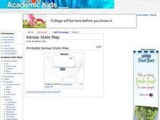
Kansas State Map
In this map of Kansas worksheet, students color and label major cities and physical features of this state. Students also study the location of Kansas in relation to the other states in the U.S. by studying the background map.
Curated OER
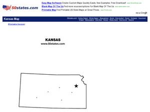
Kansas Outline Map
In this Kansas outline map worksheet, students examine political boundaries of the state and the placement its capital city as well as its major cities. This map is not labeled.
Curated OER
Flower Power
An engaging, multi-session art and science instructional activity awaits your class. Within this instructional activity, you'll find everything you need to implement the plan. They go on a nature walk around their school, and must...
Curated OER
The Kansas State Capitol
Second graders research the Kansas state capitol building. In this historical landmark lesson, 2nd graders explore the Kansas state capitol. Over three days students explore the Governor's office, Senate and House of Representatives, and...
Curated OER
Name the States Worksheet 2
In this name the states worksheet, students examine 6 state map outlines and identify each of them by writing the state names and postal abbreviations.
Curated OER
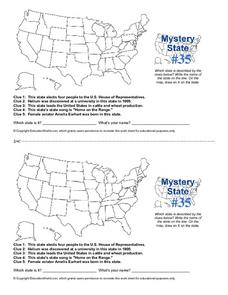
Mystery State #35
In this United States mystery worksheet, students determine which state is described by the 5 clues listed on the sheet and then mark it on the outline map of the United States.
Curated OER
Kansas Clues
Students examine the Kansas state quarter and the Buffalo nickel and look for clue to help them identify why the bison was so important to the Native American. They perform "freeze frames" depicting Native American use of the bison.
Curated OER
Do You Know Your 50 States?
Learners use the names and abbreviations of the 50 states to label a blank map of the United States.
Curated OER
Explorers in Kansas
Fourth graders read cards about the explorers: Coronado, Lewis, and Clark, Pike, and Long. In this influential expeditions lesson, 4th graders describe and observe explorers who came to Kansas. Students locate main reasons and details as...
Curated OER
Where is Kansas?
Students explore U.S. Geography by analyzing a map. For this state vs. country lesson, students utilize a U.S. map and locate the state of Kansas before researching the history and customs of the state. Students collaborate as a class to...
Curated OER
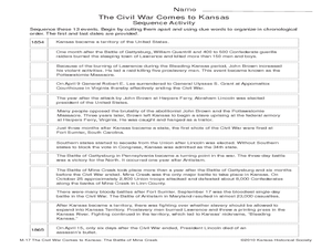
The Civil War Comes to Kansas: The Battle of Mine Creek
Seventh graders explore the impact of Price's Raid and the Battle of Mine Creek. In this American Civil War lesson, 7th graders examine a list of events based on the war in Kansas and then put them in chronological order. Students also...
Curated OER
United States Map Quiz
In this online interactive geography quiz worksheet, students respond to 50 identification questions about the shapes of countries shown. Students have 5 minutes to complete the quiz.
Curated OER
The Notorious Four-Color Problem
Take a walk through time, 1852 to 2005, following the mathematical history, development, and solution of the Four-Color Theorem. Learners take on the role of cartographers to study a United States map that is to be...
Curated OER
States in the USA Quiz
In this online interactive geography quiz instructional activity, students respond to 50 identification questions about the states in the United States of America. Students have 4 minutes to complete the quiz.
Curated OER
Kansas Land
Fourth graders discover the geographic regions of Kansas. In this geography lesson, 4th graders explore the different regions of Kansas and determine how the different geography affects daily life in Kansas.
Curated OER
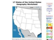
17 states
In this states worksheet, students label states in the United States that are on the west side of the country. Students label 17 states.
Curated OER
States On A Map
Third graders locate the states of Main and Kansas on a map. In this state location lesson plan, 3rd graders read the book Sarah, Plain and Tall and discuss what states she traveled through.
Curated OER
Midwestern States
In this United States geography worksheet, students study the image of the Midwestern states. Student then label the states with the following choices: Missouri, Iowa, South Dakota, Minnesota, Nebraska, Illinois, North Dakota, Kansas,...
Curated OER
The Brief American Pageant: Drifting Toward Disunion
A series of maps take viewers through the Antebellum period in American history. Focusing on the elections of Buchanan and Lincoln, as well as the Southern opposition to secession, the slideshow would make a good companion to a lecture...
K-State Research and Extensions
Water
How are maps like fish? They both have scales. The chapter includes six different activities at three different levels. Scholars complete activities using natural resources, learn how to read a map, see how to make a compass rosette,...
Curated OER
Discovering Prehistoric Trails
Eighth graders examine prehistoric terrain. In this geography lesson, 8th graders discover necessary resources for settlers. Students work in small groups to create a trail crossing the state of Kansas.
Curated OER
1850s: Road to Secession
Detailing the political and social events leading up to the Civil War, this presentation provides students with maps, political cartoons, and photographs to put this time period into historical context. The Presidential Elections of...
American Battlefield Trust
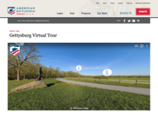
Gettysburg Virtual Tour
Step into one of the most iconic battlefields of the American Civil War with an educational interactive resource. Young historians learn about key moments, locations, soldiers, and turning points in the battle with a clickable map and...
Curated OER
The Oregon Trail
In this Oregon Trail worksheet, students practice their map skills while they explore the states of Oregon, Missouri, Idaho, Nebraska, and Wyoming. Students us a map of the US to plot six points on the map that show the Oregon Trail.
