World Maps Teacher Resources
Find World Maps lesson plans and worksheets
Showing 1,705 resources
Lesson Planet Curated
Unit 1: Introduction to World Geography - The 5 Themes of Geography
The seven resources in the Introduction to World Geography - The 5 Themes of Geography unit are designed to give middle schoolers an overview of what they will learn studying geography. The first lesson focuses on the five themes...
Lesson Planet Curated
Global History and Geography Regents Examinations
Finding tests that assess global history and geography knowledge can be challenging, but here's a resource that solves the problem. Last updated in January 2018, the exams ask scholars to analyze charts, primary sources, and graphic...
Lesson Planet Curated
The Five Themes of Geography
Explore the five themes of geography using materials designed to guide instruction and enhance comprehension. You'll find lesson plans, worksheets, activities, and videos, all of which are bound to boost learner engagement.
Lesson Planet Curated
World Population History
Six lessons challenge 21st-century learners to interpret maps, analyze real-world data sets, and use technology such as GIS to understand key global issues. The lessons, which can be used sequentially as a unit or individually, are...
World Maps Online
Introduction to the World Map
Students identify the differences between maps and globes. In this map skills instructional activity, students are shown a globe and a map and recognize the differences. Students use post-it notes to locate several locations on the world...
Curated OER
A World of Information
Students analyze data and statistics about countries around the world. They read graphs and charts, color a world map to illustrate the top ten statistics about the world, and write a paragraph to summarize their information.
Curated OER
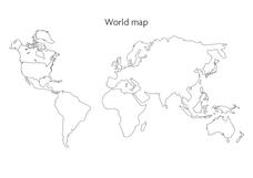
World Map
In this social studies worksheet, students use the unlabeled world map for any geography activity. The individual countries are not marked with border lines.
California Academy of Science
Tropical Belt
Where in the world is the equator? Explore a world map with your class, coloring in oceans, continents, and rainforests while locating the three major lines of latitude: the equator, Tropic of Cancer, and Tropic of Capricorn. Discuss how...
Curated OER
Where in the World is Mrs. Waffenscmidt? # 15
Where can that globe-trotting teacher be? Is your class ready to read an informational passage to find out where Mrs. Waffenschmidt is hiding this week? If they are, then they'll discover she's checking out the Rock of Gibraltar. A great...
Curated OER
Global Connections
An entertaining, and educationally valuable game of "tic-tac-toe" awaits your learners. They earn their "x's" and "o's" by correctly-answering questions on world geography. I've never seen this type of game before, and I believe that...
Curated OER
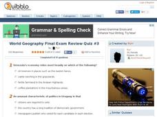
World Geography Final Exam Review Quiz #3
In this world geography worksheet, students respond to 14 multiple choice questions based on their knowledge of the world's places and features. Students may submit their answers to be scored.
Howard Hughes Medical Institute
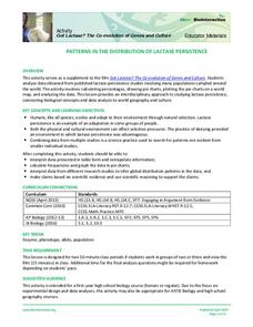
Patterns in the Distribution of Lactase Persistence
We all drink milk as babies, so why can't we all drink it as adults? Examine the trend in lactase production on the world-wide scale as science scholars analyze and interpret data. Groups create pie charts from the data, place them on a...
Curated OER
Lesson Design Archaeology- World Map
Students practice locating positions on the world map. In this map skills lesson, students explore the world map and items such as the compass rose, Equator, mountains, cities, etc. The students practice locating positions on the world...
Curated OER
Investigating the Countries of the World
Explore world geography by creating presentations for different countries around the world. Researchers identify many different countries on a globe and select one for which they will create a presentation. They share their research and...
Curated OER
Physical World Map
In this world map worksheet, learners practice their geography skills as they label the 7 continents and 5 oceans. Teachers may use this physical map for various classroom activities
Curated OER
World Map
In this world map learning exercise, students practice their geography skills as they label the 7 continents and 5 oceans. A word bank in included.
PBS
Make a Balloon Globe
"We've got the whole world in our hands," is what your students will be singing after completing this fun geography activity. Using the included templates for the seven continents and a balloon, they create their very own globes.
Rock A Lingua
Países De Habla Hispana (Spanish Speaking Countries)
There are 21 countries in the world where Spanish is a primary language—can you name them all? Explore a vivid video that plays a catchy song over a world map to illustrate where each country is located.
Curated OER
Geography A to Z: The Letter G
Using clues to answer questions is a way to increase deductive reasoning skills. Kids answer seven geography clues with answers all starting with the letter G. A great way to test world geography or warm up the class.
Curated OER
The Earth's BIG Features
Your students will enjoy the vivid pictures and interesting facts about world geography, in this presentation. Depicted are several major geographical features found around the world and a description of each.
Curated OER
Mapping the News
Students explore cartography. In this map skills and map making activity, Students work in groups to create wall size world maps including legends, compass roses, latitude and longitude, and physical features. Students...
Curated OER
Identifying Biomes
For this biomes worksheet, students will use an atlas to find the location of 12 cities listed on a graph onto their world map. Then students will use the cities' annual precipitation to figure out what biomes that city is found.
Curated OER
World Map and Globe
Students locate and identify continents and countries. In this world map lesson, students locate and identify one country on each continent.
Curated OER
Oh! The Places I CAN See!
Students explore landmarks around the world. In this world geography and technology lesson, students view world landmarks using a webcam. Students take a virtual field trip during which they zoom in and manipulate three dimensional...
Other popular searches
- World Outline Maps
- Blank Maps of World
- World War 1 Maps
- Blank World Outline Maps
- World War Ii Maps
- Maps World Deserts
- Maps of the World
- World Geography Maps
- World Religion Thematic Maps
- Mental Maps World
- World War I Maps
- Maps of World War Ii


