Curated OER
A More Perfect Union: The Story of Our Constitution
Sit back, relax, and transport to 1787! This lesson on the Constitution begins with guided imagery of the Constitutional Convention. The class reads A More Perfect Union: The Story of Our Constitution in an...
Teach Engineering
What's Wrong with the Coordinates at the North Pole?
Here is an activity that merges technology with life skills as individuals use Google Earth to explore the differences between coordinate systems and map projections. The self-guided worksheet is the fourth segment in a nine-part unit....
Balanced Assessment
Ford and Ferrari
Which is faster, a Ford or a Ferrari? The short assessment has pupils analyze graphs to determine the rates of change between the two. Individuals interpret the rates of change within the context of speeds of the cars and develop a map...
Advocates for Human Rights
Who are Immigrants?
What do Jerry Yang, Patrick Ewing, John Muir, Charlize Theron, Peter Jennings, and Saint Frances X Cabrini all have in common? They are all immigrants to the United States. Famous and not-so-famous immigrants are the focus of a resource...
Curated OER
From Sea to Shining Sea
Students determine the top 5 commodities for each state. In this agricultural commodities instructional activity, students label a map of the United States with the state capitals and the top 5 agricultural commodities for each. They...
Annenberg Foundation
The New Nation
The conclusion of the American Revolution brought about a new conflict—choosing the stye of government for the newly formed United States. Using the views of both Federalists and Anti-Federalists, learners work in pairs and groups to...
Curated OER
The Era of Good Feelings
Setting the context for the first part of the 19th century, the slides presented here display the "Era of Good Feelings," including the presidencies of Monroe and Adams. Maps and photographs help students to contextualize the concepts of...
Advocates for Human Rights
Refugees and Asylum Seekers
To gain a deeper understanding of the plight of refugees and asylum seekers, class members read stories written from the point of view of an emigrant, map the individual's journey, and note the human rights affected by each stage of the...
PBS
Working with Coordinate Planes: Activities and Supplemental Materials
Seven activities make up a collection of supplemental materials to reinforce graphing on a coordinate plane. Worksheet objectives include plotting coordinates within single and four quadrants, measuring straight and...
Annenberg Foundation
A Nation Divided
Can a presidential election cause a civil war? Learners research the events surrounding the presidential election of 1860 in a lesson that explores America's history. Using maps, videos, and primary sources, they uncover, brainstorm, and...
American Battlefield Trust
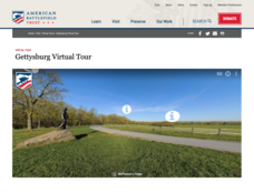
Gettysburg Virtual Tour
Step into one of the most iconic battlefields of the American Civil War with an educational interactive resource. Young historians learn about key moments, locations, soldiers, and turning points in the battle with a clickable map and...
Curated OER
State Partners
Students practice locating the 50 states on the US map, and move as a "team" throughout the general space.
Curated OER
Searching the Net
Students create a Native American Nation flip book. In this Native American lesson, students choose one of four Native American Nations: The Iroquois, Hopi, Seminoles, Sioux. They research them on the Internet using teacher given...
Curated OER
Mapping the Human Movement
Learners research data on African-American emigration, place the data in a chart and create a human movement map. They also create another map using research on current immigration information.
Curated OER
These Maps are for the Birds
Students identify and study New York State Breeding Bird Atlas maps to learn where different bird species nest and how their distributions have changed over time. They also identify how maps serve as representations of a geographic...
Curated OER
Lesson 2: Mapping Our Home
Students recognize the importance of community participation in the census. In this U. S. Census lesson plan, students use map-reading skills to find answers and learn the difference between senators and members of Congress.
Curated OER
Data Comparison And Interpretation: North Korea, South Korea, And the United States
Ninth graders brainstorm "what they know about North Korea and South Korea." They determine the approximate distance from the United States to North and South Korea and create a graph comparing the birth rates, death rates, infant...
Curated OER
Map Your State: Regions of Arizona
Fourth graders define vocabulary and locate physical features on maps. In this mapping lesson plan, 4th graders explore regions of Arizona through landforms found on topographic maps. Students research the history and culture...
Curated OER
Africa Capitals Map Quiz
In this online interactive geography quiz worksheet, students examine the map that includes 53 African countries. Students match the names of the countries to the appropriate locations.
Curated OER
Ancient Greece: Athens as a City State
Sixth graders find Greece on the map and recognize how the geography of Greece was important in its development. In this ancient Greece lesson, 6th graders research Greece and compare to the civilization of ancient Egypt. Students answer...
Curated OER
The Rise of the City States in Greece
Sixth graders examine Ancient Greece and its development of democracy. In this Greek History lesson, 6th graders explore the rise of city-states in Greece and its overall effect on the development of democracy. The class continues with...
Curated OER
Activity on United States Moon Landing: Apollo 11
Students use the World Wide Web to access additional information needed to complete a set of questions. They demonstrate an understanding of latitude and longitude by interpreting a lunar map.
Curated OER
Map of Pennsylvania's Waters
In this labeling bodies of water in Pennsylvania worksheet, students observe a map outline of the state with water sources and use the word bank of names of creeks, lakes, reservoirs, and rivers to identify them. Students label 21 bodies...
Curated OER
The Four Corners Region of the United States Cultures, Ruins and Landmarks
Students who live in the inner city are introduced to the four corners region of the United States. In groups, they examine how the region differs compared to where they live and their culture. They develop maps of the area and locate...
Other popular searches
- Kansas State Map
- Delaware State Map
- Pennsylvania State Map
- Washington State Map
- New York State Map
- Map State of Washington
- Map of California State
- City State Map
- Louisiana State Map
- State Map of Iowa
- Border State Map
- State Map of Idaho


