Corbett Maths
Enlargements with Fractional Scale Factors
Enlargements make it bigger, right? A video shows viewers how to perform a basic dilation with a fractional scale factor. They learn how to use the scale factor to find the location of the transformed vertex by multiplying the horizontal...
Teach Engineering
Using Map Scales to Figure Distances and Areas
The asteroid is getting closer and the question is whether the state of Alabraska is large enough for the shelter calculated in the previous activity. Teams determine the scale of their project and then use the scale on the map to...
Curated OER
Proportions and Scale Factor for Measurement
Learners explore the concept of proportion. In this proportion lesson, students use google maps to find the distance the their school is from home. Learners discuss what a scale factor is through teacher led discussion. Students...
PBS
Map a Model Solar System
Creating a solar system map is a snap thanks to a hands-on activity! Science scholars explore the solar system by building it wherever they choose during an interactive from PBS's Space series. Users pick both the location and scale for...
Exploratorium
Measuring and Mapping the Playground
The school playground is a great place to learn about math. Pupils measure the dimensions of a playground using baby steps and individual strides. They use their measurements to create a scale drawing of the playground by applying an...
Curated OER
Scale factors: Ratios and Proportions
Students create building and models using scale factors. In this geometry lesson, students apply the properties of ratio and proportion to solve problems. They identify the means and extremes property of cross multiplication.
Curated OER
Solve for Scale Factors Using Proportions
Eighth graders solve problems using proportions with scaled drawings. They work with maps and blue-prints discussing scales and plans and examine different polygons and figure out the scale factors or proportions they have been changed by.
Journey Through the Universe
A Scale Model Solar System
Between the time scientists discovered Pluto and reclassified it as a dwarf planet, it did not even make one full revolution around the sun. In two activities, scholars investigate scale models and their properties. Pupils find that it...
EngageNY
How Do Dilations Map Angles?
The key to understanding is making connections. Scholars explore angle dilations using properties of parallel lines. At completion, pupils prove that angles of a dilation preserve their original measure.
Curated OER
Drawing to Scale
Students examine the process of drawing a picture to scale. They analyze and discuss real-life blueprints for a house, and create a scale drawing of an original invention using calculators and rulers.
Curated OER
Scale Factors
In this scale factors worksheet, 6th graders solve 10 different problems that include types of scale factors. First, they determine the missing dimensions in each problem. Then, students round their responses to the nearest tenth before...
Curated OER
Super Size It, Please!
Pupils take photos from a given distance and determine the height of the person using a scale factor. Pupils calculate the ratio of student actual height to student photo height. They take pictures from 3 different distances to see if...
EngageNY
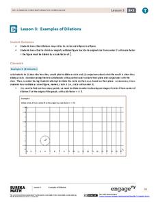
Examples of Dilations
Does it matter how many points to dilate? The resource presents problems of dilating curved figures. Class members find out that not only do they need to dilate several points but the points need to be distributed about the entire curve...
Curated OER
Exploring Biomes Lesson 4: Mapping Arizona
Once junior ecologists are familiar with Earth's major biomes, they hone in on Arizona's biomes. Using a website about Arizona's natural resources, learners will identify biotic communities. Beautiful maps and worksheets are provided for...
Curated OER
Exploring Arizona's Biotic Communities Lesson 1: Mapping Biotic Communities
As part of a unit on Arizona's biotic communities, young ecology learners create a map. They describe how humans and animals adapt in their habitat. They take notes and create graphic organizers from articles they read. Beautiful maps,...
Curated OER
Maps
Students figure out the mileage from one state to another using a map. In this map instructional activity, students look at the scale factor and turn it into a fraction. They measure the distance between two cities and use the proportion...
WindWise Education
What Factors Influence Offshore Wind?
What is that out in the water on the horizon? Teams work together to study the coastline using maps to determine the best and worst locations to place an offshore wind farm. The teams then build a scale model wind farm to see what it...
EngageNY
How Do Dilations Map Lines, Rays, and Circles?
Applying a learned technique to a new type of problem is an important skill in mathematics. The lesson asks scholars to apply their understanding to analyze dilations of different figures. They make conjectures and conclusions to...
EngageNY
How Do Dilations Map Segments?
Do you view proofs as an essential geometric skill? The resource builds on an understanding of dilations by proving the Dilation Theorem of Segments. Pupils learn to question and verify rather than make assumptions.
101 Questions
Neptune
Examine an innovative approach to a large-scale model. Pupils across the state of Maine teamed up to create a model of the solar system that spans 40 miles. Put thinking skills to work within your classes as they make the calculations to...
Curated OER
Using Local Geography to Make Maps
Students research, create, and present a scale representation of the county in which they live.
Mathed Up!
Enlargements
Make enlargements with and without centers. Pupils work through seven problems dealing with dilations or enlargements. The first couple items are strict enlargements without centers, while the others have centers. Class members also...
Curated OER
River Run Through It
With vocabulary lists, worksheets, and more, this lesson sets learners on an exploration of the Hudson River area. They read an essay about the area, analyze a relief map of New York State, and complete a worksheet.
Curated OER
Isoseismal Maps
Students examine the difference between magnitude and intensity in earthquakes. They complete map work and write a first hand account of a person living in each level of intensity on the Modified Mercalli Scale.


