Teach Engineering
Using Map Scales to Figure Distances and Areas
The asteroid is getting closer and the question is whether the state of Alabraska is large enough for the shelter calculated in the previous activity. Teams determine the scale of their project and then use the scale on the map to...
Museum of Science
Make a Map
It's important to know the final destination. Scholars first measure distances in a region of interest using a standard measuring device or by counting steps. They then use an appropriate scale and graph paper to create a map of the...
Curated OER
Designing a Hiking Trail
Put your students' map skills to the test with this engaging cross-curricular project. Given the task of developing new hiking trails for their local community, young cartographers must map out beginner and intermediate...
Curated OER
Those Who Have Come Before Me
Class members are transformed into explorers as they work in groups to locate hidden items and map their journey along the way. They then leave clues for other groups of learners to follow, and ultimately discover how past explorations...
K-State Research and Extensions
Water
How are maps like fish? They both have scales. The chapter includes six different activities at three different levels. Scholars complete activities using natural resources, learn how to read a map, see how to make a compass rosette,...
Laboratory for Atmospheric and Space Physics
A Classroom Solar System
Create a scaled model of our solar system in your classroom! Scholars work collaboratively to build paper mache planets and hang them in their proper position to showcase each planet's location in the solar system.
Rainforest Alliance
Knowing the Essential Elements of a Habitat
To gain insight into the many different types of habitats, individuals must first get to know their own. Here, scholars explore their school environment, draw a map, compare and contrast their surroundings to larger ones. They then...
University of Wisconsin
What’s a Square Foot Anyway? Laying Out the Design Plan
Clever! Participants don square-foot cardboard shoes to mark out the rain garden plot that they have spent the last few weeks designing. In this way, they are practicing scale modeling as well! Note that this activity is part of a unit,...
Oregon State
World Map of Plate Boundaries
Young geologists piece together the puzzle of plate tectonics in an earth science lesson. Given a physical map of the world, they search for land formations that indicate the location of different types of plate boundaries.
NASA
How Far Away Is Space?
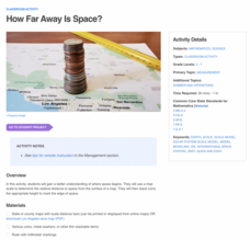
Space is about 60 miles from the surface of Earth. Pupils make calculations to model that distance by stacking coins the appropriate height using scale. They then explore the distance to objects in space such as satellites and the space...
Teach Engineering
Identifying Possible Underground Cavern Locations
Teams continue with the Asteroid Impact challenge and determine possible locations to construct their underground shelters. Participants cut scale area models of their shelters from paper and place them on the map to find locations...
National Nanotechnology Infrastructure Network
What’s In Your Neighborhood?
Chart your way to an understanding of nanoscale. Using a Google map, learners estimate a radius around their location of 1,000 and 1,000,000 meters. Predicting what 1,000,000,000 meters would look like takes them off the charts!...
Agriculture in the Classroom
Pumpkins... Not Just For Halloween
Celebrate fall with four pumpkin themed hands-on activities! After learning about pumpkins, scholars complete two activity sheets that reinforce estimation and word problems. They then plant pumpkin seeds and bake a pie in...
Teaching Tolerance
Identity Self-Portraits
What symbols represent you best? Individuals consider how they would draw peers using symbols about their identities with an interview and art activity. After conducting interviews and portraits, the art makes a great centerpiece for...
Curated OER
3D Textured Globe
The earth, our home planet, and the star of Earth Day celebrations everywhere! Celebrate Earth Day or examine Earth's place in the solar system, with a fun and easy craft, perfect for children nine and up. Paper mache ornaments, paint,...
Howard Hughes Medical Institute
Measuring Biodiversity in Gorongosa
Take your biology class' understanding of biodiversity to a whole new level! Ecology scholars use data to calculate three different diversity indices based on the organisms in the Gorongosa National Park. The four-part activity uses an...
Teaching Tolerance
Community Mural / Poster Campaign
Every piece matters. A creative lesson provides an opportunity for scholars to create murals or posters that represent their views on social justice. Academics work on smaller posters or pieces of a mural that will ultimately be...
It's About Time
Volcanic Hazards: Airborne Debris
Pupils interpret maps and graph data related to volcanic ash. Then they analyze the importance of wind speed and the dangers of the ash to both life, air temperature, and technology.
University of Wisconsin
Follow the Drop
Young surveyors look for patterns in water flow around campus. Using a map of the school (that you will need to create), they mark the direction of the path of water. They also perform calculations for the volume that becomes runoff. The...
CSI Crime Lab: Classroom Edition
Participants use their observation skills, communication skills, and reasoning skills to perform forensic tests and solve a crime. This series of activities provides a first-hand (but scaled-down) introduction to careers in Forensic...
Curated OER
Classroom Supplies
Challenge young mathematicians to buy classroom supplies by staying within the means of a $1,000 budget. The mathematical activity provides learners with the opportunity to decide what items from the supply list would benefit a class of...
Teaching Tolerance
Community Puzzle Mural
Every piece of the puzzle is important. A lesson gives individuals the opportunity to create artwork that spreads a message of inclusion and tolerance. Class members work in teams to create pieces of the mural that form a larger picture....
Teaching Tolerance
Identity Portraits
When you look at me, what do you see? Young learners answer this question by creating a portrait that reflects the identity of one of their peers. First, class members create interview questions. Then, they interview classmates to...
Curated OER
The Big Apple
This lesson has various activities that can be done simultaneously in groups or one at a time with the entire class. The activities center around New York and apples.


