Curated OER
A Map Mystery
Second graders solve a map mystery. In this technology lesson plan, 2nd graders develop an awareness of maps and the symbols associated with maps as they the "Neighborhood Map Machine."
NASA
Hurricanes and Hot Towers with TRMM
Take cover because a wild presentation on hurricanes is about to make landfall in your classroom! An outstanding PowerPoint presentation is the centerpiece of this lesson. Not only does it provide information and photographs, but several...
Curated OER
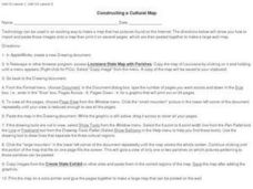
Constructing a Cultural Map
In this constructing a cultural map worksheet, students use cut and paste technology to make a map of Louisiana that has pictures from the Internet.
Curated OER
Finding Your Way Around the World
Students plan a trip around the world and create a PowerPoint presentation of the journey. In this map, atlas, and technology instructional activity, students plan a trip around the world in which they avoid using an airplane. Students...
Statistics Education Web
The United States of Obesity
Mississippi has both the highest obesity and poverty rate in the US. Does the rest of the data show a correlation between the poverty and obesity rate in a state? Learners tackle this question as they practice their skills of regression....
Space Awareness
A View From Above
Analyzing and interpreting satellite data takes knowledge and patience. Through a detailed lab investigation, young scholars learn the process of analyzing this data. They use technology to create color images and maps from real...
Curated OER
The Case of Vanishing Farmland
High schoolers consider decisions about how to use resources that are in short supply. Students role-play different perspectives in a land-use simulation, and examine land use issues around the world. This interesting lesson sheds light...
Curated OER
Map the Civil War
Students explore the Civil War through original maps. In this mapping lesson, students calculate distance and show it on an original map. Students examine the type of landscape and its landmarks and draw symbols on the map.
Global Oneness Project
The Value of Ancient Traditions
Imagine having to give up cell phones, computers, and TV? What would be lost? What gained? An examination of the Drokpa, a nomadic people who live in the grasslands of Tibet, provides class members an opportunity to consider how access...
Curated OER
Second Graders on the Map
Second graders explore the various types of maps. They examine the differences between street maps and aerial photographs. Students identify various features on each map. They use cardinal directions and the compass rose. They write...
Curated OER
Time for Technology Glyphs
Students create a time for technology glyph using Kidpix4. They complete a circle map on things they like to do on while on the computer and write about their favorite thing to do while on a computer.
Curated OER
MAKING CONNECTIONS WITH MAPS
Students define choropleth map. They construct a choropleth map. They interpret a choropleth map. They present geographic information.
Curated OER
Weather, Data, Graphs and Maps
Students collect data on the weather, graph and analyze it. In this algebra instructional activity, students interpret maps and are able to better plan their days based on the weather reading. They make predictions based on the type of...
Curated OER
TE Lesson: Habitat Mapping
Students examine the current technologies used in mapping resources in the marine environment. They look at remote sensing, sounding, and underwater vehicles. They examine image from the benthic habitat produced by the GIS in order to...
Alabama Learning Exchange (ALEX)
Sonar Mapping of the Ocean Floor
Eighth graders participate in an experiment that emulates a sonar signal bouncing off the ocean floor. They determine how the ocean floor is measured by the length of time it takes for the sonar signal to return. They work with a wooden...
Curated OER
Map Skills: Explorers, Continents, and Oceans
Third graders use a software program to make and label a map of the world. On the map, they locate the seven continents, oceans and the countries of Europe. They also draw the routes of Christopher Columbus, Juan Ponce de Leon and...
Curated OER
What in Our World Affects the Way People Live
Sixth graders study various maps that show geographical features and population. They compare the maps and make inferences about how various geographical features influence the population and human activities of an area.
PBS
Inspector Detector
How do spacecraft detect magnetic fields? The fourth installment of a five-part unit has learners develop a device with magnets that allows for the detection of magnetic fields. They use a map of an imaginary planet to try out their...
Facebook
Public Wi-Fi
Sometimes free Wi-Fi comes with a hefty price tag! Networking novices examine the components of a Wi-Fi network during a digital citizenship lesson from an extensive series. Groups work together to map out a day's worth of Internet...
Teach Engineering
Air Under Pressure
Introduce your class to air masses and how they affect the weather with a lesson that focuses on the differences between high and low air pressure systems. The class explores actual weather data using archived weather data.
Code.org
Binary Numbers
All you need is a zero and a one. Build pupils' understanding of binary values and number systems to gain familiarity with binary numbers. Using a hands-on activity and technology, scholars learn how the binary system works and its...
US Navy
The Science of Diving
Introduce gas laws using the popular topic of SCUBA diving. This activity makes a connection between the gas laws and the effect of pressure and temperature changes during diving. Young engineers complete introductory experiments to...
Curated OER
Land Use Over Time
Students view aerial photos and topographic maps of their local area. They compare and contrast major land use patterns over time by comparing these images to maps that are at least 50 years old. They analyze them using the four land use...
Curated OER
Map Studies
Students study maps and use web based activities to develop their mapping skills. In this mapping skills lesson, students use the internet to define cartography they make a list of information regarding a typical road map and explain the...


