New York State Education Department
US History and Government Examination: June 2010
Just how successful were the reform movements of the ninteenth and twentieth centuries? Using documents ranging from the writings of Mother Jones to the marriage vows of Lucy Stone, individuals consider the question in a scaffolded...
New York State Education Department
Global History and Geography Examination: June 2011
People in Ukraine, Rwanda, and Cambodia have all faced challenges to their human rights and even genocide. Using primary and secondary sources, scholars evaluate these challenges and the international community's role in them. The...
Carolina K-12
Colonialism and American Foundations Sample Test Questions
What was the main cause of European colonization in America? How did Thomas Paine's Common Sense play a role in the establishment of the United States? What was the trans-Atlantic slave trade? These are just a few of the many questions...
PBS
Make a Balloon Globe
"We've got the whole world in our hands," is what your students will be singing after completing this fun geography activity. Using the included templates for the seven continents and a balloon, they create their very own globes.
Social Skills Central
Photo Cartoons: Being Polite
Have you ever been left out of plans your friends were discussing? This photo cartoon will help your learners recognize that being polite can go beyond just saying please and thank you by making sure others feel included and...
Thoughtful Education Press
Personal Narratives: Learning from Lessons Life Teaches Us
"First Appearance," Mark Twain's tale about overcoming stage fright, serves as a model of a personal narrative and gets young writers thinking about milestones in their own lives. After examining student models and considering the...
101 Questions
Neptune
Examine an innovative approach to a large-scale model. Pupils across the state of Maine teamed up to create a model of the solar system that spans 40 miles. Put thinking skills to work within your classes as they make the calculations to...
Reading Through History
The Proclamation of 1763
The French and Indian War concluded with an important proclamation—that is, The Proclamation of 1763. Scholars read about the policies in the document and how the different sides of the French and Indian War reacted. Following, they...
Newsela
Understanding "A Long Walk to Water"
What is the secret to success? Scholars use close reading of a variety of articles to determine characteristics of people that overcame hardships to become successful. While reading, pupils annotate their copies, make claims, and...
National Wildlife Federation
Go with the Flow
The quality of a watershed has a direct impact on the community it services. Learners study their own watershed using a topographical map. They recreate the watershed components using colored pencils to track the upstream and downstream...
Super Teacher Worksheets
My Explorer Report
This is the perfect resource to accompany your class project on famous explorers! Learners detail basic information about their chosen explorer, his/her main events of exploration and means of transportation, and finally,...
CK-12 Foundation
Location on the Earth: Longitude and Latitude
To what degree do learners understand coordinates? Get them some practice in Yosemite National Park in a simple, fun interactive. Pupils explore a map and locate coordinates of popular sights within the park, then answer questions...
University of California
Anti-Communism at Home
Have you ever been accused of something without cause? The sixth installment of an eight-part series asks scholars to create a museum exhibit on the anti-communist activities in the United States at the start of the Cold War. To make...
Montana State University
Who’s on Top?
What's it like to climb Mount Everest? An educational resource encourages an in-depth knowledge of Mount Everest's scientific missions through a variety of activities, including an analysis of maps, a KWL chart, videos, a simulation, and...
New York State Education Department
US History and Government Examination: August 2016
Multiple-choice and essay questions test comprehension, writing ability, and skills with primary source analysis. The comprehensive exam covers many different subjects including the United States census, Constitution, and important...
Describing Egypt
Ty Mastaba
Many know the beauty of a pillared hall, but what makes those from ancient Egypt so breathtaking? An eye-catching resource takes viewers on a journey through the Ty Mastaba to discover the importance of pillars to architecture. They see...
National Endowment for the Humanities
Empire and Identity in the American Colonies
The American Revolution was born out of a European conflict that spilled over into North America—and the documents prove it! Using primary sources from the era of the French and Indian War, including British plans to try to unite its...
Angel Island Immigration Station Foundation
How Do Pictures Tell the Story of Angel Island?
Young historians learn more about the history of Angel Island Immigration Station through their analysis of primary source images. Guided by a list of inferential questions, scholars learn how to make and record observations on a...
NASA
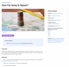
How Far Away Is Space?
Space is about 60 miles from the surface of Earth. Pupils make calculations to model that distance by stacking coins the appropriate height using scale. They then explore the distance to objects in space such as satellites and the space...
Anti-Defamation League
Viewing History from Multiple Perspectives
Celebration or protest song? The full text of Woody Guthrie's "This Land is Your Land" opens a study of the Lewis and Clark Expedition, the Louisiana Purchase, and Western Expansion from various perspectives. Middle schoolers examine...
Curated OER
Mapping It Out: A Post-Trip Lesson
Students make a rough map of Yosemite and add elevations to the map. They are encouraged to bring photos from the trip and add them to their map.
Curated OER
Drawing a Bird's Eye View Map
Learners make birds-eye view maps and place the compass rose on the map.
Curated OER
Treasure Hunt
Students find lost "treasure" using a treasure map after being shown a map that you have created where terms and symbols are discussed. The class is divided into small groups where they locate your treasure and then read a section from...
Curated OER
Summertime Travel
Third graders write about a summer event they participated in. For this paragraph writing lesson, the teacher models how to write about a place they have visited. Students then write their own paragraphs. Students will point out on...
Other popular searches
- Making Maps Geography
- Making Maps and Research
- Making Maps Using Technology
- Making Maps of History
- China, Making Maps
- Making Maps of Community
- Reading Making Maps
- Neigborhoods and Making Maps
- Making Maps Lesson Plans
- Making Map Scales
- Making Maps Usign Technology
- Making a Map Project


