Google Maps Teacher Resources

Hi, What do you want to do?

Thanks to Google Maps, you can explore the world from the comfort of your own device! Our teacher team has curated and reviewed high-quality resources to help you best use the handy navigation tool in the classroom.

Start your virtual journey with an app that allows users to explore various locations all around the globe and zoom in for a closer look. Astronomy enthusiasts will enjoy creating a model solar system that uses Google Maps for scale and proportion reference. 

Want to use Google Maps in math class? Check out a lesson that uses the application to measure time and distance, or a collaborative activity in which groups determine the best route to take between two points given average speed and the price of gasoline.

Don’t stop there—there are lots of ways to use Google Maps in your instruction! A helpful collection of 20 resources is sure to inspire some wanderlust in your lesson planning.

With Google Maps and Lesson Planet in your toolbox, your social studies curriculum is sure to be a hit!

Showing 71 resources
7 Items in Topic
Lesson Planet Curated

Take Your Collection to the Next Level

For Teachers Pre-K - Higher Ed
Learn how to embed any and everything in to your collections. From Google Maps to YouTube videos, this how-to collection will get you on your way to adding creative codes to your collections.
Lesson Plan
Curated OER

Use Google Maps to Teach Math

For Teachers 3rd - 6th Standards
Capture the engagement of young mathematicians with this upper-elementary math lesson on measuring time and distance. Using Google Maps, students first measure and compare the distance and time it takes to travel between different...
Performance
Radford University

Escape from the Zombie Apocalypse - Exploring Quadrilaterals through Google Maps and Google Earth

For Teachers 9th - 12th Standards
Prepare for the zombie apocalypse ... by studying quadrilaterals? Given a map of an imaginary town, scholars identify quadrilaterals created by streets. They then use Google Earth and Google Maps to find parallelograms, rectangles,...
Lesson Plan
Curated OER

The Water Nearby

For Teachers K - 4th
Learners explore water located near where they live. In this map skills maritime lesson, students use Google Maps to find their school and the body of water closest to them. Learners research the body of water and answer questions about it.
Lesson Plan
Discovery Education

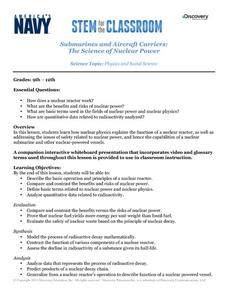
Submarines and Aircraft Carriers: The Science of Nuclear Power

For Teachers 9th - 12th Standards
As physics masters view this presentation, they learn how nuclear power is used in submarines. They use Google Maps to plot a course through the ocean and calculate the time required for surfacing and traveling. They learn about fission,...
Activity
National Nanotechnology Infrastructure Network

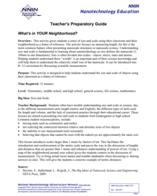
What’s In Your Neighborhood?

For Teachers K - 12th
Chart your way to an understanding of nanoscale. Using a Google map, learners estimate a radius around their location of 1,000 and 1,000,000 meters. Predicting what 1,000,000,000 meters would look like takes them off the charts!...
Lesson Plan
Curated OER

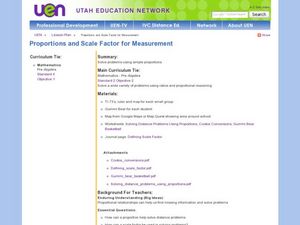
Proportions and Scale Factor for Measurement

For Teachers 5th - 7th
Students explore the concept of proportion. In this proportion lesson, students use google maps to find the distance the their school is from home. Students discuss what a scale factor is through teacher led discussion. Students...
Lesson Plan
Curated OER

A Full Load

For Teachers 6th - 8th
Students calculate the shipping costs between two destinations. In this math lesson, students determine the distance between two places using google map. They calculate the amount of gas needed to get to a specific destination.
Lesson Plan
Curated OER

You Can Die Here – Death Valley California

For Teachers 8th - 10th
Students use Google Maps to explore the rain shadow desert. In this climate lesson, students use the Internet, Google Maps, and directed inquiry worksheets to understand how rain shadow deserts form. Students apply climate concepts to...
Interactive
PBS

Map a Model Solar System

For Students 6th - 8th Standards
Creating a solar system map is a snap thanks to a hands-on activity! Science scholars explore the solar system by building it wherever they choose during an interactive from PBS's Space series. Users pick both the location and scale for...
Lesson Plan
Global Oneness Project

A Collapsing City Skyline

For Students 9th - 12th Standards
Have your high schoolers learn about the modern history of Myanmar by close-reading an article about the city and people of the city Yangon. As they'll learn, the country is going through some dramatic transitions. After...
Lesson Plan
Curated OER

On the Street Where You Live: Online Mapping

For Teachers K - 2nd
Students access the Internet and use Google Maps to pinpoint their home address and get directions to and from school. they write the directions in paragraph format.
Activity
1
1
Owl Teacher

Creating a Map to My House

For Teachers 6th - 8th Standards
Here is a simple assignment that will introduce your young geographers to location, one of the five themes of geography, through an activity in which they map the directions and lines of latitude/longitude of where they live. 
Activity
101 Questions

Home Depot

For Students 9th - 12th Standards
Household emergencies often require supplies from a home improvement store. Pupils view a map showing a home and three different stores to determine which is the closest. Follow-up activities find close food options as well.
Interactive
Howard Hughes Medical Institute

Sorting Finch Species

For Students 9th - 12th Standards
Don't just tell your class about Darwin's finches ... show them! Sort some of science's most famous birds using an interactive lesson. Learners try their hand at classifying finches using song, sonogram, and beak appearance, as well as...
Lesson Plan
West Virginia Department of Education

A State of Convenience: The Creation of West Virginia

For Teachers 6th - 12th Standards
Ever wondered why there is a West Virginia but not an East Virginia? The resource answers questions like this one and more as it takes an in-depth and detailed look at the history of West Virginia and how it became a state. Several...
Unit Plan
New York Historical Society

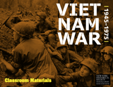
The Vietnam War: 1945-1975

For Teachers 8th - 12th Standards
Do pupils know that the Vietnam War spanned a period of 30 years? A war that long is bound to leave devastating effects. Help young historians develop a comprehensive understanding of the war through multiple units on the subject that...
Lesson Plan
Prairie Public Broadcasting

Egyptian Pyramids Virtual Field Trip!

For Teachers 6th Standards
A virtual field trip takes enthusiastic travelers to the pyramids of Giza. Using Google, scholars explore the grounds of the ancient pyramids found in Egypt then complete three worksheets: a photo analysis page, a reflection sheet, and a...
Activity
1
1
Teach Engineering

Let's Get it There Fast

For Teachers 5th - 7th Standards
Are planes the best shipping method? Using maps, pupils determine the fastest mode of transportation between two cities. Given a list of items to ship, groups decide the best shipping method to finish the 18th segment of a 22-part unit.
Lesson Plan
Carolina K-12

Who the People? Representative Democracy in North Carolina and Congress

For Teachers 8th - 12th
Our elected officials are supposed to represent us, but what does it mean when they aren't like us? Budding citizens explore the demographic makeup of the US Congress, the role of money in political elections, and the Citizens United...
Lesson Plan
Statistics Education Web

What Percent of the Continental US is Within One Mile of a Road?

For Students 9th - 12th Standards
There are places in the US where a road cannot be found for miles! The lesson asks learners to use random longitude and latitude coordinates within the US to collect data. They then determine the sample proportion and confidence interval...
Lesson Plan
Curated OER

Sunderland: Discovering Cities

For Teachers 6th - 8th
Scholars investigate a local city (Sunderland) by participating in a discussion. They explore the different elements of the UK city by identifying the industrial and economic aspects. They also read an interview of two people speaking...
Lesson Plan
Curated OER

Google Earth

For Teachers K - 2nd
Students explore cardinal directions and the compass rose using Google Earth. In this cardinal directions and compass rose lesson, students use Google Earth to visit Disney World. Students choose which direction to go to get there....
Lesson Plan
Curated OER

Wolves: Friend or Foe?

For Teachers 9th - 12th
Young scholars study wolves and their habitat in Yellowstone.  In this environment and behavior lesson students create an interactive map of wolves in Yellowstone.

Other popular searches

Browse by Subject


Google Maps