Central American Countries Teacher Resources
Find Central American Countries lesson plans and worksheets
Showing 217 resources
Curated OER
Central America Map Quiz
In this online interactive geography quiz instructional activity, students examine the map that includes 22 Central American countries. Students identify the names of the countries in 3 minutes.
Curated OER
Central America and the Caribbean
Use the library or Internet to find resources on a chosen topic. The class will comprehend the collected information, structure the information with texts and graphics for a presentation. Each presentation focuses on Hispanic culture and...
Curated OER
Central America Map wtih Country Borders
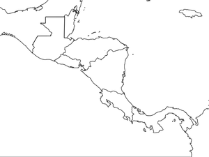
In this blank outline map worksheet, students explore the political boundaries of Central America and the nations there. This map may be used in a variety of classroom activities.
Curated OER
El Mundo Hispano
Colorful maps are clearly labeled in this PowerPoint to show viewers where different Hispanic countries are located within Central and South America. Each country is listed on its own slide with a title, the capital, close-up map, flag,...
Curated OER
Mexico and Central America Map
In this blank outline map worksheet, students study the political boundaries of Mexico and Central America. Each of the counties is labeled and the capital cities are starred.
Curated OER
Video Boxes
Students create a video box about a Central American country. In this world history instructional activity, student research Central America and pick a country they want to investigate. They work in groups to create a video box that...
Curated OER
Geograophy of Mexico And Central America
Students create a chart comparing the terrain, climate, economy, environmental issues and natural disasters for Mexico and the Central American countries. They view and discuss a video on the region then compile research on the internet.
Curated OER
South America and Central America Capitals Map Quiz
In this online interactive geography quiz instructional activity, students examine the map that includes all of Central and South America's countries. Students match each of the country names to the appropriate...
Curated OER
South America and Central America Map Quiz
In this online interactive geography quiz activity, students examine the map that includes all of Central and South America's countries. Students match each of the country names to the appropriate locations on the map.
Curated OER
Hemispheric Harmony
Students express their opinion on issues related to Central America. After reading an article, they discuss the relations between the Presidents of Mexico and the United States. Using the internet, they research a part of the party...
Curated OER
Central America Outline Map - Labelled
In this Central American political map worksheet, students make note of national boundaries and capitals in this region of the world. National capital city locations are noted with stars.
Rocklin Unified School District
Spanish Speaking Countries Project
Ask your class members to provide a tour of a Spanish speaking country with a brochure and flag project. Learners research their assigned country, making sure to check off each of the required pieces of information listed on the first...
Geography Now
Geography Now! Nicaragua
The volcano is perhaps the best symbol for the country of Nicaragua. It's beautiful, but a bit unstable. A video resource profiles the Central American nation, which is the second poorest in the Western Hemisphere. Highlights include...
Curated OER
Central America: Unlabeled Map
In this Central American political map worksheet, students examine the boundaries of the countries and capital cities located in this region of the world.
Curated OER
Welcome to the Americas
Students research and map the North and South American continents. In this geography lesson on the Americas, students can locate North, Central and South American countries and states. Students choose a location to research and prepare a...
Geography Now
Geography Now! Honduras
Honduras is home to ancient ruins and beautiful baroque buildings. It also has fish-nados, a natural phenomenon that causes fish rain upon parts of the country. A video profile explores the Central American nation, including some of its...
Curated OER
Country: El Salvador
Students visit sites to explore the history, wildlife, and geography of El Salvador. They play an interactive game of Concentration and watch a slide show that includes pie charts and bar graphs on Hispanic population in the United States.
Geography Now
Geography Now! El Salvador!
El Salvador's culture and politics may mimic its landscape—tough and beautiful. With every major city near a volcano and the legacy of a violent civil war, El Salvador grapples with its past. A video resource explores the Central...
Geography Now
Geography Now! Costa Rica
Its name means rich coast, and Costa Rica is a showcase of the resources Latin America has to offer. From its jungles to its carbon neutral environmental policy, the Central American country has managed to carve out a stable democracy...
Geography Now
Geography Now! Guatemala
The Mayans still exist, and their presence is felt everywhere—just ask the people of Guatemala. The Central American country is home to many ruins from the ancient civilization, and its people still speak many of the Mayan's original...
PBS
Carlos Vaquerano
An 11-minute video shines a spotlight on Carlos Vaquerano, an El Salvadorian who made his way to the United States of America at the age of 15 to escape the dangers that took over his country. Interviews detail how and why Vaquerano left...
Center for History Education
Guatemalan Coup of 1954: How Did the Cold War Influence American Foreign Policy Decisions?
Was it all about the bananas—or the fear of a communist threat? Young historians use a history lab to examine documents from the American-led 1954 Guatemalan coup. Using graphics, government documents, and speeches, they examine the...
Curated OER
Central America and the Caribbean Culture Travel Brochure
Ninth graders take a trip to Central American and the Caribbean. In this culture and geography lesson plan, 9th graders research selected countries of the region. Students use their findings to create tri-fold...
Curated OER
Mexico and Central America Map
In this outline map worksheet, students study the political boundaries of Mexico and the Central American countries. This map is labeled with the country names.


