Hi, what do you want to do?
Artisan Global
QuakeFeed Earthquake Map, Alerts and News
Amateur seismologists explore Earth's earthquakes in real time using a variety of map styles and parameter selections.
Curated OER
State Facts
In this state fact chart worksheet, students are provided with a chart showing all 50 states, their abbreviations, state bird, flower, animal, and the year of statehood. There are also basic facts about each state. The worksheet...
University of California
The Civil War: Secession of the South
Was the Southern states' decision to secede from the Union protected by the United States Constitution? Eighth graders discuss the constitutionality of the South's justification for secession, particularly the secession of South...
Teach Engineering
Where Are the Plastics Near Me? (Mapping the Data)
The last activity in a nine-part series has teams create a Google Earth map using the data they collected during a field trip. Using the map, groups analyze the results and make adjustments to the map to reflect their analysis. A short...
ProCon
Electoral College
The Electoral College's role in elections is sometimes confusing and controversial. Pupils use a debate topics website to research the pros and cons of the practice to debate whether the United States should still use the Electoral...
ProCon
Obesity
Is obesity a disease or just a preventable risk factor for other diseases? Scholars attempt to form their own opinions by reading a background of the issue and watching videos that explore the main pro and con arguments using an included...
ProCon
Sanctuary Cities
Should sanctuary cities receive federal funding, or do they defy federal laws? That is precisely the question scholars attempt to answer as they prepare for a class discussion or debate. After reading some brief background information,...
Port Jefferson School District
Hurricane Katrina
Young scientists track Hurricane Katrina across the Atlantic Ocean as they learn about these destructive forces of nature. Provided with a table of data tracking the location and conditions of Katrina over a one week span, students...
The Alamo
A Teacher’s Guide to Sam Houston
Need a teacher's guide all about Sam Houston and how he relates to the Texas Revolution? Look no further! The guide includes a timeline detailing Houston's life, important milestones, and relevant maps that include his movement around...
GCSE Modern World History
Mao's China
Here is a great textbook chapter on China's establishment as a communist state in 1949 and the effects of World War II on the nation. The first page prompts learners to complete a timeline activity as they read the material,...
California Historical Society
Understanding California
Here is a beautiful handout through which learners can explore the history of California, from the earliest Europeans to visit the Golden State up through its experiences during the Great Depression and position in the modern...
Novelinks
The View From Saturday: Concept/Vocabulary Analysis
Design your unit on The View From Saturday by E.L. Konigsburg with a concept and vocabulary analysis resource. It outlines the plot, literary elements, vocabulary issues, and any possible considerations for planning a differentiated...
Curated OER
US Energy Geography
The maps display the statistics for energy consumption and power production, state by state. They are tremendous visual aids for your natural resources unit. Consider having your class compare energy consumption versus production, or...
Agriculture in the Classroom
A Holiday Tradition: Which Christmas Tree Will You Choose?
Different varieties of Christmas trees provide an interesting way to combine social studies, science, math, and technology. Class members not only research the history of the Christmas tree holiday tradition, they compare and...
It's About Time
Taking a Ride on a Lithospheric Plate
Assist your pupils and broaden their horizons with several activities that determine the exact positioning of various communities over the globe. Pupils use data from the Global Positioning System to determine the position and rate of...
Indian River State College
Argumentative (Persuasive) Essay Guidelines
Here is a handout that outlines six great steps to structuring an argumentative essay, which can be continually referenced as you teach your class about persuasive writing.
Other
National Atlas of the United States
The National Atlas of the United States provides comprehensive information collected by the Federal Government and delivered through interactive maps. Select from a variety of scientific, societal, and historical information to be...
Central Intelligence Agency
Cia: World Factbook: United States
This resource from the CIA World Factbook provides a detailed fact sheet of United States. The content covers the country's geography, people, government, economy, communications, transportation, military, and transnational issues. It...
World Atlas
World Atlas: United States of America
A comprehensive guide to the United States of America including a variety of maps, statistics, facts, and information on history, geography, flags, symbols, travel, and much more.
Pew Research Center
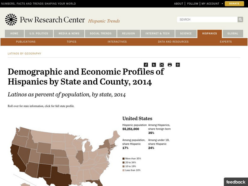
Pew Hispanic Center: Interactive Map: Where Latinos Live in the United States
Detailed population maps graphically demonstrate that changing demographics of the Hispanic population in the United States from 1980 to 2007.
Pew Research Center
Pew Social and Demographic Trends: Migration Flows in the United States
The Pew Hispanic Research Center details the migration flows of the United States. Breaks down U.S. migration patterns from the last 20 years. Scroll mouse over map to see the regional migration throughout the years. View a map which...
US Geological Survey
U.s. Geological Survey: Water Resources of the United States
Visit the U.S. Geological Survey's website for a wide variety of information on water. Content includes data on water quality, water use, acid rain, among others; publications; information on water resource programs; maps; information on...
Encyclopedia of Earth
Encyclopedia of Earth: Northern Marianna Islands (United States)
The Encyclopedia of Earth provides an overview of Northern Marianna Islands (United States), including its geography, natural resources, history, government, economy, and much more. Maps and images are also included, along with sources...
Encyclopedia of Earth
Encyclopedia of Earth: Navassa Island (United States)
The Encyclopedia of Earth provides an overview of Navassa Island (United States), including its geography, natural resources, history, government, economy, and much more. Maps and images are also included, along with sources used to...
Other popular searches
- United States Maps Regions
- Northeast United States Maps
- 50 United States Maps
- Create United States Maps
- Western United States Maps
- Custom United States Maps
- Outline Maps United States
- Blank United States Maps
- Maps, United States Rivers
- Maps United States Capitals
- Maps of the United States
- Maps United States


