Curated OER
Comparing the New Madrid and San Andreas Fault Zones
For this faults worksheet, students use an earthquake reference sheet to find the numbers for a modified Mercalli and Richter scale. They compare the San Andreas Fault zone and the New Madrid fault zone on the United States map. They...
Curated OER
Name That Town
Students explore geographic locations and locate towns on a map using map coordinates.
Curated OER
Printable Map of the State of Wisconsin
In this printable map of Wisconsin worksheet, students see a clip art map of the state superimposed on a map of the United States. There are no questions with the map.
Curated OER
Capitals of Ohio
Fourth graders construct timelines of historic Ohio events and explain how it progressed from territory to state. They locate points of interest on a state map.
Curated OER
Tropical Regions/Mapping Biodiversity
Students use a world map to locate the country of Puerto Rico. In groups, they identify the various types of vegetation found on the island. They compare and contrast the biodiversity of the country to the United States. To end the...
Curated OER
Wyoming Map
For this map of Wyoming worksheet, students view and label on a map of Wyoming its major cities, important landmarks, entertainment parks, compass rose and a legend.
Curated OER
Postmark U.S.A.
Young scholars identify and collect postmarks from across the United States. They develop a list of ways to collect postmarks, display the postmarks on a large U.S. map, and find the exact location using MapQuest.
Curated OER
Colonial Vacation Planner
Looking for a good lesson on the Colonial Period for your upper-elementary class? Then, this lesson is for you! They use website designs, U.S. travel publications, and maps to plan a family vacation to states which were part of the...
Curated OER
Effects of Urban Growth
Learners explore population growth in the United States and the impact it has had on society. First, they brainstorm the reasons for population growth and the results of these increases. Then, they design surveys, record results, and...
Centers for Ocean Sciences
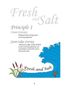
Ocean and Great Lakes Literacy: Principle 1
Is your current lesson plan for salt and freshwater literacy leaving you high and dry? If so, dive into part one of a seven-part series that explores the physical features of Earth's salt and freshwater sources. Junior hydrologists...
Global Oneness Project
The Value of Ancient Traditions
Imagine having to give up cell phones, computers, and TV? What would be lost? What gained? An examination of the Drokpa, a nomadic people who live in the grasslands of Tibet, provides class members an opportunity to consider how access...
Curated OER
The Rocks Under Illinois
The goal of this fine geology lesson is to have learners create a map that shows how the rock layers are arranged far underground where they can't be seen. The ambitious lesson plan requires high schoolers to learn the law of...
Curated OER
Geomnemonics: Facilitating the Teaching of Social Studies Content with Geography Skills
Students explore how to draw a world map by hand and how to locate countries.
Curated OER
How Do I Get There? Planning a Safe Route to School
One much-needed skill for young learners is direction giving. Have your class plan and draw a safe route for them to travel from home to school. They will also draw places and items that are in between home and school in order to build a...
Curated OER
Orienteering - Introductory Lesson
Gain knowledge of directions and degrees while learning how to read a compass. NEWS - north, east, west, south, and everything in between. It's crucial to be accurate in reading a compass and understanding degrees and direction when...
Curated OER
Past and Present
Providing an interesting way to discuss the U.S. presidency, this lesson has learners compare George Washington to the current president. They listen to books about George Washington, discuss the current president, and complete worksheets.
Miama-Dade County Public Schools
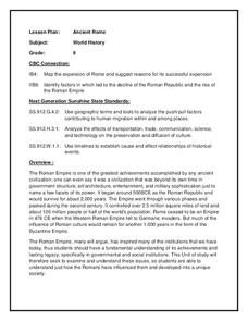
Ancient Rome
This resource outlines several general activities for a study of Ancient Rome, and includes guiding questions, a handout on the story of Romulus and Remus, and ideas for incorporating mapping and timeline activities into your review.
Bismarck Public Schools
Chapter 9 Review WKST
Here is a traditional multiple-choice, true/false, and fill-in-the-blank assessment on the presidency of James Monroe in the United States. It was designed to supplement a particular textbook chapter, but could be used to assess learning...
Carnegie Mellon University
Marcellus Shale: Who Pays?
After viewing short clips of unfortunate events, your class will consider two sides of a homeowner's court case, and then learn about the Marcellus shale deposit beneath the state of Pennsylvania and the hydraulic fracturing process. In...
Curated OER
1792 Election Results
The beginning of American politics and elections is found in these slides, which detail the 1792, 1796, 1800 elections of Washington, Adams, and Jefferson (respectively). Plan on including your own discussion points and details in this...
Curated OER
The Election of 1840
Entertaining political cartoons, campaign songs, and slogans are sprinkled throughout this presentation, which details the Presidential Election of 1840. Teachers can bring their own discussion topics to the slideshow with references to...
Curated OER
The European Conquest of the Americas
Witness the birth of the Americas in this presentation, which details the European Explorers who contributed to adding vital details on our modern-day maps. Viewers' worlds will literally expand after seeing the results of Cortes and the...
Other popular searches
- Kansas State Map
- Delaware State Map
- Pennsylvania State Map
- Washington State Map
- New York State Map
- Map State of Washington
- Map of California State
- City State Map
- Louisiana State Map
- State Map of Iowa
- Border State Map
- State Map of Idaho

