Curated OER
Cryosat Mission
Beginning with general information on satellites and seasons, concluding with polar ice and the Cryosat Mission, this worksheet gives your earth scientists an opportunity to conduct some research. Most of the assignment consists of short...
Curated OER
Satellites and the Radiation Budget
Students engage in a prelab discussion about the earth's radiation budget and global warming. They use "trading cards" to find specific websites to research radiation budget questions.
Curated OER
Reading Satellite Images
Students analyze satellite images. In this astronomy lesson, students examine 3 satellite images in order to understand how satellite images are taken and what they can teach scientists.
NASA
NASA Visualization Explorer
Read some of the most up-to-date information available from NASA's current Earth and space research! Along with showcased stories, you will find computer animations and satellite images that help you to view what humans cannot see with...
Curated OER
Message in a Bottle - A Satellite Journey through the Gulf Stream
The Gulf Stream has historically provided humans with a faster trade route because of its swift-moving waters. It continues to be a source of information and fascination for oceanographers today. As your class views this collection of...
Curated OER
What Makes Up An Artificial Satellite?
Students discover the components of a satellite using analogies to humans in a class discussion and participate in an activity in which they construct a paper model of a satellites and experiment with different types of attitude control...
Curated OER
Communication Satellites
In this communication satellites worksheet, learners complete a table showing the satellite, the lifespan of the satellite, the number of transponders on the satellite and the cost of the satellite. Students determine the retire year,...
Curated OER
Satellites and Solar Cells
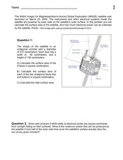
In this satellite and solar cells learning exercise, students determine the electrical power generated by the solar cells on the IMAGE satellite. Students solve 3 problems including finding the usable area of the satellite, determining...
Curated OER
A Problem in Satellite Synchrony
In this satellite synchrony worksheet, students use a spreadsheet or Least Common Multiples to solve 4 problems related to the satellite orbits, orbital periods and their synchronicity. Students determine when the satellites launched in...
Curated OER
Satellite Technology
In this satellite technology worksheet, students read about Low Earth Orbit satellites and the frictional drag from the Earth's atmosphere that causes them to fall back towards the Earth. Students use given data of the years the...
Curated OER
IMAGE Satellite and Solar Cells
In this IMAGE satellite and solar cells worksheet, students calculate the surface area of the satellite in order to determine how much electrical power can be generated by the solar cells.
Curated OER
Hinode Satellite Power
In this Hinode satellite worksheet, students find the area of the solar panels that cover the Hinode satellite to provide power. They determine the amount of power produced by the solar cells and if it is enough to keep all the...
Curated OER
Keep In Touch: Communications and Satellites
Fourth graders explore communications by reading assigned space science text. In this satellite instructional activity, 4th graders identify the concept of orbiting and examine gravitational pull by viewing diagrams. Students are...
Space Awareness
A View From Above
Analyzing and interpreting satellite data takes knowledge and patience. Through a detailed lab investigation, young scholars learn the process of analyzing this data. They use technology to create color images and maps from real...
American Museum of Natural History
Field Trip Earth
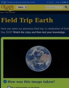
Take a field trip around Earth by way of satellite images. Learners watch a video lesson that describes different images taken from orbiting satellites. They then test their visual skills in a 14-question online quiz.
Curated OER
Sea Ice and Satellites
Students study satellites and satellite images using Google Earth. In this satellite lesson, students discuss satellites and how they work. Students watch a demonstration of how satellites work and learn what they are used for. Students...
Curated OER
Predicting the Configuration of the Satellites of Jupiter
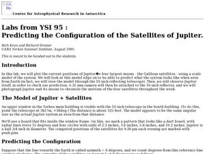
Students plot the positions of the planet Jupiter while predicting what the configuration system looks like from Earth. In this configuration of satellites lesson, students photograph Jupiter and its moons to record the motions of the...
Curated OER
Digital Images: From Satellites To The Internet
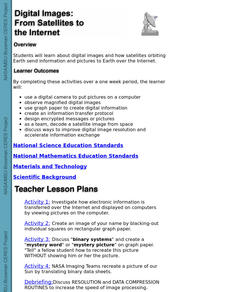
Students examine digital images and how satellites orbiting Earth send information and pictures to Earth over the Internet. They use a digital camera to put pictures on a computer and decode a satellite image from space.
Curated OER
The Global Precipitation Measurement Mission (GPM) Lesson
Introduce your class to one of the ways that technology is benefiting humanity. The Global Precipitation Measurement Mission involves the data collected by nine satellites from different countries with a united focus on studying world...
Curated OER
Explore Surface Types on a Journey Around Earth
Young scholars explore satellite data. In this technology cross-curriculum math and world geography lesson, students locate specific map areas using a microset of satellite data. Young scholars use technology and math skills to determine...
NASA
Hurricanes and Hot Towers with TRMM
Take cover because a wild presentation on hurricanes is about to make landfall in your classroom! An outstanding PowerPoint presentation is the centerpiece of this lesson. Not only does it provide information and photographs, but several...
Curated OER
Using Vegetation, Precipitation, and Surface Temperature to Study Climate Zones
Using NASA's Live Access Server, earth scientists compare the temperature, precipitation, and normalized difference vegetation index for four different locations. They use the data to identify the climate zone of each location using...
Curated OER
Using Satellite Imagery to Discuss the Science Behind Brazilian Deforestation
Students can delve into earth science by using satellite imagery to learn about the deforestation of the Brazilian rainforest.
Curated OER
Solar Proton Events
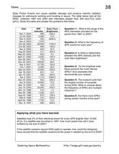
On this worksheet, space scientists use a data table to answer questions about the relationship between the brightness of solar flares and the intensity of the solar proton events. They apply what they learned from the data to address...
Other popular searches
- Artificial Satellites
- Falling Satellites
- Natural Satellites
- Orbiting Satellites
- Space Satellites
- Weather Satellites
- Soho Satellites
- Satellites Voyager
- Yohkoh Satellites
- Global Positioning Satellites
- Satellites and Orbits
- Centripetal Force Satellites


