Curated OER
Find Yourself with Global Positioning
High schoolers examine different types of new mapping technologies. They use the internet to gather information about mapping and navigation. They create their own global positioning tool and defend it to the class.
Illustrative Mathematics
Global Positioning System II
Intricate details of a modern technology that many of us take for granted in our phones, computers (and some cars) are laid bare in a short but deeply investigative activity. The math behind a seemingly simple GPS device is...
Curated OER
TE Lesson: Navigating at the Speed of Satellites
Students study the basic concepts of the Global Positioning System and how it increases the accuracy of navigation. They examine trilateration and how the speed of light is used to calculate distances.
Curated OER
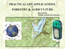
Practical GPS Applications in Forestry & Agriculture
An explanation of the Global Positioning System (GPS) and the Geographic Information System (GIS) is given in this presentation. Uses and applications are considered. How it works and sources of error are also touched upon. A large...
Curated OER
Where Am I - Navigation and Satellites
Learners explore geography by completing a navigation activity in class. For this satellite positioning lesson, students define terms such as orbit, satellite, GPS and triangulation. Learners view diagrams of the Earth's orbit and...
Curated OER
An Introduction to GPS
GPS is a technological tool that has become available for use by the general public. Navigate the components and science involved in this remote sensing system. Here is a comprehensive collection of slides that would be valuable to share...
Curated OER
Reading Satellite Images
Students analyze satellite images. In this astronomy lesson, students examine 3 satellite images in order to understand how satellite images are taken and what they can teach scientists.
Curated OER
Lesson on GPS
Students investigate global positioning systems. In this technology and mapping lesson, students view a PowerPoint presentation in which they identify the features of a GPS, state its uses, and follow steps to find a waypoint.
NASA
Mapping the Watery Hills and Dales
How does GPS know where everything is located? Pupils read about satellites that are mapping the ocean and the question on how satellites know where they are. Readers discover the workings of the Global Positioning System and create...
Curated OER
Where Am I: Navigation and Satellites
Students explore the concept of triangulation that is used in navigation satellites and global positioning systems designed by engineers. They determine ways these technologies can help people determine their position or the location of...
It's About Time
Taking a Ride on a Lithospheric Plate
Assist your pupils and broaden their horizons with several activities that determine the exact positioning of various communities over the globe. Pupils use data from the Global Positioning System to determine the position and rate of...
Santa Ana Unified School District
Getting to the Core: Globalization
How have advances in technology and communication changed our world? That is the questions that world history students contemplate as they examine a series of primary and secondary source materials
Curated OER
Find It!
Students analyze the basic concept of Global Positioning Systems using triangulation and measurement on a small scale in the classroom. They describe a satellite and how it helps in locating a person on Earth. They explain how...
Curated OER
The Plasmasphere
In this plasmasphere worksheet, students read about the dilute region of gases 10,000 kilometers above the Earth where atoms are ionized. Students use a photograph taken by the IMAGE EUV instrument to answer 3 questions about the...
Curated OER
I Know Where You Are!
Students study what a GPS is and use it to challenge themselves and find positions on a map. For this investigative lesson students find various points on a map using a GPS system and answer questions on a worksheet.
Curated OER
It's About Time
Students investigate how Global Positioning Systems work and how and why GPS receivers make errors. They graph data points and apply estimation and prediction to real-life GPS situations, discuss time delay, and complete a worksheet.
Curated OER
GPS Treasure Hunt for Knowledge
Students examine themselves as being part of a global community. In this global community lesson, students investigate GPS systems. Students gain knowledge on how the device works. Students discover that satellites provide information...
Curated OER
FILLING IN THE GAPS - Acquiring and Analyzing Satellite and Ground-Based Data
Students monitor rainfall, compute daily averages, and compare their methods of computation to those used by actual researchers using satellite observations.
Curated OER
Scientist Tracking Network
Learners correlate surface radiation with mean surface temperature of several geographic regions. They observe how these parameters change with latitude and construct an understanding of the relationship of solar radiation to seasonal...
Curated OER
Waterworks
Students investigate the water quality of a river. In this water quality lesson plan, students use microscopes, probing devices, and global positioning systems to determine water quality and create presentations on it.
Curated OER
Space Science:Wherever You Go, There You Are
Students explore navigation principles by observing, measuring, and interpreting data to determine locations. Using a compass, compass rose, and a transit, they plot courses and discover the workings of the Global Positioning System...
Curated OER
Growing Plants Using Space Technology
Students explain why delivering planet nutrients to crops at the correct time and amount is important. Students list possible negative effects of improper nutrient delivery. Students descrive two problems that farmers are now able to...
Curated OER
Exploring Earth Through Maps and Technology
In this maps worksheet, students read 3 pages of detailed information about maps, latitude, longitude, topography, satellites and global positioning. Students then answer 10 questions. There is also a research project assignment available.


