Annenberg Foundation
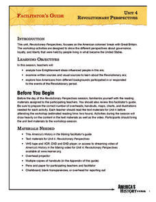
Revolutionary Perspectives
Life, liberty, and the pursuit of happiness. Learners go to the heart of the causes of the American Revolution. Examining political cartoons, Enlightenment documents, and firsthand accounts, they present their ideas and reflective...
Roy Rosenzweig Center for History and New Media
The Battle of Trenton
The Continental Army's victory at the Battle of Trenton marked a turning point in the American Revolution. Young historians examine maps, read primary source materials, and create a timeline of events to understand why the victory was so...
Curated OER
Puerto Rico: The 51st State?
Students examine the political status of Puerto Rico. In this global studies lesson, students explore Puerto Rico and consider the feelings of Puerto Ricans regarding their unique political status.
Curated OER
U.S. and Canada: How are We the Same? How are We Different?
Get high school geographers to compare and contrast Canada and the United States. They begin by drawing a freehand map of North America, then complete readings to gain insight into Canada. The text is not provided; however, another text...
Curated OER
Malta: The Landscape
Students work in small groups to create a topographic map of Malta. They must include labeled line drawings of bordering countries and bodies of water. Students use salt and flour clay to make Malta three dimensional, showing the nearest...
Curated OER
Follow Your Dreams: Career Goals
It is so important for impending high school graduates to start thinking about their potential careers. Here, they discuss the persistence of Blondie Hasler and his impressive transatlantic trip. They follow various routes on a map and...
Curated OER
United States Map
Students compare the United States on a globe and on a map. In this map lesson, students relate the sizes of the continents and locate the United States. Students identify the location of the continental US as well as Alaska and Hawaii.
Curated OER
Romania
In this blank outline map instructional activity, students explore the political boundaries Romania located in Europe. This map may be used in a variety of classroom activities.
Curated OER
Silk Roads Big Map: A Silk Roads Encounters Project
Students are introduced to the Silk Road and its purpose. Using a map outline, they create an oversized replica of the Silk Road from Europe to Asia. They add political and physical features to the map along with the routes of travelers.
Curated OER
Desertification
Middle schoolers investigate the process of desertification in the Sahel region of Africa. They discuss photos from a National Geographic magazine, analyze the physical/political map of the Sahara, identify the causes and effects of...
Curated OER
Land Elevation
Students investigate land elevation. In this map skills lesson, students use a physical map to identify various elevations of the land. Students find landform features such hills and coastlines.
Curated OER
Country Capitals
Students locate country capitals on a world map. For this map skills lesson, students review the definition of the word country and discuss what a capital is. Students locate and label capital cities on a world map using a map marker.
Curated OER
U.S. Geography- The Northeast
Students investigate the geography of the Northeast states. In this map skills instructional activity, students are shown a map of the Northeast states and identify the state names and borders. Students construct individual maps of the...
Curated OER
World Map and Globe-Equator, North Pole, and South Pole
Students identify the Equator, North Pole, and South Pole on a map. For this geography lesson, students use a world map and circle the North and South Pole. Students locate the Equator on a globe and use a map marker to highlight it.
Curated OER
Using Four Main Directions in the Classroom
Students identify the four cardinal directions. In this map skills geography lesson, students use a magnetic compass to label the four directions in the classroom. Students use the four directions to locate objects in the classroom.
Curated OER
Hemingway Hangouts
Students use printed maps and websites to estimate driving distances and plan routes to Hemingway's home. They visit several locations online and record facts about each location.They calculate, distances, driving time, and other factors.
New York State Education Department
US History and Government Examination: January 2017
Looking for a resource that tests both US History and government? Here's a test that serves as a great way to test comprehension of complex concepts by using a variety of question formats and covering a wide array of topics. The...
National Geographic
Australia, Antarctica, and Oceana
Go on a traveling adventure throughout Australia, Oceana, and Antarctica! This textbook excerpt offers a full unit of study that can easily be supplemented by extra projects or research materials. Learners study maps, read about...
iCivics
Win the White House
Here is a unique and engaging approach to learning about the steps a presidential candidate must take during a campaign. Learners role play the part of a candidate in this online interactive, taking part in a presidential...
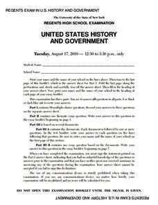
New York State Education Department
US History and Government Examination: August 2010
Geography has played a complex role in America history. The Atlantic Ocean has served as a buffer to protect the United States from European Wars, but its proximity to Cuba, however, left it vulnerable to nuclear war during the Cuban...
National Woman's History Museum
The Path to Women’s Suffrage
The Path to Women's Suffrage unit focuses on how Western Expansion was instrumental in gaining women the right to vote through the Nineteenth Amendment. Young historians analyze maps, examine primary source documents, and create a...
GCSE Modern World History
Mao's China
Here is a great textbook chapter on China's establishment as a communist state in 1949 and the effects of World War II on the nation. The first page prompts learners to complete a timeline activity as they read the material,...
National Gallery of Art
Islamic Art and Culture
Provided by the National Gallery of Art in Washington, this resource for teachers examines Islamic art, including calligraphy, arabesques, and geometric designs. A recounting of the spread of the faith and the tumultuous political...
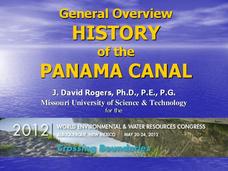
Missouri University of science & Technology
General Overview History of the Panama Canal
Called the Eight Wonder of the World by some and the Big Ditch by others, the Panama Canal is indeed an engineering marvel. The long, complicated, and sometimes controversial history of the canal is captured in a presentation loaded with...
Other popular searches
- Wwi Political Map
- Maps of Europe Political
- Physical and Political Maps
- Canada Political Map
- Americas Political Map
- Blank Political Maps
- Political Map of Africa
- United Kingdom Political Map
- Europe Political Map
- Physical & Political Maps
- Mexico Political Map
- State Political Maps


