Jamestown-Yorktown Foundation
How Did Relations between Britain and the Colonies Change after the French and Indian War?
What does the French and Indian War have to do with the American Revolution? Following the war, Britain issued the Proclamation of 1763 in an attempt to limit the colonists' western expansion. To understand how the proclamation, the...
Curated OER
PLATE MOVEMENTS AND CLIMATE CHANGE
Students label three geological maps with continents provided to analyze the relationships between the movement of tectonic plates and the changes in the climate. In small groups, they discuss their findings and form hypotheses about the...
Curated OER
Climate in Our Back Yard
Students construct a "A Year in Pennsylvania" poster on which they creatively describe at least three examples of how the climate they live in shapes their lives during every season of the year.
Curated OER
Persistent Paths: Trails, Tracks and Turnpikes Across the Alleghenies
High schoolers study maps to determine barriers associated with the Pennsylvania mountains and the Native Americans. In this investigative lesson plan learners study the routes used by Native Americans, explain physical features of...
Curated OER
Birds on Wade Islands
In this birds on Wade Islands worksheet, students read a 1 page passage about the state of the birds on Wade Islands and answer 1 short answer questions about it. Students answer "What actions should the wildlife agencies take?"
Curated OER
Geographic Features of the East Coast
Fourth graders view a map of the thirteen colonies and discuss why the people who came from England built towns along the Atlantic coast. They read the directions on the worksheet and underline words in the question that ask them to do...
Curated OER
Sheets Island Archipelago
In this Sheets Island worksheet, students read about the controlling of the Sheets Island, look at a map of it, and answer short answer questions. Students answer 4 questions.
Curated OER
Rooster's Night Out
First graders complete interdisciplinary activities associated with a folktale from Cuba. For this Cuban folktale lesson, 1st graders read the Rooster's Night Out, before completing comprehension worksheets, make recipes, and...
Curated OER
Discover Your World
Fifth graders, in groups, locate a place on a map where the group would like to visit, research the place then write a complete report on the outcome of the findings. They groups must make a cooperative oral presentation to the class.
Curated OER
Africa's Climatic Regions
Pupils are introduced to the different climates and vegetation of Africa, and compare them to similar climatic regions found in the United States.
Curated OER
Communications: To the Rescue!
Students role-play as soldiers rescuing lost mountain climbers. Working in teams, they interpret maps to locate the climbers and use flashlights to send and receive coded messages about the rescue. Their goal is to complete the task in...
Curated OER
Volcanoes:How Safe Are They?
Students explore volcanoes, locate them on maps, record general information about volcanoes, and organize information on a fact sheet.
Curated OER
U.S. Place Names Show Our Diversity
Students study place names for different area in the US and determine why they were named in such a way. They examine maps to look at the religious names, "new" beginning names, and copy cat names. They complete a word search to find...
Curated OER
Naya Nuki's Journey
Students read "Naya Nuki Shoshoni Girl Who Ran" by Kenneth Thomasma. Students chart Naya Nuki's route on a map and identify the navigational signs she used to find her way home. Students also analyze the weather she encounters.
Curated OER
Lincoln Home National Historic Site: A Place of Growth and Memory
Eighth graders study the history of Lincoln's home. In this American History lesson, 8th graders examine artifacts from his home to learn about his beliefs. Students participate in a webquest on Lincoln's home.
Curated OER
Possible Locations
Middle schoolers create maps with cutout pieces of paper that represent caverns. They develop a scale for their map and decide where the best location is to live. They discover the importance of map reading skills.
Curated OER
Geography of the English Settlements
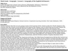
Third graders locate several important American colonial cities on a map and research how their proximity to water and nearby arable land affected the rate and success of settlement.
Curated OER
Start with a Chart
Young scholars use a given chart and the 50 state quarters to synthesize information about the 50 states and the dates that they were admitted into the union. Students complete a math worksheet while referring to the chart.
Curated OER
Three Days at Gettysburg
Eighth graders discuss why the Battle of Gettysburg was important to the Civil War. In groups, they identify the major events of each day of the battle. They analyze how the battle changed the direction of the war and discuss the outcome.
Curated OER
International Festival: Venezuela
Students become familiar with the Venezuelan culture and geography. In this Venezuelan Festival lesson, students compare and contrast themselves to the people of Venezuela. Students participate in activities to understand the...
Agriculture in the Classroom
Design 'Y'er Genes
How do changes in DNA affect an organism? Scholars explore chromosomes, genes, DNA, and mutations by modeling the DNA of a strawberry. They build a DNA model, then manipulate it to show how changing the genes transforms the strawberry...
Read Write Think
Book Report Alternative: Rewind the Plot!
Have you ever looked for a new way to teach an old concept? Scholars thinking about the rising action of a story in a whole new perspective. However, Book Report Alternative: Rewind the Plot! challenges readers and allows for much...
Agriculture in the Classroom
Build it Better
If you think you can do better, feel free to give it a try. Pupils learn about the work on Temple Grandin and consider ways to improve animal handling facilities. They work in groups to build models to showcase their ideas.
Curated OER
The Distance Between Us and Them: Sea Floor Spreading in the Atlantic Ocean
Students examine how geologists determine rates of sea floor spreading between two tectonic plates. They apply mathematical concepts such as the calculation and use of velocities and conversion from one set of units to another.


