Geography Now
Geography Now! Egypt
There's more to Egypt than just pyramids—it is the crossroads between North Africa and the Middle East. Egypt is the world's largest Arab country, and it is the center of Arab cinema and publishing. A video resource explores these...
Geography Now
Geography Now! Algeria
Only three percent of Algeria's land is arable, and it's not uncommon to see signs in three different languages: Berber, French, and Arabic. The complicated African nation's history and geography go back thousands of years, and it has...
Geography Now
Geography Now! Angola
Where in the world can you find a $26 sandwich? That's not uncommon in the oil-rich country of Angola, where many goods must be imported and are expensive. The West African nation is enjoying a resurgence since a brutal Cold War era...
PBS
Make a Balloon Globe
"We've got the whole world in our hands," is what your students will be singing after completing this fun geography activity. Using the included templates for the seven continents and a balloon, they create their very own globes.
Geography Now
Geography Now! Libya
Libya is an African country, but it is home to Italian-influenced Arab people. The complex state has been at the heart of some controversies, including dictator Muammar Gaddafi. A video resource profiles the ancient history of the modern...
AGSSS
World Regions
Help your learners to visualize where historical events have taken place around the globe with a map that details the major regions of the seven continents.
Institute for Geophysics
Understanding Maps of Earth
Here is your go-to student resource on primary geography concepts, including facts about the surface of the earth and its hemispheres, latitude and longitude, globes, types of maps, and identifying continents and oceans.
NASA
Outline Maps
Don't miss this gold mine of blank maps for your next geography lesson! Regions include traditional continents such as Asia, Europe, and Africa, as well as other major world areas such as the Pacific Rim and the Middle East.
TED-Ed
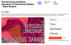
The Ferocious Predatory Dinosaurs of Cretaceous Sahara
What's not to love about dinosaurs? Lucky for us humans, we can love to learn about them from 100 million years away, especially a group of extra large predatory dinosaurs from the Cretaceous period. Watch a descriptive video that...


