DocsTeach
Red Record of Lynching Map Analysis
Long before the civil rights movement, leaders were working to secure equal rights. An informative activity explains the 1922 anti-lynching campaign with a map. Scholars analyze the map, complete a worksheet, and participate in group...
DocsTeach
Analyzing a Map of the Louisiana Purchase
With the stroke of a pen, Thomas Jefferson roughly doubled the size of the United States. The Louisiana Purchase not only grew the new country, but also it gave rise to the legends surrounding westward expansion and accelerated the...
DocsTeach
Lewis and Clark's Expedition to the Complex West
Lewis and Clark's famous expedition is a prime example of the United States' westward expansion. Aspiring historians examine maps from Lewis and Clark's journey, as well as discuss their interactions with Native American tribes. The...
DocsTeach
Exploring America's Diversity: Rosalia Fundaro (Beginner)
Elementary scholars learn about the life of Rosalia Fundaro, an Italian immigrant, using primary sources. They analyze documents, complete written prompts, and participate in group discussion to understand Rosalia's life in the United...
Texas State Energy Conservation Office
Investigation: Concept Mapping Fuels
After reading an article, "Fuels for Everything," collaborative groups create a concept map poster of the transportation and non-transportation fuels. This makes a strong introduction to the different types of fuels used for transportion...
HISTORY Channel
Westward Expansion of the United States
How did early American pioneers decide what to take with them on their journeys, and what was their traveling experience like? Here you'll find a collection of activities to help you explore Westward Expansion with your young learners.
Teach Engineering
Where Are the Plastics Near Me? (Mapping the Data)
The last activity in a nine-part series has teams create a Google Earth map using the data they collected during a field trip. Using the map, groups analyze the results and make adjustments to the map to reflect their analysis. A short...
DocsTeach
The Impact of the Immigration Act of 1924
Welcome to America ... only if you're on an approved list. The activity uses a map to explain how the Immigration Act of 1924 placed quotas on immigration from certain countries, such as India. Scholars analyze the map, complete a...
Baylor College
Microbes and Disease
Discuss how diseases have impacted human history. Divide your class into groups and assign each group one of the following: tuberculosis, malaria, plague, cholera, smallpox, and AIDS. They read up on, complete a concept map, and present...
Digital Public Library of America
The Poetry of Emily Dickinson
Are you contemplating a poetry study featuring Emily Dickinson? Finding good primary sources to accompany the study can be a challenge—never fear, help is here! Check out this primary source set that includes manuscripts of several of...
iCivics
Drafting Board: Electoral College
Should the president of the United States be voted by the Electoral College or the popular vote? Your young historians will consider the pros and cons of the Electoral College, and make an argument using reasons and evidence...
All for KIDZ
The Orphan of Ellis Island
Everyone comes from somewhere. An interdisciplinary lesson on Elvira Woodruff's The Orphan of Ellis Island includes discussion starter and writing prompts for the novel, as well as a graphic organizer to help learners begin their...
Baylor College
People and Climate
Model how the sun's energy strikes the planet and help your class relate it to a climate map. Assign small groups an individual climate zone to discuss. They reflect on and research how humans survive in the assigned climate and write a...
Baylor College
Pre-Assessment Activity: What Do You Know About Microbes?
In an introductory lesson, youngsters take a pre-assessment quiz, get a grasp of a gram of mass, and then estimate the mass of microorganisms that live within a human body. Using Glo Germ™, a material that allows you to simulate the...
DocsTeach
The Civil War: Celebrate or Commemorate? Debate Definitions
Match game for the win! Build learners' historical vocabulary using an interactive matching game. Class members match each term to its definition with a tap. A writing prompt rounds out the lesson, leading to further discussion on how...
Teach Engineering
What's Wrong with the Coordinates at the North Pole?
Here is an activity that merges technology with life skills as individuals use Google Earth to explore the differences between coordinate systems and map projections. The self-guided activity is the fourth segment in a nine-part unit....
Teach Engineering
Incoming Asteroid! What's the Problem?
Oh, no! An asteroid is on a collision course with Earth!. Class members must rise to the challenge of designing a shelter that will protect people from the impact and permit them to live in this shelter for one year. In this first lesson...
Foundation for Water & Energy Education
What is the Water Cycle? Activity B
Curious physical scientists follow a lesson on the properties of water with this lesson on distillation. They observe a miniature water cycle model that filters dirty water into clean water. These two lessons combined are an enriching...
US Environmental Protection Agency
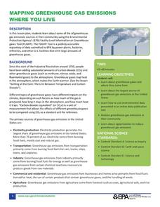
Mapping Greenhouse Gas Emissions Where You Live
After investigating the US Environmental Protection Agency's climate change website, your environmental studies students discuss greenhouse gas emissions. They use an online interactive tool to look at data from power production...
Miama-Dade County Public Schools
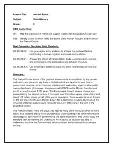
Ancient Rome
This resource outlines several general activities for a study of Ancient Rome, and includes guiding questions, a handout on the story of Romulus and Remus, and ideas for incorporating mapping and timeline activities into your review.
US Apple Association
Apples: A Class Act! (Grades 4–6)
Middle schoolers have a bushel of fun as they engage in activities and research core facts about apples. Packed with suggestions for in-class activities and out-of-class research, the colorful 6-page packet is sure to satisfy hungry...
Agriculture in the Classroom
Pumpkins... Not Just For Halloween
Celebrate fall with four pumpkin themed hands-on activities! After learning about pumpkins, scholars complete two activity sheets that reinforce estimation and word problems. They then plant pumpkin seeds and bake a pie in...
Illustrative Mathematics
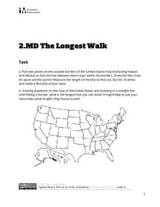
The Longest Walk
How long of a line can you draw within this activity? Learners pick two points outside and within the map to create the longest line they can. After drawing 10 lines, learners plot the length of each line on a line plot. Then they...
Curated OER
Finding River Cities
Using a wall map, students will find major rivers in the four regions of the United States. Then they answer questions about how people use natural resources, such as rivers.
Other popular searches
- United States Maps
- United States Maps Regions
- Northeast United States Maps
- 50 United States Maps
- Create United States Maps
- Western United States Maps
- Custom United States Maps
- Outline Maps United States
- Blank United States Maps
- United States Landforms Maps
- United States Geography Maps
- United States Political Maps


