Curated OER
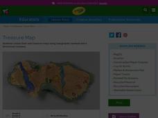
Treasure Map
Learners study and recognize topographical symbols on maps. They create their own topographical Treasure Maps using symbols they learned or invent new ones. They create a bird's-eye view and include landscape details such as mountains...
Centers for Ocean Sciences
Ocean and Great Lakes Literacy: Principle 1
Is your current lesson plan for salt and freshwater literacy leaving you high and dry? If so, dive into part one of a seven-part series that explores the physical features of Earth's salt and freshwater sources. Junior hydrologists...
Curated OER
Play Doh Map of Your State
Students create a state map using Playdoh. In this hands-on state geography lesson, students work in groups to form a three-dimensional map of their state using Playdoh made at home following a (given) recipe. Students use four colors...
Curated OER
Topo Map Mania!
Students read and use topographical maps. They also use a compass to find bearing to an object on a map and in the classroom. Ask your students how they might travel to somewhere they have never been to befo
Curated OER
Weather Map Challenge
In this weather worksheet students use a weather map to answer given questions. Students answer questions using map symbols and make predictions based on map. Students create additional questions with answers using the same map.
Curated OER
Maps Reinforcement
For this map worksheet, middle schoolers complete 6 multiple choice questions and 5 short answer questions about 3 different map figures.
Curated OER
Map Scale
Third and fourth graders are introduced to the concept of map scale. Using an illustration, they discuss if it shows the actual size of the object and why scale is used to represent areas. They use some items in the illustration to...
Curated OER
Grid Frame Mapping
Young scholars map and describe small area of the schoolyard and discuss habitats.
Curriculum Corner
Earth Day Book
This Earth Day, celebrate our beautiful planet with an activity book that challenges scholars to show off their map skills, complete a crossword puzzle, write acrostic poems, alphabetize, and reflect on their personal Earth-friendly habits.
Curated OER
Mapping Electricity
Students complete Internet research and use their map reading skills to learn about how the United States creates and uses electricity in different states. In this energy sources lesson, students study the mini map of energy usage in the...
Curated OER
Globe Skills Lesson 10 Apollo 11
Students develop their globe skills. In this geography skills lesson plan, students use a globe and a softball to replicate distance between the earth and its moon.
It's About Time
Organizing a Store
When provided with multiple objects, how many ways can the class organize and display them based on predetermined factors? Assist class members with a handy activity—theoretically teaching them concepts to understand periodic table...
Curated OER
Determining Cutting Site Locations
Students explore DNA restriction mapping. They cut pieces of paper into lengths representing those produced when specific enzymes are used to cut a strand of DNA.
Rainforest Alliance
Knowing the Essential Elements of a Habitat
To gain insight into the many different types of habitats, individuals must first get to know their own. Here, scholars explore their school environment, draw a map, compare and contrast their surroundings to larger ones. They then write...
NOAA
A Watery World
With about 70% of the earth's surface covered in oceans, it's fair to say that we live in a very wet world. Young scientists gain a better appreciation of this fact as they use maps to identify the world's ocean basins in the first...
Curated OER
The Amazing Race
Students improve their directional awareness by locating sites and symbols on a map. They increase their heart rates while traveling to each site and performing the specified task/exercise at each site.
Curated OER
People Change the Landscape
Students examine ways in which humans have brought change to the natural environment. In this ecology and literacy lesson, students listen to the book Island Boy by Barbara Cooney. Students observe and define map-reading vocabulary as...
Curated OER
Cacao Tree Geography
Students use a map to learn about where chocolate comes from. In this lesson on the cacao tree, students locate various regions where the cacao tree grows. They will discuss why the cacao tree grows more favorably in particular climates...
KOG Ranger Program
Fire Behavior in Forests
Understanding the ways a fire will act is a key factor in fire safety and fire prevention. Young campers focus on how the weather and terrain can affect the behavior of a fire with topographic maps and different scenarios.
Curated OER
From Maps to Models
Students explore watersheds through the use of a topographic map. They observe topographical maps and discuss their characteristics. In groups, students create a model clay island and make a topographical map of it. Afterward, groups...
Baylor College
Mapping the Spread of HIV/AIDS
Where is HIV/AIDS most prevalent and what are the current trends regarding HIV? Have groups work together to map the world's HIV/AIDS rates, then create a class map with all the data. Lesson includes cross-disciplinary concepts including...
Curated OER
Variables Affecting Earth's Albedo
Students study the variables that affect the Earth's albedo. In this environmental data analysis lesson students interpret and graph information and calculate changes.
Curated OER
Project Map: Scale Worksheet
In this map reading instructional activity, students determine the distance from a plotted treasure on a topographic map. They must adjust for magnetic declination.
Other popular searches
- Map Skills Lesson Plans
- Map Skills Worksheets
- Elementary Map Skills
- Geography Map Skills
- Basic Map Skills
- Social Studies Map Skills
- Globe and Map Skills
- Beginning Map Skills
- United States Map Skills
- Map Skills, Continents
- Early Explorers Map Skills
- Free Map Skills Worksheets


