Curated OER
Exploring Arizona's Biotic Communities Lesson 1: Mapping Biotic Communities
As part of a unit on Arizona's biotic communities, young ecology learners create a map. They describe how humans and animals adapt in their habitat. They take notes and create graphic organizers from articles they read. Beautiful maps,...
Howard Hughes Medical Institute
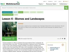
Lesson 6: Biomes and Landscapes
Aside from the amazing animals in Gorongosa National Park, what else is there to discover? The sixth installment in an eight-part themed series contains an interactive map where scholars can learn more about the geographic features of...
National Wildlife Federation
Hot, Hotter, Hottest: Extreme Weather's Impact on Our Resources
How dry is it? It's so dry, the river only runs twice a week! Through an analysis of maps and discussions, pairs learn about droughts across the United States in the ninth of 12 lessons. They then read about, answer questions, analyze...
Space Awareness
Let's Map the Earth
Before maps went mobile, people actually had to learn how to read maps. Pupils look at map elements in order to understand how to read them and locate specific locations. Finally, young cartographers discover how to make aerial maps.
Curated OER
Weather Maps and Prediction
Young meteorologists read basic weather maps by learning about the symbols that are associated with them. This two-day lesson has some excellent demonstrations and activities to get youngsters thinking about the weather in scientific...
NOAA
Mapping the Ocean Floor: Bathymetry
Bathymetry is not a measure of the depths of bathtubs! Through the three lessons, scholars explore two different types of maps and how they are made. The resource focuses on topographic and bathymetric maps and teaching the techniques...
CK-12 Foundation
Topographic and Geologic Maps: Topographic Maps
Maps are great for helping you get where you're going, but what does that place actually look like? Geology scholars compare and contrast the features of topographical and geologic maps using an interactive lesson. The resource describes...
EngageNY
Mid-Unit Assessment: Close Reading of Bullfrog at Magnolia Circle: Bullfrog Life Cycle
The sixth lesson plan in this Bullfrog at Magnolia Circle unit assesses your third graders' ability to read and understand informational text. The included assessment asks learners to take notes about the main idea and supporting...
National Gardening Association
Migration Mishaps
Elementary ecologists pretend to be migratory hummingbirds. They fly between wintering and nesting grounds, trying to reach a habitat haven. In a musical-chair fashion, some birds will miss out, and are removed from the game. To further...
Polar Trec
Playground Profiling—Topographic Profile Mapping
The Kuril islands stretch from Japan to Russia, and the ongoing dispute about their jurisdiction prevents many scientific research studies. Scholars learn to create a topographic profile of a specific area around their schools. Then they...
Just Health Action
Environmental Justice Matters: Mapping Environmental Justice Impacts (Part 1)
A case study of Seattle, Washington permits class members to compare and rank how different areas of Seattle are impacted by environment burdens. Groups investigate different zip codes, collect data on five categories, and color-code a...
PBS
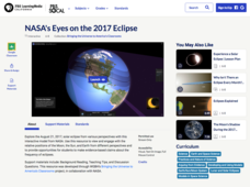
NASA's Eyes on the 2017 Eclipse
How did the 2017 eclipse look in Los Angeles—or Chicago? Experience both views, plus many more, using a lesson from PBS's Space series for middle schoolers. Scholars follow the movements of the sun, moon, and Earth during the most recent...
Channel Islands Film
Arlington Springs Man: Lesson Plan 2
West of the West's documentary Arlington Springs Man and a two-page scientific article about the same topic provide the text for a reading comprehension exercise that asks individuals to craft a one page summary of information gathered...
National Geographic
Mapping the Shape of Everest
With Mount Everest as the motivator, your earth science class learns about topographic maps. Begin by showing a film clip from The Wildest Dream: Conquest of Everest, featuring fearsome virtual imagery of a path up world's tallest...
Rainforest Alliance
How Do Jaguars and Howler Monkeys in Belize Depend on Us?
How does weather play a role in the lives of land and sea creatures? Find out with a lesson plan focused on habitats and the ways animals from different homes are connected. Here, learners explore how the life of a jaguar and...
Curated OER
Play Doh Map of Your State
Young scholars create a state map using Playdoh. In this hands-on state geography lesson, students work in groups to form a three-dimensional map of their state using Playdoh made at home following a (given) recipe. Young scholars...
Rainforest Alliance
Knowing the Essential Elements of a Habitat
To gain insight into the many different types of habitats, individuals must first get to know their own. Here, scholars explore their school environment, draw a map, compare and contrast their surroundings to larger ones. They then...
Science Matters
Finding the Epicenter
The epicenter is the point on the ground above the initial point of rupture. The 10th lesson in a series of 20 encourages scholars to learn to triangulate the epicenter of an earthquake based on the arrival times of p waves and s...
Curated OER
Exploring the Sky: Reading Maria's Comet
Discover the science behind astronomy. After reading the book Maria's Comet, which is about a young woman who breaks new ground by becoming a female astronomer, young learners practice reading comprehension with...
NOAA
Into the Deep
Take young scientists into the depths of the world's ocean with the second lesson of this three-part earth science series. After first drawing pictures representing how they imagine the bottom of the ocean to appear, students...
Curated OER
Comparison of Snow Cover on Different Continents
Students use the Live Access Server (LAS) to form maps and a numerical text file of snow cover for each continent on a particular date and analyze the data for each map, corresponding text file to determine an estimate of snow cover for...
Curated OER
Designing a Hiking Trail
Put your students' map skills to the test with this engaging cross-curricular project. Given the task of developing new hiking trails for their local community, young cartographers must map out beginner and intermediate...
Polar Trec
Create a Topographic Profile of Beacon Valley
Landforms in Beacon Valley, Antarctica, where there is no snow, bear a striking resemblance to landforms found on Mars. Scholars identify landforms found in Beacon Valley through analysis of topographic maps in the activity. They then...
Science Matters
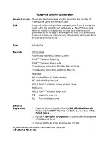
Wattsville and Mercalli Booklet
There has been an earthquake! Can you listen to the description of damage given by callers in order to determine the epicenter? The 11th of 20 lessons has pupils read a script of one emergency caller. The class records the information on...

