Owl Teacher
Imaginary Nation: Constructing a Map
Your young geographers will combine what they have learned about the five themes of geography and their inner creativity to design a physical map for an imaginary nation.
Curated OER
Earth: Land Use Picture Project
Students explore how changes in human land use are impacting local environments. They also explore some of the social impacts of various land uses in their area. They identify and discuss some social impacts of the different land uses.
Beverly Hills High School
Mapping Napoleon's Empire at Its Height (1812)
The complicated political history of Europe becomes apparent as young historians create a map of the borders of France when Napoleon's Empire was a its height in 1812.
Institute for Geophysics
Understanding Maps of Earth
Here is your go-to student resource on primary geography concepts, including facts about the surface of the earth and its hemispheres, latitude and longitude, globes, types of maps, and identifying continents and oceans.
K-State Research and Extensions
Water
How are maps like fish? They both have scales. The chapter includes six different activities at three different levels. Scholars complete activities using natural resources, learn how to read a map, see how to make a compass rosette,...
Oregon State
World Map of Plate Boundaries
Young geologists piece together the puzzle of plate tectonics in an earth science lesson. Given a physical map of the world, they search for land formations that indicate the location of different types of plate boundaries.
Mrs. Robbins' Social Studies Site
The Berlin Blockade
The Berlin Blockade may not take up as much space in the history books as other events of the Cold War, but for the citizens of west Berlin in 1948—and the events to follow between the Soviet Union and the United Stattes—those 318 days...
Rainforest Alliance
Protecting the Critical Habitat of the Manatee and Loggerhead Turtle
Explore ocean habitats with a lesson that showcases the home of manatees and loggerhead turtles in Belize. Here, pupils compare and contrast the homes of ocean animals to those of humans, listen to an original short story about...
Forest Foundation
Forest Watersheds
Where does the water we use come from? To understand the concept of a watershed, class members study the water cycle and then engage in an activity that simulates a watershed.
Bowland
You Reckon?
Sometimes simple is just better. A set of activities teaches young mathematicians about using plausible estimation to solve problems. They break problems down to simpler problems, use rounding and estimation strategies, and consider...
PBS
Make a Balloon Globe
"We've got the whole world in our hands," is what your students will be singing after completing this fun geography activity. Using the included templates for the seven continents and a balloon, they create their very own globes.
Miama-Dade County Public Schools
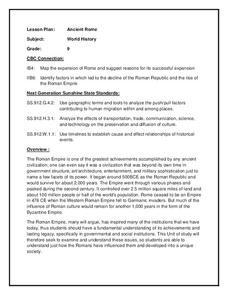
Ancient Rome
This resource outlines several general activities for a study of Ancient Rome, and includes guiding questions, a handout on the story of Romulus and Remus, and ideas for incorporating mapping and timeline activities into your review.
NASA
Erosion and Landslides
A professional-quality PowerPoint, which includes links to footage of actual landslides in action, opens this moving lesson. Viewers learn what conditions lead to erosion and land giving way. They simulate landslides with a variety of...
University of Wisconsin
Follow the Drop
Young surveyors look for patterns in water flow around campus. Using a map of the school (that you will need to create), they mark the direction of the path of water. They also perform calculations for the volume that becomes runoff. The...
Rainforest Alliance
How Do Jaguars and Howler Monkeys in Belize Depend on Us?
How does weather play a role in the lives of land and sea creatures? Find out with a instructional activity focused on habitats and the ways animals from different homes are connected. Here, learners explore how the life of a...
Curated OER
3D Textured Globe
The earth, our home planet, and the star of Earth Day celebrations everywhere! Celebrate Earth Day or examine Earth's place in the solar system, with a fun and easy craft, perfect for children nine and up. Paper mache ornaments, paint,...
Boston University
Scramble for Africa
In this fantastic simulation, your young historians take on the roles of imperialistic European countries in the nineteenth century and then "scramble" to carve up the continent of Africa! This is a very hands-on activity that will help...
Sharp School
Travel Brochure Project
Designing a travel brochure is a classic project that will help your class members develop a variety of skills, such as researching informational texts, designing creative visual products, and communicating what you have learned.
Star Wars in the Classroom
Star Wars Geography Unit
What kind of animals live on an ice planet like Hoth? How would the habitat on Tatooine allow different organisms to thrive? Connect social studies, science, and Star Wars in one engaging activity that focuses on the ecosystems...
Illustrative Mathematics
Placing a Fire Hydrant
Triangle centers and the segments that create them easily become an exercise in memorization, without the help of engaging applications like this lesson. Here the class investigates the measure of center that is equidistant to the three...
Curated OER
Latitude/Longitude Activity
Youngsters work in groups to solve clues involving latitude and longitude coordinates in order to decipher mystery animals in this fun learning experience!
Biblioteca Virtual Miguel de Cervantes
Biblioteca Virtual Miguel De Cervantes: Paraguay
This resource site in Spanish for the country of Paraguay. The flag and a general map of the country are included. Of particular interest is the statistical data available on land size, climate, population, life expectancy, infant...
Biblioteca Virtual Miguel de Cervantes
Biblioteca Virtual Miguel De Cervantes: El Salvador
This resource site in Spanish for the country of El Salvador. The flag and a general map of the country are included. Of particular interest is the statistical data available on land size, climate, population, life expectancy, infant...
Biblioteca Virtual Miguel de Cervantes
Biblioteca Virtual Miguel De Cervantes: Costa Rica
This resource site in Spanish for the country of Costa Rica. The flag and a general map of the country are included. Of particular interest is the statistical data available on land size, climate, population, life expectancy, infant...


