Happy Housewife
State Notebooking Pages
When learning about US geography, it can hard to remember facts about 50 different states. Help your young scholars organize all of this information with a collection of easy-to-use note-taking guides.
Curated OER
States & Capitals 1-25
Young pupils test their geography skills by matching the 50 states to their correct state capitals. The states are listed in alphabetical order on the left, and a list of state capitals are presented in random order in a right-hand...
Curated OER
Arizona State Quarter
In this Arizona worksheet, students analyze a picture of the state quarter of Arizona. Using the information on the coin, students answer 5 short answer questions.
Curated OER
Puerto Rico: The 51st State?
Learners explore Puerto Rico. In this Puerto Rico current events lesson, students conduct a Webquest to answer questions about Puerto Rico's culture. Learners discuss whether Puerto Rico is a country or a state, and defend their...
Curated OER
Puerto Rico: The 51st State?
Learners research the history of Puerto Rico, its culture, and geography. In this Puerto Rico lesson, students find Puerto Rico on a map and find specific regions or cities. Learners discuss Puerto Rico's statehood and listen to salsa...
Curated OER
Arizona
Students engage in a series of lessons about Arizona. They perform experiments and participate in activities across the curriculum. They perform research on websites imbedded in this plan to complete a variety of tasks.
Curated OER
Play Doh Map of Your State
Students create a state map using Playdoh. In this hands-on state geography lesson, students work in groups to form a three-dimensional map of their state using Playdoh made at home following a (given) recipe. Students use four colors...
Curated OER
Arizona State Word Jumble
For this word scramble worksheet, students unscramble the letters to spell words associated with Arizona. Students complete 20 words.
Curated OER
Biggest Cities in Each State Quiz
In this online interactive geography quiz worksheet, students examine the chart that includes the names of 50 U.S. states. Students identify the names of the two largest cities in each state in 8 minutes.
Curated OER
Arizona: Crossword Puzzle
In this United States history worksheet, students use the 15 clues in order to fill in the crossword puzzle with the appropriate answers pertaining to Arizona.
Curated OER
Arizona Outline Map
In this Arizona outline map activity, students examine political boundaries of the state and the placement its capital city as well as its major cities. This map is not labeled.
Curated OER
USA States, Capitals Print Worksheet
For this United States worksheet, learners read a list of all of the states and their capitals. Students write the abbreviations for each state. Learners are given 50 states and 50 capitals.
Curated OER
American States and Their Capitals
In this United States capitals instructional activity, students match the 15 states on the left side of the sheet to their respective capitals on the right side of the sheet.
Curated OER
U.S.A. State Capitols
In this state capitol worksheet, learners fill in the state capitol of given states. A reference web site is given for additional activities.
Curated OER
Tooling Around Arizona: Reading Arizona Maps
Learners research Arizona maps. In this map lesson, students discuss map titles, scales, directions, elevation, and symbols. The class will examine topography, landforms, and rivers found on an Arizona map.
Curated OER
Quilt? What Quilt? I Don't See a Quilt!
Students analyze maps and cultures of major cities in the state of Arizona and designate different regions within the state according to geography and economy.
Curated OER
Baseball--Where the Parks Are
In this social studies instructional activity, students utilize a map to label the location of each city with a Major League team and then with colored pencils label the homes of the All-American Girls League teams.
Curated OER
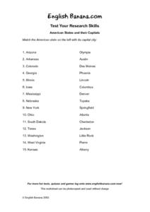
American States and Their Capital- Test Your Research Skills Worksheet
In this geography skills worksheet, students match the American state listed on the left with its capital city listed on the right by drawing a line from one to the other.
Curated OER
States Quizzes
In this state postal code activity, students respond to 45 fill in the blank questions that require them to use the listed state postal codes as answers.
Curated OER
States in America and Their Capitals
In this capitals of states in America worksheet, students answer multiple choice questions about the capitals of states. Students complete 10 questions total.
Curated OER
Dreaming of a Healthy City
Ninth graders design a healthy city. They identify the essential elements of a city and describe how climate and geography can determine the layout of a city. They create a blueprint of their design and share in small groups.
Curated OER
Understanding Growth of the Phoenix Area
Students study the growth of the Phoenix area using geographic images, maps, tables, and graphs. They study the idea of community.
Curated OER
The Four Corners Region of the United States Cultures, Ruins and Landmarks
Students who live in the inner city are introduced to the four corners region of the United States. In groups, they examine how the region differs compared to where they live and their culture. They develop maps of the area and locate...
Curated OER
The Silly States: Where Is Your State and City?
First graders read The Scrambled States of America and discuss whether it is real or fantasy as compared to the United States. In this geography lesson, 1st graders identify their city or state on a map and work in groups to color the...


