Earth Surface Features Teacher Resources
Find Earth Surface Features lesson plans and worksheets
Showing 1,846 resources
Curated OER
Natural Disaster
Describe how plate tectonics account for various land formations. Learners discuss different marine sanctuaries and create a poster about tectonic activity in these areas. They share their posters with the class.
Curated OER
A Model of Three Faults
Students observe fault movements on model of the Earth's surface, find fault movements associated with different types of plate boundaries, research examples of non-plate boundary faults, and research and report on the types of faults...
Curated OER
The Earth's BIG Features
Your students will enjoy the vivid pictures and interesting facts about world geography, in this presentation. Depicted are several major geographical features found around the world and a description of each.
NorthEast Ohio Geoscience Education Outreach
Hydrology and Landforms
Three days of erosion exploration await your elementary geologists. Learners begin by examining rivers via Google Earth, then they model water flow in sand, and finally, they identify resulting landforms. This lesson is written...
Curated OER
Earth Day
Students explain that there are pollutants in the Anacostia River, what those pollutants can cause, and how to prevent further pollution. They read about pollution and graph levels of fecal coliform in the water.
Curated OER
Mountain Creation: A Drama Exploration
Students explore mountain formation. In this cross curriculum earth science and legend writing instructional activity, students listen to the poem "The Way to make Perfect Mountains" by Byrd Baylor and identify examples of vivid language...
Curated OER
Continental Drift
Playdough has reached a new level. This clay-motion video demonstrates continental drift, faults, volcanoes, and mountain formation. If you don't show this clip perhaps you could employ the concept and have your class make an amazing...
Institute for Geophysics
Understanding Maps of Earth
Here is your go-to student resource on primary geography concepts, including facts about the surface of the earth and its hemispheres, latitude and longitude, globes, types of maps, and identifying continents and oceans.
Science Matters
Earth Shaking Events
The world's largest measured earthquake happened in 1960 in Chile, reaching a terrifying 9.5 magnitude on the Richter Scale. The second lesson in the 20-part series introduces earthquakes and fault lines. Scholars map where previous...
Lee & Low Books
Classroom Guide for Sacred Mountain: Everest
The most famous climbers of Mount Everest could never have made it to the summit without the assistance of the local Sherpa. Christine Taylor-Butler's nonfiction children's book Sacred Mountain: Everest is the focus of an extensive...
National Park Service
Erosion
A set of PowerPoint slides supports a lecture or class review of weathering and erosion. Viewers learn the definition of each and examine various photos for evidence. Erosion is further depicted as caused by wind, water, and ice....
Curated OER
The Continents and Oceans of the World
Learners explore world mapping skills. In this world geography instructional activity, students identify and label the continents and oceans on a world map using the Visual Thesaurus. Learners generate mnemonic devices to help memorize...
Curated OER
Plate Tectonics - Electronic Scavenger Hunt
Young scholars explore the attributes of plate tectonics. In this plate tectonics lesson, students use computers to access a plate tectonics scavenger hunt file and complete the required activities using their textbooks.
Curated OER
Earth Clock- A Timeline, Past to Present
Students create an earth clock. In this earth clock lesson, students create a clock which serves as a timeline of the history of the earth from 4.567 billion years ago to present day.
Curated OER
Earth
Students study the earth in relation to the solar system. In this planetary lesson students complete several investigations into the measurement of the earth and its magnetic field.
Curated OER
Earth: The Apple of our Eye
Students are led through a demonstration in which they cut open an apple, which represents the earth. They follow through the hands-on lesson, cutting the apple into various portions--each representing some aspect of the earth.
Curated OER
Landforms in a Tub
Fifth graders use common household items to build landforms and simulate weathering and erosion.
Curated OER
Carve That Mountain
Students investigate major landforms (e.g., mountains, rivers, plains, hills, oceans and plateaus). They build a three-dimensional model of a landscape depicting several of these landforms. Once they have built their model, they act as...
Curated OER
Plate Tectonic Cycle
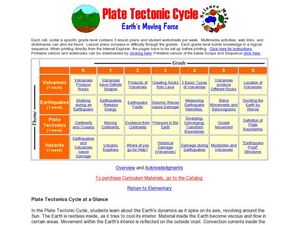
Students explore the Earth's movements by completing worksheets. In this plate tectonics instructional activity, students define such natural disasters as volcanoes, earthquakes, tsunamis and mudslides and discuss their connections to...
Curated OER
Geological Features: How Weathering & Erosion Help Create Landforms
Students explore how the Earth's surface changes resulting in geological features and landforms. They perform a read-a-loud on Thomas
Locker's Mountain Dance, complete a KWL chart, and create a
landform using plaster of paris.
Curated OER
Early Earth History
In this earth history worksheet, students answer 12 questions about geological time, the eras of Earth, the changes taking place in early Earth and the life present during the eras. They also answer 2 questions about the Paleozoic Era.
Curated OER
Theory of Plate Tectonics
In this plate tectonics worksheet, student answer 15 multiple choice questions about plate movement, types of boundaries, collision of plates, continental plates, and the lithosphere.
Curated OER
Plate Tectonics
Students research separate elements of the theory of Plate Tectonics, then share that information with each other, drawing conclusions from the culminated information.
Curated OER
Continents Game
Students study geography. In this geographic terms lessons, students compare the continents based on their different features. They work as a class to put the continents in order from least to greatest based on the different geographic...


