Curated OER
Where the Parks Are
Students research major league baseball in United States and Canada. In this baseball history lesson plan, students use a map of the United States and Canada to find and label each major league team. Students then color the home cities...
Curated OER
Orienteering - Lesson 1 - Maps & Map Scales
Lesson 1 of 10 lessons in this orienteering unit is about maps and map scales. After all, orienteering is all about maps, compasses, and finding ones' way around. It is imperative to be able to read maps and understand the relevance of...
Curated OER
Run/Walk Across America
Walk, jog, or run across America. Maps of individual states, visual progress, competition, and rewards, seem to be great motivational ideas. Make sure that the distances that each class has to walk or run are the same, because getting...
Curated OER
Orienteering - Introductory Lesson
Gain knowledge of directions and degrees while learning how to read a compass. NEWS - north, east, west, south, and everything in between. It's crucial to be accurate in reading a compass and understanding degrees and direction when...
Curated OER
Walk the State Line
Students practice balancing activities while learning the states in the USA.
Curated OER
The Marsh Land as a Changing Environment
Sixth graders continue their examination of the state of Connecticut. After taking a field trip, they identify the types of birds, plants, invertebrates and vertebrates who make their home in the salt marshes. In groups, they identify...
Curated OER
Baseball--Where the Parks Are
In this social studies worksheet, students utilize a map to label the location of each city with a Major League team and then with colored pencils label the homes of the All-American Girls League teams.
Curated OER
Soar to Salt Lake City
Learners improve their cardio-respiratory fitness and to learn about our country. They move (skip, jog, walk, slide, gallop, etc.) for 2 minutes (approximately .2 mile). Fourth graders calculate our weekly mileage and are responsible...
Curated OER
North America Knowledge
Second graders move around a large map of the North America drawn on the playground. They follow the directions called out by the teacher. They may also develop their own tasks for other students to follow.
Curated OER
Sports Franchises: The Demographic Dimension
Students examine how U.S. population patterns have changed over time. Using the growth of major league baseball to illustrate these patterns, students create maps, examine regional migration patterns, and make predictions for the future.
Curated OER
Walk and Bike Across America
Students learn how to use maps, compute mileage, and be physically active while exploring America's national parks, historical heritage, and nutritional information via key agricultural sites.
Curated OER
Get Into March Madness!
The Annual NCAA Basketball Tournament is here........take advantage!
Curated OER
Discovering Our Legacy of Giving
Seventh graders examine the characteristics of philanthropists. In this cross- curricular lesson, 7th graders evaluate the character traits of people from a film. Students write a metaphor about responsibility to community.
Curated OER
Geography Lesson 1
Students examine relationship between population centers and sports teams, explore influence of weather on attendance, and research influence of geography, traffic flow and disposable income on site selection for sports stadiums.
Calvin Crest Outdoor School
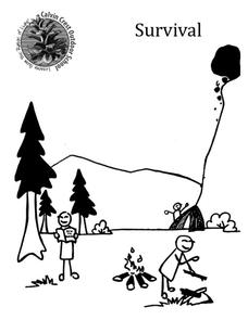
Survival
Equip young campers with important survival knowledge with a set of engaging lessons. Teammates work together to complete three outdoor activities, which include building a shelter, starting a campfire, and finding directions in the...
Centers for Disease Control and Prevention
Centers for Disease Control: West Nile Virus
Provides basic information on West Nile virus including how to avoid it and a map that shows which parts of the United States have the most cases.
Other popular searches
- United States Maps Regions
- Northeast United States Maps
- 50 United States Maps
- Create United States Maps
- Western United States Maps
- Custom United States Maps
- Outline Maps United States
- Blank United States Maps
- Maps, United States Rivers
- Maps United States Capitals
- Maps of the United States
- Maps United States


