Curated OER
Defining Regions
Fifth graders will work in cooperative learning groups to research North American regions and create presentations to share with their classmates. To show what they have learned, 5th graders will create maps of North American regions.
Curated OER
ADULT ESOL LESSON PLAN--Environment and the World
Students locate and trace Florida on a United States map as well as their local counties and city of residence on a state map. In addition, they label all the directions north, south, east and west on each map.
Curated OER
Map Comprehension
Third graders practice reading different types of maps. They locate state borders, capitals, the national capital and states. As a class, they recite the states they have visited in their young age and how they got there. They develop...
Curated OER
Vermont Map, Word Search, Scrambled Places and Crossword Puzzle
In this geography worksheet, students learn the important physical features and major cities in the state of Vermont by completing any of the 5 worksheets. There is a free form map, a "label me" map, word search, scrambled places and...
Curated OER
Precipitation Map
In this precipitation map worksheet, students study the key and the map for the various precipitations that occur across the United States. Students then answer questions about the precipitation.
Curated OER
United States of America: Name That State!
In this states activity, students write the names of all 50 states, matching numbers on a map of the US with their correct state names.
Curated OER
The War of 1812
You won't find a better worksheet than this! Here is a fabulous, comprehensive test on the War of 1812. Learners complete 50 questions of a wide variety; true or false, matching, fill-in-the-blank, multiple choice, and essays. They must...
Curated OER
Minnesota
In this Minnesota activity, students analyze a simple unlabeled outline map of the state of Minnesota. Students may color the map or label it with cities or physical features.
Curated OER
Popcorn Geography
Students use kernels to create a "Top Corn-Producing States" map or graph. They read and round off numbers. Students identify on a U.S. outline map the location of corn-growing states. They create a visual (map or graph) illustration...
Curated OER
Weather in Your City
Students observe weather conditions of a particular city. Multiple intelligences are explored within this lesson. They locate their particular city on a United States map. Each student writes about their discoveries in his/her journal...
Curated OER
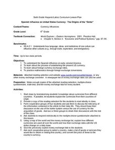
Spanish Influence on United States Currency: The Origins of the "Dollar"
Sixth graders research the Spanish influence on early colonial America and the process of establishing the present U.S. currency. They read and discuss an informational handout in small groups, and take a short quiz. Students then...
Curated OER
Location, Location, Location!
Twelfth graders locate cities, states and countries on maps. They use the cardinal directions to locate places on maps. They describe where they were born by giving clues without naming the exact state. They trade papers and try to guess...
Curated OER
Summertime Travel
Third graders write about a summer event they participated in. In this paragraph writing instructional activity, the teacher models how to write about a place they have visited. Students then write their own paragraphs. Students...
Curated OER
America Will Be
Students work together to research and create different types of maps of the United States to be used as part of a geography trivia game.Groups research North American annual rainfall, climate, mountain ranges major rivers and state...
Curated OER
The Water Around Us
Pupils discuss importance of reading maps and knowing about the geography of the United States, and locate bodies of water on different types of maps and examine how they are used in the state or local community.
Curated OER
Four Learning Styles
Students play a game where they insert the states of the United States onto a map, and discuss the four learning styles as they play. In this learning styles lesson plan, students discuss how each learning style would play and think...
Curated OER
Colonial Vacation Planner
Students plan a family vacation to states that were among the original 13 colonies. The groups determine which state they visit, map their route, calculate the mileage, and determine how much money they spend on gasoline.
Curated OER
Using Four Main Directions in the Classroom
Pupils identify the four cardinal directions. In this map skills geography lesson plan, students use a magnetic compass to label the four directions in the classroom. Pupils use the four directions to locate objects in the classroom.
Curated OER
US: Midwest Region
In this United States political map learning exercise, students examine the state boundaries of the Midwestern Region. The map also highlights each of the state capitals denoted by stars.
Curated OER
US: Northeast Region: Unlabelled
In this United States political map worksheet, students examine the Northeast Region state boundaries. The map also highlights each of the state capitals denoted by stars.
Curated OER
Stately Names
In this algebra worksheet, students complete a word puzzle with clues that links the name to that of a State. There are 26 word problems with an answer key.
Curated OER
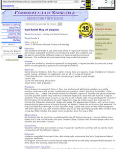
Salt Relief Map of Virginia
Fourth graders create a salt relief map of the four regions of Virginia. They indentify land forms and bodies of water, and summarize how they made their project.
Curated OER
Map Skills
In this map skills worksheet, students research and label the states in Australia and add in the major cities, oceans and seas.
Curated OER
Mystery State #20
In this mystery state activity, students answer five clues to identify the state in question. They then locate that state on a map.
Other popular searches
- Kansas State Map
- Delaware State Map
- Pennsylvania State Map
- Washington State Map
- New York State Map
- Map State of Washington
- Map of California State
- City State Map
- Louisiana State Map
- State Map of Iowa
- Border State Map
- State Map of Idaho


