Curated OER
"Potato Mountain": Reading/Understanding Topographic Maps
Students investigate how to read topographic maps. In this map reading lesson students complete a topographic map activity.
Curated OER
Reading distance on maps
Eighth graders complete worksheets on reading the distance on maps in miles or kilometers. For this maps lesson plan, 8th graders use a calculator and ruler.
Curated OER
Cinderella Map Key
Students design a map key in order to show where the different Cinderella stories have taken place. In this map key lesson plan, students place symbols on a map to show the diversity of the stories.
Curated OER
Math 312 Spring 98 - Mappings and Points
In this mapping and points worksheet, students describe and sketch point sets of complex numbers. They evaluates functions of a complex variable in an extended plane. This one-page worksheet contains five problems.
Curated OER
Direction of River Flow
Middle schoolers determine the direction the river flows. They use a US map with rivers listed, colored pencils and a compass or transparency with directions marked. Students use a color key to determine which direction the river is...
Curated OER
Making Topographic Maps and Mountain Profiles
Students study how to mark inclines and construct a mountain profile. In this topographic map lesson students mark contour intervals and draw mountain profiles.
Curated OER
The Kansas State Capitol
Second graders research the Kansas state capitol building. In this historical landmark instructional activity, 2nd graders explore the Kansas state capitol. Over three days students explore the Governor's office, Senate and House of...
Education World
Mystery State #1
In this United States mystery learning exercise, students determine which state is described by the 5 clues listed on the sheet and then mark it on the outline map of the United States.
Curated OER
State and National Parks
In this insects worksheet, students 7 questions regarding state and national parks. A print out version of this worksheet is available, but the online version contains links to various webpages with information on the topics, so...
Curated OER
New York State Testing Program Grade 8 Math Sample Test 2005
In this New York state sample test worksheet, 8th graders solve thirty-three sample math problems designed to help students prepare for the grade eight math test. Tips for taking the test are provided.
Curated OER
Printable Map of the State of Vermont
In this printable map of Vermont worksheet, students see a clip art picture of Vermont superimposed on the United States map. The capitol city of Montpelier is labeled on the map.
Curated OER
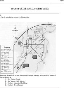
Fourth Grade Social Studies
For this social studies worksheet, 4th graders answer multiple choice questions on state maps, city maps, road maps, political maps, and more. Students complete 25 multiple choice questions.
Curated OER
Cardinal Directions
First graders study cardinal directions on maps. In this geography lesson, 1st graders determine and show where North, South, East, and West are on various maps.
Curated OER
Latitude and Longitude
Students demonstrate how to locate places on a map using a grid. In this map skills lesson plan, students are introduced to latitude and longitude lines. Students define these terms and view a large map of a state. Students come up to...
Curated OER
Lesson 3: Seven Day Road Trip
Students plan a seven day road trip. For this travel lesson, students plan a driving trip that includes five major cities or attractions in Florida or another state of their choice. They show the trip on a map, calculate distances that...
Curated OER
A Shuttle's Eye View
Students explore the goals of the Shuttle Radar Topography Mission as a springboard to exploring the topographical features of their own state or region. They synthesize their understanding of landforms and topography by mapping their...
Curated OER
Project Whistlestop:Missouri Vacation Learning Unit
Fourth graders reserach the state of Missouri. For this Missouri History lesson, 4th graders plan a vacation to a region of Missouri. Students work in collaborative groups to determine all aspects of the trip. Students use math...
Curated OER
Indiana Travel Guide
Fourth graders share their information about their home state. In this research lesson, 4th graders use graphic organizers to make a travel guide about the state of Indiana. This lesson could be modified for use with any state, it also...
Curated OER
A New Federation
Students describe the relationships between state and federal parliaments in Australia. They identify responsibilities shared between federal and state and territory governments. Students explore an alternative federal structure by...
Curated OER
5th grade social studies geography
In this geography worksheet, 5th graders complete multiple choice questions about hemispheres, maps, cities, ecology, and more. Students complete 25 questions.
Curated OER
Surveying the Land
Students explore the different kinds of maps and the purpose of each. For this Geography lesson, students work in small groups to create a map which includes the use of a map key.
Curated OER
George Washington's Revolutionary Journeys
Middle schoolers take a closer look at historical maps. In this American Revolution lesson, students examine the provided historical maps and documents to determine the assignments that George Washington assigned to subordinates during...
Curated OER
California Geography
Fourth graders explore geography of four distinct regions of California: mountains, coast, central valley, and desert. They locate California on map, identify state's boundaries and borders, and explore agriculture, a major economic...
Curated OER
2010 Census Lesson 1: It's About Us
Students analyze data from the 2000 census to learn how the census works. In this civics instructional activity, students read a story to find out about the census, then use a map and census data to analyze changes. Lesson includes...
Other popular searches
- Kansas State Map
- Delaware State Map
- Pennsylvania State Map
- Washington State Map
- New York State Map
- Map State of Washington
- Map of California State
- City State Map
- Louisiana State Map
- State Map of Iowa
- Border State Map
- State Map of Idaho


