Curated OER
Agriculture: It Doesn't Just Happen
After reading an informational text on the Agricultural Research Service, learners research the role of the ARS in Oklahoma. Using reputable online sources, they label a map of the state with relevant areas. Researchers focus on one of...
Texas State Energy Conservation Office
Investigation: Tour de Texas
Teams of Texas tourists gather into groups to analyze what they can do with $50 worth of an alternative fuel. They write checks, keep a balance sheet, and map out their sight-seeing route taking into consideration the location of...
Anti-Defamation League
Impact of the U.S. Expansion on Indigenous People and Stereotypes About Native American People
The 2004 U.S. bicentennial sparks a discussion about its meaning and importance to United States history. Readings, maps, tables, and reflective writing prompt small groups to explore the westward expansion, Lewis and Clark, and how...
Curated OER
Teaching With Documents: U.S. Constitution Workshop
What does it mean to be American? Explore the constitution and what it really means to be a citizen here. First, learners of all ages will investigate different primary source documents. Then, they establish each document's...
Curated OER
States On A Map
Third graders locate the states of Main and Kansas on a map. In this state location lesson plan, 3rd graders read the book Sarah, Plain and Tall and discuss what states she traveled through.
Curated OER
Mapping Population Changes In The United States
Learners create a choropleth map to illustrate the population growth rate of the United States. They explore how to construct a choropleth map, and discuss the impact of population changes for the future.
Curated OER
Mapping Where Animals Live
For this animal mapping worksheet, students read a short passage about amphibians and reptiles in New York State, then use a set of maps to answer related questions.
Curated OER
Puerto Rico: The 51st State?
Students examine the political status of Puerto Rico. In this global studies lesson, students explore Puerto Rico and consider the feelings of Puerto Ricans regarding their unique political status.
Curated OER
State My Name
Students study the names of all fifty states, their capitols, location on a map, and an economic resource of each state. They complete a matching game activity.
Curated OER
Natural Resources and Transportation in the United States
Students study thematic maps (included with the lesson) to determine possible relationships. They develop three hypotheses about the relationship. Students choose one of their hypotheses to explain. The explanation is to include reasons...
Curated OER
Introduction to Symbols
Learners study the concept of picture symbols as a way to express ideas without using words. In this picture symbol instructional activity, students place symbols on a U.S. map according to meaning. Learners then review various...
Curated OER
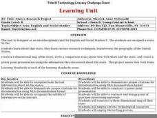
States Research Project
Eighth graders create an in-depth research report on a state. They conduct Internet research, write a comparison essay about New York State and their assigned state, create a 3-dimensional map, and develop a Powerpoint presentation.
Curated OER
Map Creation
Second graders identify a map, symbol, key, and compass rose. Students create and print a map for teacher evaluation using the computer. Students identify the symbols on their map and orally present them to the class.
Curated OER
The Fifty States
Students research to find information about the U.S. States. In this fifty states instructional activity, students choose a state to research and locate it on the map. Students research to find the population of that state and record by...
Curated OER
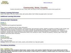
Community, State, Country
First graders identify the town, county, state, and country in which they reside and the places where people work. They draw a picture of one of the places where people work.
Curated OER
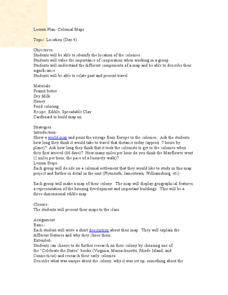
Colonial Maps
Students discover the history of America by identifying the traditional colonies. In this U.S. history lesson, students examine a world map and identify where the voyagers left from Europe to arrive at the United States. ...
Curated OER
Mapping the Most Common U.S. City Names
Students discuss the most common U.S. place names. They map the locations of U.S. cities with the most common names and use an atlas, or an online map tool such as MapQuest or Yahoo Maps.
Curated OER
Maps as Models of Earth
Eighth graders use different types of maps to find locations and surface features. In this map-reading lesson students use a compass to find direction.
Curated OER
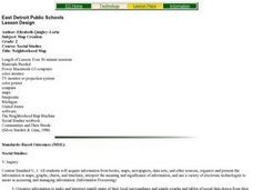
Map Reading
After examining a map from 1803 and 2003, they explore how to become map readers. They describe what they see on the map from 1803 and compare the information to the map from 2003. Students create their own map of the neighborhood that...
Curated OER
Maps
Students figure out the mileage from one state to another using a map. In this map lesson plan, students look at the scale factor and turn it into a fraction. They measure the distance between two cities and use the proportion to find...
Curated OER
Bermuda Triangle: Map Activity
In this Bermuda triangle worksheet, students complete a set of 4 questions using a given map of the Bermuda triangle. Answers are included on page 2.
Curated OER
Isla Story Map and Time-line
Fourth graders arrange five major events from the story Isla in correct order on a quiz. They represent the sequence of at least five story events through a story map based on the book, Isla.
Curated OER
United States Capitals Map Quiz
In this online interactive states and captials quiz worksheet, students examine the 50 pictured states and try to name all of the state capitals.
Curated OER
Maps In Our Everyday Lives
Young scholars break into groups and complete a chart about information on maps of their hometown.
Other popular searches
- Kansas State Map
- Delaware State Map
- Pennsylvania State Map
- Washington State Map
- New York State Map
- Map State of Washington
- Map of California State
- City State Map
- Louisiana State Map
- State Map of Iowa
- Border State Map
- State Map of Idaho
