Curated OER
Printable Map of Arkansas
In this printable map of Arkansas worksheet, students see a clip art picture of the state of Arkansas superimposed on the map of the United States. The see the capitol city, Little Rock, labeled on the map. There are no directions given...
Curated OER
United States 1860
In this United States historical map worksheet, students examine the state and territorial boundaries as well as the large cities of the nation in 1860.
Curated OER
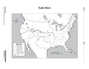
Trails West Map
In this United States historical map worksheet, students examine the trails that settlers of the Western United States took during the period of Western Expansion.
Curated OER
Mapping the Family
Learners research the locations where their fathers have lived. In this map skills lesson, students identify the locations their fathers have lived in the world as they create charts and maps that note the information.
Curated OER
Mystery State #18
In this mystery state instructional activity, students answer five clues to identify the state in question. They then locate that state on a map.
Curated OER
Mystery State #51
In this mystery state worksheet, pupils answer five clues to identify the state in question. They then locate that state on a map.
Curated OER
Colonial America 1776 Map
In this United States historical map worksheet, students examine the colonial boundaries in 1776 as well as the Proclamation Line of 1763.
Curated OER
The 13 British Colonies Map
In this United States historical map worksheet, students examine the 13 colonial boundaries and noted major cities.
Curated OER
Will There Be a White Christmas This Year?
Young scholars examine historical weather data, and create map and color key that illustrates the likelihood of a white Christmas in different locations across the United States.
Student Handouts
Geography of Dr. Martin Luther King, Jr.
Young geographers follow Dr. Martin Luther King's journey during the civil rights movement by identifying major events on a map of the eastern United States, such as his birth in Atlanta, Georgia and his famous...
Curated OER
Exercise Set 2.6: An Introduction to Functions
In this functions learning exercise, students solve 70 short answer questions. Students find domain of functions and evaluate them for a given value. Students determine if a mapping diagram represents a function.
Curated OER
Where in the World Is Mexico?
Learners practice map-reading skills as they locate Mexico and its cities on a world map. By creating a puzzle out of a map of Mexico, students engage in a meaningful hands-on activity to help them explore that country's geography.
Curated OER
Growth of Florida's Railroads
Based on an examination of Florida's railroad system, this multi-step lesson addresses FCAT requirements specific to Florida. After reading a passage, scholars use a map of the state to label railroad systems. They describe the goods...
Curated OER
How Far Is It?
Students use a map key to estimate the distance from Salt Lake City, Utah, to ten other cities. Then they use an online distance calculator to see how close their estimates come!
Curated OER
Weather Lesson Five
Learners define a weather forecast, make a forecast using a weather map, identify three prediction guidelines, and explain how computers help to make forecasts. Students make a 24-hour forecast for each of the thirteen states targeted.
Curated OER
Sand Explorations
Students experiment with different samples of sand from Maui leeward and windward beaches. They create a sand map to suggest at least one contributing factor for the formation of each beach sample. They test the samples to determine...
Curated OER
Mock Election
Here is an excellent PowerPoint presenting loads of information about the US election process. Some of the topics included in the slide show: the reasons voting is important, how to choose a candidate, how the federal, state, and local...
Curated OER
Ohio Vocabulary
After selecting State Unit Studies and choosing Ohio, you'll find a plethora of information on The Buckeye State. There's an information sheet, an Ohio state map, and several sheets that detail the capital, flag, flower, bird, tree,...
Curated OER
Sunny Symbols
After listening to a series of stories about signs and symbols associated with the United States, pupils discuss the importance of the sun in Native American legends and as a representation of New Mexico. As part of this exploration,...
Curated OER
Push or Pull?
Utilizing the Nebraska State Quarter, pupils learn about the pioneers who had wagons that were pulled across Nebraska by oxen during the westward movement. Excellent worksheets are embedded in the plan that guide them through this fine...
Curated OER
Call to Arms: A Service Project
Sick of selling candy and washing cars? How about hosting a Digital Day or a Learning Lunch? The suggestions here make fund raising fun and rewarding. Raise money to preserve important maps and other primary source documents.
Curated OER
Understanding Stereotypes
Pupils confront age-related stereotypes, explore how stereotyping impacts their lives, and discuss how they can make changes to reduce over-generalizations, unfair assumptions, and critical judgments about people groups. They use a...
Curated OER
Farming the Great Land
Students decide which land in Alaska is suitable for farming using a state map. Teachers help the students discover why only so much of the land is suitable for farming.
Delegation of the European Union to the United States
Cultural Identity
How does cultural diversity impact political identity? That is the question researchers face as they continue their examination of the European Union and the programs it has developed in its attempt to achieve unity in diversity. To gain...
Other popular searches
- Kansas State Map
- Delaware State Map
- Pennsylvania State Map
- Washington State Map
- New York State Map
- Map State of Washington
- Map of California State
- City State Map
- Louisiana State Map
- State Map of Iowa
- Border State Map
- State Map of Idaho


