Ms. Catsos
Ancient Rome Map Worksheet
It wasn't just the great leaders of ancient Rome that shaped their civilization—the geography of the region played a major role as well. After first identifying major land masses, bodies of water, and city states on a map of Europe,...
Curated OER
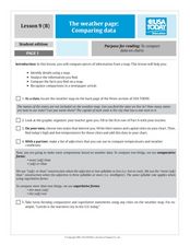
The Weather Page-Comparing Data
Students examine weather patterns in the United States. In this weather instructional activity, students use a United States map to identify high and low temperatures in two states. Students compare the data and record their findings...
Curated OER
Denali Park Topographic Maps
Young scholars construct a topographic map of the Denali National Park. They identify different elevations and record historic landmarks in student science journals.
Curated OER
Mapmaker, Mapmaker, Make Me a Map!
Students evaluate the different types of historical and geographical information that one can gather through close study of historical maps from the 16th through the 19th centuries. They create their own maps.
Curated OER
Map the Civil War
Students explore the Civil War through original maps. In this mapping lesson, students calculate distance and show it on an original map. Students examine the type of landscape and its landmarks and draw symbols on the map.
Curated OER
State Nicknames Quiz
In this online interactive geography quiz worksheet, students examine the chart that includes the names of 49 states. Students identify the nicknames of the states in 6 minutes.
Curated OER
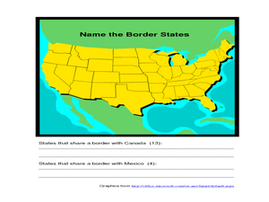
Identifying Border States of the U.S.
For this identifying border states of the U.S. worksheet, 3rd graders visually identify then write the names of the states that border Canada and Mexico; page 1 is a lesson, page 2 is the worksheet.
Curated OER
Learning About Maps
Students investigate the many uses and features of maps and globes and locate where they live on both. In this map lesson, student play a travel game and create their own maps to explore states, continents, countries, and islands.
Curated OER
Water Features - Lesson 2 - U.S. Political Map Grade 4-5
Students locate water features on maps. In this geography lesson, students complete worksheets that require them to identify water features on a U. S. political map.
Curated OER
States and Capitals - Lesson 4 - U.S. Political Map
For this U.S. state capitals worksheet, students identify the capital cities of the 50 states using the latitude and longitude coordinates provided.
Curated OER
U.S. Political Map
Students explore the symbols found in a map legend. In this map skills lesson plan, students locate the legend on a political map and explain what each of the symbols mean. Students locate and identify several symbols on the map.
Curated OER
U.S. Political Map
In this political map worksheet, students use the map of the United States and the 7 cities to measure the straight-line distance between the cities. Students add the total number of miles traveled and write their answers in the spaces.
Curated OER
Song Mapping
Young scholars explore locations on the United States map. In this map skills lesson, students recite the song This Land Is Your Land and locate various places listed in the song on the map.
Curated OER
Printable Map of Connecticut
In this printable map of Connecticut worksheet, students examine the map of Connecticut that is superimposed on the United States map. They see the capitol city of Hartford on the map. There are no directions given.
Curated OER
Mapping Your State's Role in the Vietnam War
Students recognize reasons to celebrate Memorial Day. Students create a map of victims of the VIetnam War. Using the internet, students research information about soldiers from their state who were killd in action in Vietnam. Students...
Curated OER
States/capitals
Students identify the geographic locations of each state of the United States. Working cooperatively, they put togehter a giant puzzle of the United States using their individual pieces.
Curated OER
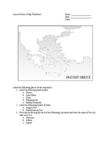
Ancient Greece Map Worksheet
Since the beginning of time, geography has shaped the development of human civilization, and ancient Greece is no exception. This activity supports young historians with exploring this relationship as they first identify key land masses,...
Curated OER
What They Left Behind: Early Multi-National Influences in the United States
Students research the impact of European voyages of discovery and colonial influence on different aspects of American culture. They access a number of online sources and reference maps to trace the influences of England, France, Holland,...
Curated OER
Arkansas State Mineral: Quartz Mineral
The quartz crystals found in the mountains of Arkansas are among the purest and clearest in the world! This lesson has middle schoolers focus on this state mineral of Arkansas as they study the state's geography. A fun game is...
Teach Engineering
Where Are the Plastics Near Me? (Mapping the Data)
The last activity in a nine-part series has teams create a Google Earth map using the data they collected during a field trip. Using the map, groups analyze the results and make adjustments to the map to reflect their analysis. A short...
Social Studies School Service
Ancient China: Introduction, Map
What a great resource for introducing your youngsters to the world of ancient China and the earliest stages of its timeline. Included are creative ideas for organizing your room, as well as an engaging lesson, anticipatory set,...
Curated OER
Map-A-Buddy
Students investigate the concept of tracking and spatial movements of animals in relation to the environment in which they live. They participate in an interactive activity by tracking one another over a pre-defined region, record the...
Curated OER
Regents High School Examination: Physical Setting Earth Science 2010
Every topic under the sun is covered in this New York State Regents High School Examination. With the focus of earth science, participants answer 85 quesitons about the solar system, geologic time, rocks and minerals, landforms, and...
Curated OER
Regents High School Examination: Physical Setting Earth Science 2006
Test your class on earth science with this extensive resource. This test, created by The University of the State of New York Regents, is made up of 50 multiple choice questions and 32 short answer questions that cover the branches of...
Other popular searches
- Kansas State Map
- Delaware State Map
- Pennsylvania State Map
- Washington State Map
- New York State Map
- Map State of Washington
- Map of California State
- City State Map
- Louisiana State Map
- State Map of Iowa
- Border State Map
- State Map of Idaho


