Global Oneness Project
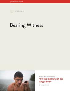
Bearing Witness
A controversial construction project in South America, the Belo Monte dam, is endangering local cultures, ecosystems, and communities. High schoolers create a concept map based on an online article they read before engaging in...
PBS
Abraham Lincoln: Man versus Legend
Abraham Lincoln was one of the greatest presidents ever ... right? Scholars research the accomplishments and struggles of the Lincoln presidency. They uncover facts, materials and information via video clips, primary, and secondary...
Skyscraper Museum
Changes in a City Over Time
Investigate the growth and development of New York City with the final lesson in this four-part series on skyscrapers. Learners first explore the concept of urban growth by looking closely at a series of three paintings made of Wall...
University of California
Anti-Communism at Home
Have you ever been accused of something without cause? The sixth installment of an eight-part series asks scholars to create a museum exhibit on the anti-communist activities in the United States at the start of the Cold War. To make...
National History Day
Why Did the United States Enter World War I in 1917?
World War I was the first major conflict on a global scale. Using primary documents, learners determine why the United States chose to enter World War I when it did. After analytical writing and group research, the causes of America's...
Miama-Dade County Public Schools
Ancient Rome
This resource outlines several general activities for a study of Ancient Rome, and includes guiding questions, a handout on the story of Romulus and Remus, and ideas for incorporating mapping and timeline activities into your review.
Curated OER
Documenting Texas Women’s History through Photographs
Students explore women’s history. In this women’s studies lesson, students will examine seven photographs that depict prominent female figures from Texas’s history. Students will engage in a discussion of the photographs as a mode of...
Curated OER
Soil: Food Mapping
Learners examine the concept of food mapping . In this agriculture lesson, students explore food and agriculture systems in the United States in the past and today. Learners complete food mapping activities.
Core Knowledge Foundation
Columbus Sailed the Ocean Blue
Young adventurers embark on a journey, setting sail along the blue ocean with Christopher Columbus. Teachers will find that this unit makes their lesson planning smooth sailing!
Curated OER
French and Indian War: Make A Map
Fifth graders create a map of the battles that occurred during The French and Indian War. In this history lesson plan, 5th graders read about the war in their text books, then divide into groups to create a detailed map of a famous...
Curated OER
But Where Is It On This Modern Map? A problem-solving, mind-boggling experience!
Trace Columbus' voyages by locating them on 21st Century maps. Using a navigators lesson, 4th graders will examine the Age of Exploration and trace Columbus's routes accurately on laminated world maps using different maps. Note:...
Curated OER
Cardinal Directions
First graders study cardinal directions on maps. In this geography lesson, 1st graders determine and show where North, South, East, and West are on various maps.
Curated OER
Mapmaker, Mapmaker, Make Me a Map!
Students evaluate the different types of historical and geographical information that one can gather through close study of historical maps from the 16th through the 19th centuries. They create their own maps.
Curated OER
Social Studies: Cooking Methods - Past and Present
Fourth graders identify geographic regions (Texas' Edwards Plateau) and sequence steps in the hot rock cooking process. They compare and contrast prehistoric and contemporary cooking methods. Students conduct online research and record...
Curated OER
Postcards from California: A Unit on Geography, Social Studies, History and California's Resources
Fourth graders examine patterns that influence population density in the various regions of California. The unit's three lessons utilize graphic organizers for the interpretation and presentation of data.
Curated OER
Lesson 2: Mapping Sub-districts
Students learn more about the census. In this mapping sub-districts lesson plan, students visualize census data on a map, use a map key to read a population map, and better understand the concept of population density.
Curated OER
Houghton Mifflin Social Studies/Chapter 8, Lesson 1: Farming Takes Hold (pp. 184-187)
Fourth graders discuss that the movement toward farming during the 1850's to the 1870's meant for California. The economy of California is studied in relationship to the effects of farming. There are several focus questions to help...
Curated OER
United States Map - Lesson 7: Four Main Directions
Students locate the North and South Poles, and learn the definitions of the four directions by using a United States Map and a globe. In this directions lesson plan, students define north, south, east, and west on a map and a globe.
Curated OER
Puerto Rico: The 51st State?
Students examine the political status of Puerto Rico. In this global studies lesson, students explore Puerto Rico and consider the feelings of Puerto Ricans regarding their unique political status.
Curated OER
Plotting a Hurricane Using Latitude and Longitude
Learners define and use "absolute location," latitude, and longitude. They locate on a map or globe the Earth's poles, circles, tropics, and beginning points of measurements for latitude and longitude.
Curated OER
This is My Neighborhood
Students predict the things that they may see, smell, or hear in their neighborhood. They take part in a neighborhood walk, creating a rough map of their neighborhood as they go. Upon return to the classroom, students create a final map...
Curated OER
Geography: Puerto Rico
Take a trip to Puerto Rico! Learners engage in a web quest, identify Puerto Rico on the map, and gather information related to physical features and cultural factors. Their efforts culminate when they design a brochure comparing the...
Curated OER
1492: Using Data to Explain a Journey
Students examine how Christopher Columbus made his way across the Atlantic. In this data lesson students use an Internet program to navigate like Columbus.
Curated OER
Being Resourceful: Wisconsin quarter reverse
If your class understands goods and services then they'll be ready for this activity on various resources. After reading a series of books and engaging in class lecture and discussion, pupils will fill out worksheets. They will list...


