Curated OER
The Trans Saharan Trade Route
For this trans Saharan trade route worksheet, students respond to 6 short answer questions about African trade routes after they read the included article.
Curated OER
Columbus wants to find a shorter route to Asia
Eighth graders identify the reasons why Columbus wanted to find a shorter route to Asia. They make a timeline of the sequence of events surrounding his explorations. Students draw a map of the routes taken by early explorers around...
Curated OER
Learning About Location: Charting the Path of the George W. Elder
Students acquire a working knowledge of the geographical concepts: absolute location, relative location, longitude and latitude. They analyze primary sources that shows the physical and human characteristics of the places along the 1899...
Curated OER
Triangular Trade Route
Eighth graders explore The Middle Passage and the Triangular Trade Route. They read their text to explore the treatment of African slaves and their route to America. After observing maps and pictures of slave ships, 8th graders share...
Curated OER
Trade Route By Sea To Asia
Eighth graders study a map and identify the countries of Spain, Portugal, India, China and Thailand. After a class discussion, 8th graders explain the advantages of trading over land and by sea and they explore the men who journeyed to...
Curated OER
The Underground Railroad
Students explore the Underground Railroad routes. In this map skills and Civil War lesson, students use map and globe reading vocabulary and skills to track the routes the slaves followed from the Bahamas to the United States and from...
Curated OER
Route To School Mapping Assignment
Students create a map showing the route from home to school. Students include a legend, compass, label buildings, and color the map route on the map. They write out specific directions.
Curated OER
The African Slave Trade: From West Africa to South Carolina and Beyond
Eighth graders explore the African slave trade. They identify the principal figures practicing the African slave trades at three locations. Students draw the physical routes of the slave trade on a map and they list the reasons for the...
Curated OER
Overland Trails To The West
Consider the political, physical, and geographical factors that led to and marked the Westward Expansion. Learners will track the various routes developed during the 1800's. They create a first person journal describing what they see,...
Curated OER
Circulatory and Respiratory Systems
Eighth graders are able to write a paragraph describing each system based on the information retrieved in class. They trace a route from Holly Springs, MS to Greenwood using the maps that they were given. Students discuss the role of...
Curated OER
Osprey Journey
Learners investigate the migration route of one bird, Osprey B4, using information gathered from satellites to track birds over a two-year period. They coimpare their graphs with maps of B4's migrations that have been plotted by...
Curated OER
Triangular Trade and Middle Passage Review Individual Worksheet
Eighth graders explore the key concepts within the Colonization of America, the significance of the Triangular Trade Route, the origin of slavery, and the Middle Passage. After a short discussion and review, 8th graders orally practice...
Curated OER
Globe Foldable
Maybe the world wasn't built in a day but kids can certainly assemble a globe in one class period using the images provided by these templates. Cut, fold, piece, glue, and voila!
Curated OER
The Indian Removal Act
Eighth graders describe the relocation of Native Americans during the 1830's. The teacher pretends he has been told to move out of his room and the students are to help. They take the longest route and end up in the hall without any...
Curated OER
The Pilgrims
Students use distance measuring tools to follow directions and chart the path the pilgrims made from Plymouth, England to Boston, Massachusetts. For this Pilgrim voyage lesson, students use a map to chart the distance traveled by the...
Curated OER
The Gold Rush
Students identify the routes involved in the Gold Rush on a map. In this map skills lesson, students use a United States map to locate the routes used to travel to California during the Gold Rush. Students demonstrate how to use the map...
Curated OER
A Walk in Winchester
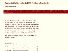
In this Winchester instructional activity, students determine the number of different routes to a determined location. This one-page instructional activity contains 1 problem. The answer is provided at the bottom of the page.
Curated OER
Magellan
Students identify the route of Magellan's voyage. In this map skills lesson, students use a globe to identify various coordinates where Magellan traveled.
Curated OER
Immune System Alive
Learners examine the function of the immune system. They read and discuss text, complete a K-W-L chart, sequence photos of white blood cells encountering bacteria, develop an outline, and write an essay.
Curated OER
The Great Migration
Students research the Great Migration and answer questions to discover where it took place, when it took place, who were migrating, and why in a 2 page paper. They use a map or atlas to plot out the routes and destinations of those...
Curated OER
Peru History
Students gain an understanding of Peru's history. They analyze how specific ideas and beliefs have had an effect on a particular period of time and they trace the route of the Spanish Conquistadors on a map of Peru.
Curated OER
Lewis & Clark Map
In this Lewis and Clark expedition map worksheet, students examine the route of the expedition and the separate return routes of both Lewis and Clark.
Curated OER
Destination of Slaves in 1800
In this slave trade worksheet, learners use the provided Atlantic Slave Trade statistics to create a pie chart and a bar graph. Students also respond to 4 short answer questions.
Curated OER
Oregon Trail Maps
Fourth graders explore the Oregon Trail. In this Oregon Trail lesson, 4th graders collaborate to conduct Internet research regarding states along the Oregon trail route. Students present their findings to their peers.


