Curated OER
Archaeology- State Map
Students study state maps. In this map skills lesson, students identify the states' location and how to use a legend. Students complete photocopies of the state map.
Curated OER
What You Can Learn From a Map
Learners discover how to interpret maps. In this geography skills instructional activity, students explore geographic themes as they complete worksheet activities regarding road maps, shaded relief maps, and topographic maps.
Curated OER
Mapping South America
Students explore South America. In this South American lesson, students use their geography skills to create population, terrain, biomes/vegetation, and major exports maps. Students present their finished maps to their classmates and...
Curated OER
What Are We Going To Do About Baby Six Billion?
Students formulate and evaluate suggestions about government policy using demographic examples and projections. They examine websites and utilize worksheets imbedded in this plan.
Curated OER
World Cities of 5 Million or More
Students consult online resources to identify and map the world's largest cities and metropolitan areas. They analyze birth rates, settlement patterns and other demographic data and make predictions for the future. They write essays...
Curated OER
Postcards from California: A Unit on Geography, Social Studies, History and California's Resources
Fourth graders examine patterns that influence population density in the various regions of California. The unit's three lessons utilize graphic organizers for the interpretation and presentation of data.
Curated OER
Geography of Japan
Students complete a worksheet that guides them through an overview of Japanese geography. Students research the topography, climate, population and size of Japan and consider how these factors work together to produce Japanese culture.
Curated OER
The Aging Population of Canada
Students analyze age-group population data and make inferences on the impact of the aging population in Canada. They, in groups, focus on health care, social programs and labor issues.
Curated OER
Europe Puzzle
In this geography activity, students complete a crossword puzzle in reference to the geography of Europe. They identify the capital cities of various countries and the bodies of water which surround specific countries of Europe.
Curated OER
As Simple as Beans: Canada's Population
Students gather facts about Canada from various maps. In this Canada lesson, students use beans to relate the populations of the U.S. and Canada. Students create population distribution maps based on the placement of the beans.
Curated OER
Themes of Geography in the News Contest
Students discuss current events in the world today. After choosing one to focus on, they identify the themes of Geography present in them and practice using new vocabulary. They use the internet to find all of the themes present in...
Curated OER
The Role of Geography -- The United States and the Republic of Turkey
Preteens review the five themes of geography. In groups, they examine the United States and Turkey to discover how geography can impact the way people live. They create a foldable for each country, listing information for each of the...
Curated OER
Geography, Map Skills & the Internet:
Students research various websites focusing on Italy while enhancing student utilization of computer, keyboards and the Internet. They discuss their findings on the geography, history, topography, and culture.
Curated OER
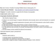
Lesson Plan: Five Themes of Geography
After learning the five themes of geography, learners take an Internet trip and categorize information found into one of the five themes. They answer five questions about the places explored. That is about all there is to this...
Curated OER
Geography: why is Arkansas a great place to grow rice?
Second graders become familiar with the geography of Arkansas and analyze why it is a good place for certain crops to grow. In this rice lesson, 2nd graders list reasons Arkansas is a good place to grow rice. Students become...
Curated OER
The Geography of Renaissance
Students use the internet to research the geography of the Renaissance. Using maps of Europe, they identify at least three key cities during the time period and discuss the main types of transportation. They research the various customs...
Curated OER
Worksheet 2: Geography Quiz: True or False
Students read 10 statements associated with geography information from Worksheet 1 and determine if they are true or false. This worksheet would be a good follow-up to Worksheet 1 after the answers have been determined.
Curated OER
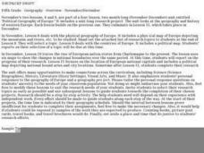
Political Geography of Europe
Fifth graders listen to a lecture that traces the political geography of Europe from 814 through 1997. They incorporate these themes into a research project on Western Europe.
Curated OER
Geography of the Wasatch Front
Pupils examine and discuss urban geography and land-cover types along the Wasatch Front. They analyze thermal images, create collages, and predict surface and air temperatures from aerial photos in the Salt Lake City Valley.
Population Connection
A Demographically Divided World
Did you know that birth and life rates vary across the world? The resource, the second in a six-part series, discusses just how demographics differ across countries and why it might be the case. Scholars complete worksheets, watch...
Curated OER
The Influence of Human Activity on the Environment
The surge in human population in the last 2,000 years, due in large part to better health care, has brought a surge in the demand for resources and in pollution. The graphics, photographs, and real-life examples in a thought-provoking...
Curated OER
Shrinking Spaces
Students describe the impact of population growth on the environment. They describe how cities affect their surrounding environment and explain how cities are handling growth and its resulting effect on the quality of life. They visit...
Curated OER
Biggest Cities in India Quiz
In this online interactive geography quiz instructional activity, students examine the chart that includes the population of 20 Indian cities. Students identify the names of the largest...
Curated OER
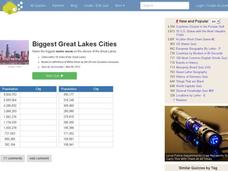
Great Lakes Cities Quiz
In this online interactive geography activity, students examine a map of the Great Lakes region and identify the 20 noted cities on the map using a pull down menu within 4 minutes.
Other popular searches
- Population Geography Graph
- Population Geography Map
- Geography Population Density
- Geography World Population
- Population Geography Factors
- Population Geography Data
- Population Geography Brazil
- Geography Population
- Geography Italy Population
- Geography Population Change
- Population Geography India
- World Geography Population


