Curated OER
Finding Longitude and Latitude on Pennsylvania Maps
Students draw the lines of longitude and latitude on a map. Students look at a topographical maps to see how topography relates to land use.
Curated OER
Project Map: Latitude And Longitude Worksheet
In this latitude and longitude worksheet, students find the coordinates of 14 cities around the world and use this information to complete 14 short answer questions. This worksheet includes online atlas web links.
ReadWriteThink
Biography Project: Research and Class Presentation
I Have A Dream ... that after the lesson, all individuals master the reading, writing, researching, listening, and speaking skills the biography project helps them develop. Martin Luther King, Jr. serves as a topic example for a model...
Federal Reserve Bank
Piggy Bank Primer: 25 Cents Worth of History
It's all about money. Here's a resource that introduces kids to the Federal Reserve System, different coins produced by the mints, and fun facts about state coins.
Curated OER
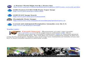
A Comparison Study of Water Vapor Data to Precipitation over North America
Students use NASA satellite data to compare water vapor over the United States. In this data analysis instructional activity students use an Excel spreadsheet to map their data.
Curated OER
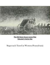
Old Stone House Lesson Plan
From stagecoach to railroad tracks, your class will discover how advancements in travel in the United States during the nineteenth century played an integral role in the industrialization and development of American society. The main...
Curated OER
Rivers Run Through It
In this mapping practice worksheet, 5th graders read an informational paragraph and answer 7 questions about the parts of a map along with places shown on a given map.
Curated OER
The Battle of Brandywine
Students explore the Battle of Brandywine, how to analyze maps, and construct a model of a battlefield.
Curated OER
Families and Neighborhoods
Young scholars distinguish where their homes are in relation to the city of Pittsburgh. For this geography lesson, students read the book All Families Are Specialand find their city on a map of Pennsylvania. Young scholars...
Curated OER
States of Fitness
Learners participate in physical activities coordinating to divisions on a map.
Curated OER
Scaling the Map
Middle schoolers practice determining map distances using the map scales. They discover how much an area represents on the map in relation to the actual area. They decide on the best place to build their cavern.
Curated OER
State Report
Students create a state report/ presentation. They research U.S. state information using the Internet and retrieve information about specific topics (Individual States in the USA) using technology resources.
Curated OER
PA Watersheds, Many Ways to the Sea
Students examine the water cycle and the factors that interact with watersheds. In this watersheds lesson students describe the purification process, trace the flow of infiltrate water through aquifers, and research the Internet to...
Curated OER
The Acadian Odyssey
The dispersion of the Acadians is outlined in this informative PowerPoint. Colorful maps help show where different Acadians settled throughout the United States. Tip: After viewing this slideshow, have students create a timeline of the...
Foreign Policy Research Institute
A Geography Lesson
Fewer and fewer people have a strong grasp of world geography, but this activity helps high schoolers understand geopolitics by creating their own original historical map. The activity requires selecting a country from the list provided,...
ReadWriteThink
Dear Librarian: Writing a Persuasive Letter
Everyone deserves to read a great book! Here, pupils write a persuasive letter to the school's librarian detailing their favorite story and why it should be found on the shelves. Class members' persuasive reading passages are shared with...
Curated OER
Philadelphia and the Constitutional Convention "Heat Up"
Students explore the Constitutional Convention of 1787. In this U.S. Constitution lesson, students role play the parts of delegates in a simulation of the convention.
Curated OER
Carbondale: The Biography of a Coal Town
Students use a brief history of the growth and decline of the anthracite region in the state to create a photograph and map "peak shaped" time line. They practice map and photo analysis strategies to "read" photographs and maps.
Curated OER
Supreme Court
Eleventh graders explore the redistricting process. In this American Government instructional activity, 11th graders examine the electoral map. Students write an essay posing an argument for the redistricting process.
Curated OER
Cornplanter and the Fate of His Land
Students explore Chief Cornplanter and his importance as the leader of the Seneca tribe. In this Chief Cornplanter instructional activity, students examine how the Seneca land was taken over by the right of eminent domain. ...
Curated OER
Site and Situation: Right Place at the Right Time
Learners analyze geographic details. In this research skills lesson, students research maps as well as primary and secondary sources to analyze growth, population, and manufacturing in Altoona, Pennsylvania following World...
Curated OER
Bushy Run: A Decisive Battle of Pontiac's Rebellion
Students study the battle at Bushy Run. In this Pontiac's Rebellion lesson, students examine an 1765 map of the Bushy Run battle as well as letters and a modern topographic map of the area in order to simulate the event and research how...
Curated OER
The Formation and Value of Temperate Grasslands
Students study the Temperate Grasslands biome of North America. They explain that it is an endangered ecosystem because the rich soils have been converted to farming in most areas. They view videos imbedded in this plan, then complete...
Agriculture in the Classroom
Farmland: GMOs and Organic Agriculture
Learn more about genetic modification, organic farming, and the role of biotechnology in agriculture by watching a documentary that shows how newly gained knowledge can be applied to specific situations involving farmers and the choices...


