NASA
Outline Maps
Don't miss this gold mine of blank maps for your next geography lesson! Regions include traditional continents such as Asia, Europe, and Africa, as well as other major world areas such as the Pacific Rim and the Middle East.
Curated OER
Mexico Outline Map 2
In this outline map worksheet, students discover and investigate the North American country of Mexico. This blank outline map may be used for a variety of classroom activities.
Curated OER
Mexico: Political Map
In this Mexico political map worksheet, students examine state boundaries. The map also highlights major cities in Mexico.
Curated OER
Mexico: Political Map
In this Mexico political map instructional activity, students examine state boundaries. The map also highlights major cities in Mexico. This map is unlabeled.
Curated OER
Mexico Map
In this blank outline map worksheet, students study the political boundaries of the North American country of Mexico. This map may be used in a variety of classroom activities.
Curated OER
Mexico Map
For this blank outline map worksheet, learners study the political boundaries of the North American country of Mexico. The capital cities of each state are denoted with stars.
Curated OER
Mexico and Central America Map
In this blank outline map activity, students study the political boundaries of Mexico and Central America. Each of the counties is labeled and the capital cities are starred.
Curated OER
Where in the World Is Mexico?
Learners practice map-reading skills as they locate Mexico and its cities on a world map. By creating a puzzle out of a map of Mexico, students engage in a meaningful hands-on activity to help them explore that country's geography.
Curated OER
Central America Outline Map
In this Central American political map worksheet, students make note of national boundaries and capitals in this region of the world. National capital city locations are noted with stars.
Curated OER
North America: Political Outline Map
In this North America political map worksheet, students examine the state and province boundaries of Mexico, Canada, and the United States.
Curated OER
Mexico and Central America Map
In this outline map worksheet, learners study the political boundaries of Mexico and the Central American countries. This map is labeled with the country names.
Curated OER
Mystery State #38
In this United States mystery worksheet, students determine which state is described by the 5 clues listed on the sheet and then mark it on the outline map of the United States.
Curated OER
Rivers, Maps, and Math
Students use maps to locate and label the major rivers of North and South America. Using the internet, they identify forests, grasslands, mountain ranges and other landforms on the continents as well. They compare and contrast the...
SeaWorld
Animal Migrations
Here is a fabulous set of activities for your young scientists. Each lesson contains map, hands-on, and game activities that will help the class understand why and how animals migrate from one place to another. First they'll examine the...
Curated OER
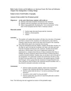
Immigration: Creating Change
Students explore how immigration has changed the culture of America. After identifying the foods and diets of Europeans and Native cultures, students create a map indicating where foods came from. Students design a restaurant menu,...
Curated OER
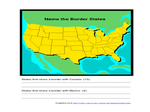
Identifying Border States of the U.S.
For this identifying border states of the U.S. worksheet, 3rd graders visually identify then write the names of the states that border Canada and Mexico; page 1 is a lesson, page 2 is the worksheet.
ReadWriteThink
Biography Project: Research and Class Presentation
I Have A Dream ... that after the lesson, all individuals master the reading, writing, researching, listening, and speaking skills the biography project helps them develop. Martin Luther King, Jr. serves as a topic example for a model...
Curated OER
Cultural Corner- "Mexico"
Young scholars use print and electronic resources to gather information about Mexico. They present a mini-museum to share with students, parents, and other interested classes around the district. They present their information in a video...
Curated OER
Name the States Worksheet 1
In this name the states worksheet, students examine 6 state map outlines and identify each of them by writing the state names and postal abbreviations.
Curated OER
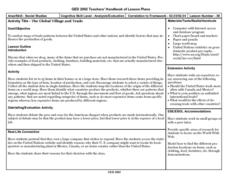
The Global Village and Trade
Young scholars analyze maps of trade patterns between the United States and other nations and identify factors that may influence the production of goods.
Curated OER
Conquering North America
Learners create a study guide on colonization of North America. In this American Colonization lesson plan, students complete a chart of explorers and their conquests. Learners complete a crossword puzzle using explorer facts. Students...
Curated OER
Latin America: Places and Regions
Seventh graders create a Latin American portfolio in the form of a country presentation using PowerPoint software. They use their knowledge of geographic concepts to interpret maps, globes, charts, diagrams, and timelines.
Curated OER
This Land is Your Land: Volunteering in the Community
Students discover what a Relief Office does. For this volunteer lesson, students investigate what a Relief Office does, and who helps run it. Students discuss ways he/she could become a volunteer.
Curated OER
Las Tejanas
Fourth graders recognize that the Tejanas were Texas women of Spanish-Mexican origin who contributed to the history of Texas. Students read and research the Tejanas women, complete an essay about a day in the life of a Tejanas woman ,and...


