Curated OER
Volcanic Environments
A diagram showing a cross-section of Earth points out the location of different plate boundaries and displays the numbers one through five. Beneath the diagram are five photos of different types of volcanoes. The object of the activity...
Curated OER
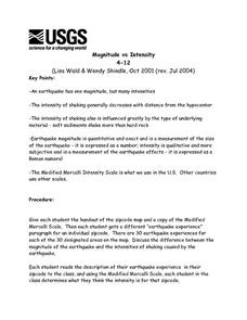
Magnitude vs Intensity
Learners use a zipcode map to locate earthquake experiences based on the Modified Mercalli Scale. They discuss the difference of the magnitude of an earthquake compared to the intensity of the shaking it causes.
Curated OER
Basin & Range Faulting
Students identify that the crust of the earth is constantly moving and that with the exception of faults accompanied by earthquakes, this rate of movement is far too slow to notice. Then they print a copy of cross-section map A and...
Curated OER
Mapping Meteorites
After reading an article, "Cameras Capture a 5-Second Fireball and Its Meteorite's Secrets," space science superstars use the triangulation method to determine the location of a distant object. In-class activities and homework are...
Curated OER
The Dynamic Earth
Students use the Internet to investigate earthquakes and plate tectonics. In this plate tectonics instructional activity, students complete a web quest with multiple links and activity types relating to earthquakes and volcanoes. They...
Curated OER
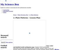
Plate Patterns
Students review the patterns they discovered from a previous activity. In this investigative lesson plan students plot data as a class and color a map.
Curated OER
Show What You Know!
In this earthquakes worksheet, students create a brochure, poster, or other form of presentation to show what they know about earthquakes. Students complete 4 sections.
Curated OER
How do Volcanoes Fit in the Picture?
For this volcanoes worksheet, students look at maps and answer short answer questions about volcanoes, plate boundaries, and earthquakes. Students complete 4 questions.
Curated OER
The Big One
Eighth graders study earthquakes. In this earthquake instructional activity students research the Internet on earthquakes and plot earthquake locations.
Curated OER
Structure of the Earth
Sixth graders investigate earthquakes and volcanoes. They demonstrate fault lines with a folded piece of paper, conduct an erosion experiment, and construct a volcano using clay, baking soda and vinegar.
Curated OER
Plate Tectonics
Students identify that most of mountain ranges found on all major land masses and in the oceans are external reflections of tectonic movements within the earth. They identify that earthquakes and related phenomena are caused by the...
Curated OER
Structure of the Earth
Eighth graders examine the forces that are constantly acting on the Earth. They describe the theory of tectonic plates and demonstrate the two kinds of earthquake waves. They also examine the role of volcanoes in the structure of the...
Curated OER
Volcano!-Is That a Volcano on Your Plate?
Students explore how and where volcanoes form. They also explore how the interactions between oceanic and continental crust create volcanoes and other mountains and earthquakes in a simulation activity using cardboard of two thicknesses.
Curated OER
Explosive Ideas!
Young scholars explore the layers of the Earth and the dynamic changes that they cause on Earth's surface. Volcanoes and earthquakes become the focus of the lesson as the Oregon State quarter and its Crater Lake images are linked to the...
Curated OER
Japan and The Ring of Fire
Students engage in a study of the volcanic forces and earthquakes associated with The Ring of Fire in the Pacific Ocean. The people of Japan are researched in how they have dealt with living in the area. Also students write in journals...
Curated OER
Natural History of Costa Rica
Students use outline maps to become acquainted with Costa Rica. They see how it was formed and how its origin has created very diverse environments. Students then use atlases and compare their physical maps with maps of climate and the...
Curated OER
Japan's Geography Worksheet
In this geography skills worksheet, students label a map of Japan and then respond to 8 short answer questions about the country.
Curated OER
Explosive Ideas: Oregon quarter reverse
Explore Earth and her amazing layers with this lesson on planetary change. Students will research the ways in which Earth's layers cause change. They will complete a "Tectonic Puzzle" and use a worksheet to answer questions about Earth's...
Curated OER
Earthquake Depth
Students research and locate earthquake epicenters on a map using latitude and longitude. They determine if the depth of an earthquake has any relationship to the distance from a plate boundary.
Curated OER
Earth Science: In Depth Look at Earthquakes
Students engage in an interactive Internet lesson covering the reasons and results of earthquakes. After reading eyewitness accounts and viewing animations, they use seismograms to measure and locate the epicenters. In an ongoing study,...
Curated OER
Volcanoes, Earthquakes, and Tsunamis
Students work in groups to research a tsunami, earthquake, or volcano. They use the internet to find information, and create a presentation. Each presentation should include a definition of their phenomenon, an illustration, three or...
Curated OER
The Earth's Crust
Young scholars use clay to form models of the different landforms and then complete a data table using a map, atlas, or the Internet to locate famous landforms in the United States. Students complete various activities, writing down...
Curated OER
Exploring Earthquakes in Space and Time Through the Internet and a Geographic Information System
Students examine the frequency and distribution of earthquake epicenters and compare these epicenters to the distribution of plate boundaries and cities.
Science Matters
A Model of Plate Faults
The San Andreas fault is one of the longest fault zones in the world. In a series of 20 lessons, the fourth lesson has pupils use a paper model to recreate various types of plate faults. Each is held in position then drawn...
