Curated OER
What Can a Map Tell You?
Students investigate how maps can provide useful information about health issues. They study a map to draw conclusions about cholera death in London.
Curated OER
A Map Mystery
Second graders solve a map mystery. In this technology lesson plan, 2nd graders develop an awareness of maps and the symbols associated with maps as they the "Neighborhood Map Machine."
Curated OER
Mapping Electricity
Students complete Internet research and use their map reading skills to learn about how the United States creates and uses electricity in different states. In this energy sources activity, students study the mini map of energy usage...
Curated OER
Geography Puzzles
Learners study the continents of the world. In this Internet geography lesson, students connect to online mapping games. Learners collaborate in order to develop their understanding of world geography, including countries and capital...
Curated OER
Arkansas Geography/History Relief Map
Sixth graders research a number of sources including the Internet to find information about the regions of Arkansas while locating sites of national historic interest. They located sites on maps while working at assigned websites. They...
Macmillan Education
Organising Your Studies
What's the best way to study? Well, it depends. . . Session two of a 23-activity life skills series focuses on a variety of study skills strategies and suggests when/why to choose one over another.
Curated OER
Online Behavior: Privacy and Ethics
Over the course of three classes, tech-saturated youth review their cyber portraits, map their virtual lives, examine their relative anonymity, and establish a "virtual conscience" to guide choices that foster privacy protection and...
TED-Ed
A Digital Reimagining of Gettysburg
Why would Robert E. Lee order Pickett's Charge, an action that changed the course of the Civil War? Geographer and historian Anne Knowles uses digital technology to explain what she thinks is the missing piece in trying to understand...
Curated OER
Where Is Rome?
Third graders discover Ancient Rome through maps and worksheets. In this world history instructional activity, 3rd graders locate Rome on a world map and identify the scope of the Roman Empire. Students label an entire map of...
Curated OER
Is the Hudson River Too Salty to Drink?
Students explore reasons for varied salinity in bodies of water. In this geographical inquiry lesson, students use a variety of visual and written information including maps, data tables, and graphs, to form a hypothesis as to why the...
EngageNY
Organizing an Opinion, Reasons, and Evidence: Text 1 for Each Expert Group
Working in small groups, scholars continue reading an informational text about either Roberto Clemente or Althea Gibson. As they read, pupils create graphic organizers in their journals to help map their ideas logically.
Curated OER
Study Skills Assignment
Students utilize six different types of study skills as they review material for a final exam. They are graded on the exam and on the study process for the exam.
National Research Center for Career and Technical Education
Information Technology: Photoshop Scale
Scaling is a practical skill as well as a topic to be addressed throughout the Common Core math standards. You are given three different presentations and a detailed teacher's guide to use while teaching proportion, as well as practice...
Curated OER
Where I Live…
Second graders explore their community. In this social studies lesson plan, 2nd graders use Internet tools to locate their community on a map and then locate where they live.
Melissa Institute for Violence Prevention and Treatment
Concept Muraling
Concept muraling helps learners improve their comprehension of a text by giving them a way to organize their understanding of the key concepts in that text. Introduce readers to this process with a carefully scaffolded lesson that models...
Population Connection
The Human-Made Landscape
Agriculture, deforestation, and urbanization. How have human's changed the planet and how might we mitigate the effects of human activity on the planet? To answer these questions class members research the changes in human land use from...
Edgate
Native Americans of the Lewis and Clark Trail
As part of a study of the Corps of Discovery expedition, class groups research the different Native American tribes Lewis and Clark encountered on their journey and share their findings with the class.
Facebook
Public Wi-Fi
Sometimes free Wi-Fi comes with a hefty price tag! Networking novices examine the components of a Wi-Fi network during a digital citizenship lesson from an extensive series. Groups work together to map out a day's worth of Internet...
Newseum
Search Boosters: How Content Creators Can Game the System
Scholars examine the techniques content creators use to boost their search rankings. After watching a short "Search Boosters" video, groups select a story from the "News or Noise? Media Map" and analyze the devices used in the story. The...
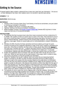
Newseum
Getting to the Source
Reliable news stories are based on facts from reliable sources. Young journalists learn how to evaluate the reliability of news sources by watching a short explainer video. Teams apply their new source-digging skills to a current news...
Curated OER
Nursery Rhymes
Learners recall details of nursery rhyme read by teacher, identify main characters, and demonstrate knowledge of poem by creating concept map about story that includes title, clip art, and changes in font and color.
Curated OER
Winter Wonderland: Internet Literature Project
Students, using the Internet, communicate with peers around the world about winter-themed books. They study authors, write book reviews, re-write endings, interview book characters, create scene dioramas, paint murals, and write...
Curated OER
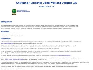
Analyzing Hurricanes Using Web and Desktop GIS
Young scholars analyze hurricanes. In hurricanes lesson, students use the Internet and GIS to analyze hurricanes. Young scholars view the National Atlas of Maps to discuss the direction hurricanes move. Students study the wind and...
Curated OER
Our 50 States
Students identify the location of the 50 states using an interactive map. They practice geography skills by playing a fun game. Pupils become familiar with the state abbreviations for the US states. Students become familiar with the...
Other popular searches
- Map Skills Lesson Plans
- Map Skills Worksheets
- Elementary Map Skills
- Geography Map Skills
- Basic Map Skills
- Social Studies Map Skills
- Globe and Map Skills
- Beginning Map Skills
- United States Map Skills
- Map Skills, Continents
- Early Explorers Map Skills
- Free Map Skills Worksheets


