Global Oneness Project
A Collapsing City Skyline
Have your high schoolers learn about the modern history of Myanmar by close-reading an article about the city and people of the city Yangon. As they'll learn, the country is going through some dramatic transitions. After reading the...
Curated OER
Michigan Cities Map Quiz
In this online interactive geography worksheet, students examine a map of Michigan and identify the 14 noted cities on the map using a pull down menu within 3 minutes.
Curated OER
Washington Cities Map Quiz
In this online interactive geography instructional activity, students examine a map of the state of Washington and identify the 13 noted cities on the map using a pull down menu within 3 minutes.
Global Oneness Project
Documenting Architectural Heritage
Imagine going from being one of the richest, most important cities in the world to one of the poorest. Imagine the history captured in the architecture of such a city. Imagine these same now abandoned buildings being destroyed. How would...
Curated OER
Open Cities: Europe
In this European cities worksheet, 10th graders find the countries of Europe on a map, match countries with capital cities, categorize different types of cities and identify cities from pictures and on a map.
Curated OER
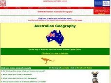
Australian Geography
In this map reading worksheet, students label a map of Australia by adding the names of states and cities. They answer eight questions about the map.
Curated OER
The Gold Rush
Students identify the routes involved in the Gold Rush on a map. In this map skills lesson, students use a United States map to locate the routes used to travel to California during the Gold Rush. Students demonstrate how to use the map...
Curated OER
The American Revolution: 1775 - 1783
Track the ins and outs and wartime strategies used by both the British and the Americans during the Revolutionary War. Multiple comparisons are made between both factions, maps, statistical data, images, and light text is used throughout...
Curated OER
Fort Jackson and Fort St. Phillip
Review the history of Fort Jackson and Fort St. Phillip during the American Civil War in this informative PowerPoint. Included in this presentation are interesting facts, photos, and maps to increase student understanding of these...
Curated OER
The Geography of the United States
Full of bright maps and interesting information, this presentation details U.S. Geography. Slides include basic facts about size, regions, topography, and demographics, as well as fascinating trivia about the United States, including...
Curated OER
Sinking City of Venice
High schoolers view a video clip about Venice's sinking problem. They identify possible solutions and discuss the difficulity in solving it. They also complete a worksheet to end the lesson.
Curated OER
Cargo Shipping
Students work effectively in groups to achieve a common goal: Create the most efficient cargo shipping route. They successfully identify and locate port cities using latitude and longitude. To use the formula r=d/t (rate equals distance...
Curated OER
Ping!
Seventh graders study side-scan sonar and discover how it can be used to locate objects underwater. They complete a sonar simulation activity in which they create and map mystery landscapes inside shoeboxes.
Curated OER
Louisiana
Third graders study factual information about Louisiana including the state flag, bird, tree, and important geographical points using the Internet and maps. They explain the different groups that settled the state in this mini-unit.
Curated OER
'Tis a Long, Long Way to Tipperary!
Students practice finding the location of cities across the world by using an interactive Web site, and figure out the world's time and the value of time zones the world over.
Curated OER
The Influence of The Byzantine Empire on Russia and Eastern Europe
Students examine the influence on Russian and Eastern European language, religion, art, and architecture by the Byzantine Empire. They define key vocabulary terms, listen to a lecture and participate in a class discussion, and label a map.
Curated OER
Let's Spice It With Pepper
Students identify and locate the areas in which pepper and spices orginated. On a map, they locate the areas and write the name of the spice that is found there. They use historical events to trace its route to the Americas. They...
Curated OER
Galveston 1900: Storm of the Century
Seventh graders comprehend the effect the 1900 Hurricane, the deadliest natural disaster in United States history, had on Galveston by examining period accounts and photographs. They comprehend how the devastation of the hurricane lead...
Curated OER
Social Studies: Maryland and Its Culture
Students discuss the history and culture of Baltimore, Maryland. they discover the importance of the city's port along with the state bird and song. Background sources include "The Prairie Dog That Met the President" and "Journey of...
Curated OER
Weather With a Latitude
Students read the temperature from a thermometer. In this weather lesson, students read a thermometer and record the temperature at twenty minute intervals. Students discuss results.
Curated OER
Transportation
In this transportation worksheet, students list the positive and negative aspects of different types of transportation. Students keep a diary of the different ways they used transportation for a week. This worksheet has 7 graphic...
Curated OER
Product Line
Students research products imported from Europe and use a map to show the routes the products might have followed to reach this country. They take a field trip to a store that carries imported products and take note of how many come from...
Curated OER
Conflict Resolution
Learners consider how conflict resolution principles can be used by countries. In this diplomacy lesson, students participate in a simulation that requires them to use conflict resolution skills to settle a fictional country and deal...
Curated OER
Bison Sites of Texas
Students locate bison-related sites on a map and identify important bison-related sites. The Bison has had a profound effect on the history of Texas and studenst discover the importance of the animal to the history of the state.


