Curated OER
Tennessee Map
In this Tennessee outline map, learners examine the political boundaries of the state. Students mark the state capital, major cities, and other state attractions.
Curated OER
Where Am I: How to Read a Map
Third graders develop an understanding of maps. They explore what a map is, who uses maps, and how to use maps. Students investigate the compas rose. They create a compose rose which illustrates the cardinal directions. Students practice...
Curated OER
The Tennessee River: The Tie That Binds
Seventh graders examine the Tennessee River to see why it is still a major transportation artery in lieu of the age of modern transportation such as interstate highways, air cargo, and elaborate railway systems.
Curated OER
Sing for Your State: Tennessee quarter reverse
What's the connection between singing and a state quarter? Creative thinking and observation, perhaps. Pupils will observe and take note of all the characteristics found on the Tennessee state quarter. They will then use their...
Curated OER
Tennessee Outline Map
In this Tennessee outline map worksheet, students examine political boundaries of the state and the placement its capital city as well as its major cities. This map is not labeled.
Curated OER
Worksheet for Analysis of a Map
In this primary source analysis activity, students respond to 6 short answer questions that require them to analyze the maps of their choice.
Curated OER
Tennessee State Map
In this Tennessee state geography activity, students color and label major cities and physical features on the map. Students also study a second map of the U.S. that shows the location of the state of Tennessee.
Curated OER
State Map Locations
In this four state map locations learning exercise, students match up the following four state names to their actual locations on a United States map: Vermont, Tennessee, Kentucky and Rhode Island.
Curated OER
Understanding Weather Maps and the Importance of StormT
Students explain how storm tracking is important to understanding sources of acid rain pollution. The read and explain a weather map. They set up plastic or glass collection container for rain in an open area away from buildings and trees.
Curated OER
Musical Change
Young learners record observations about different coin denominations and create a song about coins to the traditional song, "The Wheels on the Bus." This instructional activity is based on the Tennessee Quarter Reverse, and has all...
Curated OER
State to State Scavenger Hunt
For this states worksheet, learners utilize the Internet to access one specific website to locate the answers to five fill in the blank statements about the states found on a United States map.
Curated OER
Do You Know Your 50 States?
Learners use the names and abbreviations of the 50 states to label a blank map of the United States.
Curated OER
Finding Longitude and Latitude on Pennsylvania Maps
Students draw the lines of longitude and latitude on a map. Students look at a topographical maps to see how topography relates to land use.
Curated OER
Tennessee
In this social studies worksheet, students complete a map by inserting the names of places in Tennessee in the correct locations. This link also includes a word search, a crossword puzzle and a scrambled places of Tennessee worksheet.
Curated OER
Ozark Folk Culture and Geography in the Mountain View, Arkansas Area
Upper grade through early high schoolers develop an understanding of Ozark culture, and the geography of the Ozark Plateau. They study place, location, human environmental impacts, and movement. This interesting plan incorporates muic,...
American Battlefield Trust
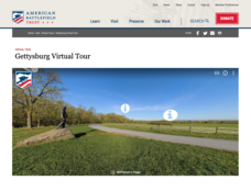
Gettysburg Virtual Tour
Step into one of the most iconic battlefields of the American Civil War with an educational interactive resource. Young historians learn about key moments, locations, soldiers, and turning points in the battle with a clickable map and...
ReadWriteThink
Biography Project: Research and Class Presentation
I Have A Dream ... that after the lesson, all individuals master the reading, writing, researching, listening, and speaking skills the biography project helps them develop. Martin Luther King, Jr. serves as a topic example for a model...
The Alamo
A Teacher’s Guide to Sam Houston
Need a teacher's guide all about Sam Houston and how he relates to the Texas Revolution? Look no further! The guide includes a timeline detailing Houston's life, important milestones, and relevant maps that include his movement around...
Curated OER
Geographics in Arkansas
Third graders discuss where Arkansas is located on the United States map. They use geographic tools to participate in activities.
Curated OER
Tour of the World
For this tour of the world puzzle, students read a map and determine a travel itinerary based upon given criteria. They are required to visit 23 cities. This one-page worksheet contains one puzzle. The answer is provided at the bottom...
Curated OER
Scaling the Map
Students practice determining map distances using the map scales. They discover how much an area represents on the map in relation to the actual area. They decide on the best place to build their cavern.
Curated OER
Mapping Martin Luther King Jr.
Young scholars examine geographic locations that were important in Martin Luther King Jr.'s life. They research Martin Luther King Jr., and create U.S. maps that show the locations important to him.
Curated OER
Finding My Way
Students determine a route from their home to the Stones River National Battlefield. In this map work lesson, students use a detailed city map of Murfreesboro to locate a route to the Stones River National Battlefield. They follow...
Curated OER
The Talking Goat
Young scholars read and analyze an African folktale. They read and discuss the folktale, analyze a map of Africa and Liberia, complete a worksheet, answer discussion questions, and analyze the patterns and analogies of the folktale.


