PBS
Working with Coordinate Planes: Activities and Supplemental Materials
Seven activities make up a collection of supplemental materials to reinforce graphing on a coordinate plane. Worksheet objectives include plotting coordinates within single and four quadrants, measuring straight and diagonal lines, and...
Curated OER
What a Relief Map
Students create a map using cookie dough. In this geography lesson plan, students research the physical features of a country, draw a diagram and design and create a map out of cookie dough.
Curated OER
Me on the Map Lesson 2
Students analyze and interpret maps, globes and geographic information systems to define and identify cities, counties, states, countries and continents to create a booklet called me on the map. They also determine and calculate the...
Curated OER
Reading a Map
Third graders become familiar with the vocabulary and skills related to mapping. In this guided reading activity, 3rd graders find proper nouns on from the map. Students read Goldilocks. Students make a map of their room.
Curated OER
Map Work About the Korean War
Students use an interactive website that chronicles the occupation of the Korean peninsula by each year and complete a worksheet. This helps them to research the causes of the Korean War.
Curated OER
Latin American Relief Map
Students, in groups, research, design and construct a relief map of a section of Latin America using papier-mache. They show major landforms, elevations and notable bodies of water. They present their maps to the class.
Curated OER
Meet You at the Midden: Map Game
Fourth graders use a sketch map to interpret map symbols in order to participate in a game. Using the game cards, they identify reasons why people modify their environment to meet their needs. They compare and contrast how people lived...
Curated OER
Moving West with the Forts: Using an Interactive Map
Seventh graders practice reading maps and locating the forts stationed in Texas. Using the internet, they analyze westward movements from statehood to the Civil War. In groups, they complete a worksheet about the forts and share their...
Curated OER
US City Quality of Life Analysis and Comparison
Students analyze US census data and criteria to compare and measure the quality of life in the country's fifty largest cities. After accessing the 2005 quality of life world report online, students conduct their study to compare three...
CC Homestead
Summarize
Designed for third graders but appropriate for older learners as well, this packet of materials underscores the necessity of teaching kids how to summarize, how to identify main ideas and supporting details, and how to ask questions...
Advocates for Human Rights
A Global Perspective on Immigration
To gain a global perspective on immigration, groups investigate and create a map of the migration patterns in Africa, Asia, Europe, Latin America, and the Middle East. Class members then examine the background, immigration history, and...
Messenger Education
Look But Don’t Touch—Exploration with Remote Sensing
Mars is home to the tallest mountain in our solar system, Olympus Mons. In this set of two activities, learners review geologic land formations through the analysis of aerial maps. They then apply this knowledge to aerial maps of objects...
National Wildlife Federation
Hot, Hotter, Hottest: Extreme Weather's Impact on Our Resources
How dry is it? It's so dry, the river only runs twice a week! Through an analysis of maps and discussions, pairs learn about droughts across the United States in the ninth of 12 lessons. They then read about, answer questions, analyze...
National Endowment for the Humanities
The War in the South, 1778–1781
The second in a three-part look at the Revolutionary War focuses the years from 1778 through 1781 and zooms in on military operations in the southern colonies, the French alliance, and the role African-Americans played in events. Class...
The Alamo
The Alamo
Remember the Alamo! Scholars investigate the Battle of San Jacinto during the Texas Revolution. Using models, maps, quotes, biographies, and the Oath of Allegiance, the Alamo comes to life as the stories of those who fought and died in...
Curated OER
The Odyssey Lesson 6
"How are belief systems represented and reproduced through nature?" This essential question guides lesson 6 of this unit on The Odyssey (the rest of the unit is linked). Students first write about a scenario in which they are disguised,...
Curated OER
Knowing the Essential Elements of a Habitat
First graders compare their environment with that of Belize by researching via the internet on the sites provided. Students participate in various activities/centers utilizing the information they discovered.
Curated OER
Ecosystems-The Essential Connection
Young scholars develop their abilities to solve problems both in school and in a variety of situations similar to that they have encountered in life. They define the term ecosystem in nature by comparing them to familiar organizational...
California Mathematics Project
Meteorology
See how estimation is essential to making temperature weather maps. Scholars use ratios and rates of change to estimate temperatures at locations where temperature readings have not been made. They connect this idea to linear functions.
US Environmental Protection Agency
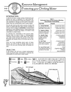
Protecting Your Drinking Water
Having a clean, reliable source of drinking water is essential for any community, but in many cases this is easier said than done. Engage young environmentalists in exploring the five factors affecting vulnerability of a groundwater...
Curated OER
Create a Story May
First graders review the terms characters, setting and events in stories. They are shown how to access the Kidspiration Map, and how to add pictures in the correct spaces on the map. Students insert pictures in the map of the story...
Curated OER
Compass Rose Directions
Second graders use cardinal and intermediate directions to locate places on maps and places in the classroom, school, and community. They draw a setting map of "Little Red Riding Hood." Students give five steps of cardinal or...
Curated OER
Establishment of Plainfield
Eighth graders analyze documents and maps of Plainfield, CT from different time periods, then, working in a small group, create a map for a giventime. In this Plainfield instructional activity, 8th graders read primary and secondary...
Curated OER
Treaties
Students explore Canadian maps. In this map skills and Canadian history lesson, students locate reserves that originated from treaties made while establishing the Saskatchewan First Nation reserve communities. Students research these...


