Curated OER
Reading a Local and National Weather Map
Students examine weather maps. They examine icons and map symbols. Students explore vocabulary words related to weather. Students analyze and evaluate information provided on the weather map.
Curated OER
Making Good Decisions
Students examine the consequences of behaviors and what the concept of trade offs are. In this good decision lesson students read an article and answer questions on making good decisions.
Curated OER
Reading Weather Maps
Fourth graders the symbols that are used on weather maps. They develop five day forecasts based on information they gather from weather maps in the newspaper and on the Internet.
Curated OER
Mapping The Ocean Floor
Young scholars explore and analyze the bottom structure of underwater habitats. They describe and explain what can't see through the collection and correlation of accurate data. Learners assess that technology is utilized as a tool for...
Curated OER
Exploring the Hudson in 1609
While this lesson focuses on a study of the Hudson River, it could be used as a template for a discussion of map skills, converting measurements, and plotting a route. The lesson includes vocabulary and other resources to make it a...
Curated OER
Soils
Students apply knowledge of soil, environmental impacts, economics, multiple human demands, and use given data for a proposed scenario in making land use decisions. They debate land use issues and/or scenarios and discuss a case study.
EduGAINs
Go H2O! Investigating Residential Water Systems
Before your learners excuse themselves to get a drink at the water fountain, prompt them to think about where that water comes from. A middle school science instructional activity encourages groups to research their community's source of...
American Institute of Physics
The Tuskegee Weathermen: African-American Meteorologists during World War II
Chances are good that young scholars have heard of the Tuskegee Airmen but few would predict that these pilots had their own support in the form of the Tuskegee Weathermen. These Black meteorologists were recruited and trained to provide...
International Technology Education Association
Reinventing Time
Take a trip through time. A lesson resource provides instruction on the origin of current measurements for time. The text explains the different tools humans used throughout history to measure time as well as provides examples such as...
National Geographic
Australia, Antarctica, and Oceana
Go on a traveling adventure throughout Australia, Oceana, and Antarctica! This textbook excerpt offers a full unit of study that can easily be supplemented by extra projects or research materials. Learners study maps, read about native...
Chicago Botanic Garden
Faces of Climate Change
Sometimes, the best solution to a problem can be found by walking in someone else's shoes. Here, scholars use character cards to take on the roles of people around the world. They determine how their character's life affects our...
CK-12 Foundation
Location on the Earth: Longitude and Latitude
To what degree do learners understand coordinates? Get them some practice in Yosemite National Park in a simple, fun interactive. Pupils explore a map and locate coordinates of popular sights within the park, then answer questions to...
Curated OER
LAND USE DEBATE / TOWN MEETING
Ninth graders research, analyze, and orally defend an issue related to the use of geologic resources. They defend their position in written form by composing a letter to an appropriate source.
California Mathematics Project
Meteorology
See how estimation is essential to making temperature weather maps. Scholars use ratios and rates of change to estimate temperatures at locations where temperature readings have not been made. They connect this idea to linear functions.
Curated OER
Climate Change in My City
Young scholars investigate the climate changes occurring locally, regionally and globally over the last one hundred years. They brainstorm and predict whether the current year's weather was warmer or colder than last year then check the...
Discovery Education
Sonar & Echolocation
A well-designed, comprehensive, and attractive slide show supports direct instruction on how sonar and echolocation work. Contained within the slides are links to interactive websites and instructions for using apps on a mobile device to...
Agriculture in the Classroom
A Holiday Tradition: Which Christmas Tree Will You Choose?
Different varieties of Christmas trees provide an interesting way to combine social studies, science, math, and technology. Class members not only research the history of the Christmas tree holiday tradition, they compare and contrast...
Curated OER
Creating a Thematic Map Using S'COOL Data
Learners observe weather patterns, collect data, and make a weather predictions for various locations on a map.
Teach Engineering
Magnetic Fields
Introduce your class to magnetic fields with an activity that demonstrates that a compass is affected by the magnetic field of the earth, unless a closer, stronger magnetic field is present. Pupils can use this fact in the associated...
Curated OER
Reading a Local and National Weather Map
Students practice reading a national and local weather map. Using this information, they work together to make predictions about the weather for the next few days. They discuss the use of symbols and maps as a class and discuss how...
Curated OER
Water Quality and Watersheds: A GIS Investigation
Requiring more than one class period, this resource takes earth science learners on a journey through a watershed. Using ArcGIS Explorer, an online geographic information system, they view maps of watersheds and surrounding landscapes....
National Wildlife Federation
Get Your Techno On
Desert regions are hotter for multiple reasons; the lack of vegetation causes the sun's heat to go straight into the surface and the lack of moisture means none of the heat is being transferred into evaporation. This concept, and other...
Texas State Energy Conservation Office
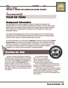
Investigation: Tour de Texas
Teams of Texas tourists gather into groups to analyze what they can do with $50 worth of an alternative fuel. They write checks, keep a balance sheet, and map out their sight-seeing route taking into consideration the location of...
Curated OER
Geological Maps of the Western Regions
Students study the geological makeup of the West. In this geological maps lesson students creat a map that includes a key and present it to the class.


