Curated OER
Electronic Mapping
Students identify countries, oceans, and capitals by building an electronic map.
Curated OER
Mapping My Spot in History
Students create their own town's history. They place themselves on the map in a literal as well as figurative sense. Students produce portions of an updated version of an early twentieth century panoramic map. Students gather information...
Curated OER
Creating Mind maps
Middle schoolers discuss their impressions of Africa. They work in groups to create a mind map. Students are explained what a mind map is. They discuss what they think are the defining features of the continent of Africa. Middle...
Curated OER
Orienteering - Lesson 3 - Topographical Maps and Contour Lines
Learn how to read a topographical map and understand what the contour lines mean. Explore longitude and latitude. Find a cliff, a valley, a mountain peak, and more. This is just one of the ten lessons in this unit on oreinteering....
Curated OER
Making Cranberry Bread
While the preparation for this lesson plan is extensive, the results are well worth the effort. Prior to the lesson plan, Xerox the pictures from Cranberry Thanksgiving by Wende and Harry Devlin, collect the ingredients for Cranberry...
Curated OER
Landscape Picture Map: Making a Map Grid
Young scholars create a map grid system. In this map activity, students discuss how mapmakers use a grid system to make giving directions easier. Young scholars learn how the grid system works and create a grid system on their landscape...
Curated OER
Making Lewis and Clark's Journals Come Alive
Students are presented daily excerpts from Lewis and Clark's experiences. The dates and activities are tracked on a classroom map.
Curated OER
Analyzing Two Dances and Making a Dance Map: The Nutcracker
Students discuss dance elements and create a dance map. They choose a dance theme and incorporate movement into their dance maps and choreography. They also experiment with different types of music.
Polar Trec
Mini-Ocean Bathymetric Mapping Research Cruise
Middle or high schoolers transform into oceanographers in a week-long simulation. To begin, each group follows directions to create a model of the ocean floor with specified features. Next, the groups prepare to set sail on a research...
Mathematics Assessment Project
Modeling: Making Matchsticks
Math: The only subject where the solution to a problem is seven million matches. Young scholars first complete an assessment task estimating the number of matches they can make from a tree of given dimensions. They then evaluate provided...
National Endowment for the Humanities
Hopi Place Names
What's in a name? Historians consider the question as they examine places important to the Hopi people and the meanings of their place names. Included worksheets include maps and charts to help class members examine the geography of Hopi...
Curated OER
Vocabulary Multiple Choice. Worksheet 22
In this vocabulary activity, students select the best of four choices to complete each of eight sentences. The activity is intended to be used with advanced English language learners.
Social Media Toolbox
Ethical Decision Making
When faced with a dilemma, how do journalists decide how much news to use? Social media scholars explore the philosophies of ethical resolution in the first of a 16-part Social Media Toolbox series. Partnered pupils use a Potter Box to...
The New York Times
Making Do: Learning and Growing Through Adversity
What is it that makes people keep going when they face challenges in life? Ask your class to consider this question in relation to their own experiences and as they read material from The New York Times. Using personal experiences...
Curated OER
Observation and Inference
Assess your young scientists' understanding of the difference between observation and inference with this 20-question multiple choice quiz. It reviews a variety of physics and astronomy concepts, such as solar eclipses and sunspots, the...
Centers for Ocean Sciences
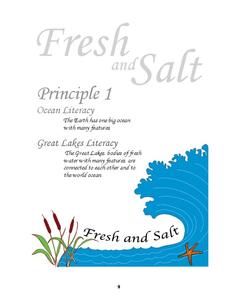
Ocean and Great Lakes Literacy: Principle 1
Is your current lesson plan for salt and freshwater literacy leaving you high and dry? If so, dive into part one of a seven-part series that explores the physical features of Earth's salt and freshwater sources. Junior hydrologists...
Curated OER
Making Topographic Maps and Mountain Profiles
Students study how to mark inclines and construct a mountain profile. In this topographic map lesson students mark contour intervals and draw mountain profiles.
Curated OER
Understanding: Geography
Students explore their neighborhoods. In this geography instructional activity, students make a map of their neighborhood. They must include a key, natural terrain, buildings and streets. They also write a descriptive paragraph about...
Curated OER
What Makes a Map?
Learners, in groups, brainstorm to find what makes up a map, what kind of information can be "read" from a map, who might use a map, how their world is defined or helped by maps, etc. They make a map of their "world."
Curated OER
Comprehension: Identify Story Grammar
This fully scripted lesson could be a big help for someone new to teaching Kindergarten. It outlines what you should do and say as you teach grammar and literary elements such as, main character, setting, and events through reading. The...
Novelinks
The Giver: Reading Road Map
Sometimes it's helpful to read certain passages in a novel slowly and carefully, and to read other parts more quickly to move the plot along. Learners tread carefully through Chapter 20 of Lois Lowry's The Giver, noting which...
Curated OER
Reading Comprehension 5: Level 8
Why is an atlas called an atlas? Because it is named for the Greek Titan, Atlas, of course. Young readers learn all about Atlas and atlases in a short passage used as the basis of a reading comprehension exercise. After responding to...
Curated OER
Finding Your Way Around the World
Students plan a trip around the world and create a PowerPoint presentation of the journey. In this map, atlas, and technology instructional activity, students plan a trip around the world in which they avoid using an airplane. Students...
Little 10 Robot
Geography Drive USA™
A trivia-style virtual road trip in which the player's car is moved from state to state as questions are correctly answered. Ideally, a player would learn about different states by reading the simple brochures available in the...
Other popular searches
- Making Maps Geography
- Making Maps and Research
- Making Maps Using Technology
- Making Maps of History
- China, Making Maps
- Making Maps of Community
- Reading Making Maps
- Neigborhoods and Making Maps
- Making Maps Lesson Plans
- Making Map Scales
- Making Maps Usign Technology
- Making a Map Project


