Curated OER
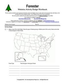
Forester
In this forester activity, students illustrate a map that shows the types of forests growing in various parts of the country. They also identify six forest trees common to the area where they live and explain how both wildlife and humans...
Curated OER
The Korean War - A Time Line Activity
Students create a Korean War time line. They identify, describe, and label nine of the key events and turning points of the Korean Conflict. They include all nine events listed on the direction sheet, contain a title, and have at...
Curated OER
Filling in the Picture
Students study archaeological sites. They discover some of the problems inherent in choosing sites and what parts are chosen for excavation. They evaluate and explain their choices for study and articulate the process of archaeological...
Curated OER
Family Life in a Village in Bangladesh
In this Bangladesh worksheet, students read about the lives of men and women and the weather in Bangladesh. They then take that information to create a poster. Maps are also provided.
Curated OER
Navigating by the Numbers
Students observe how math is important in navigation and engineering. They study how surveyors use math and science to calcute, count, measure, label, and indicate distances on a map. They estimate specific distances.
Curated OER
Inuit and Arctic Animals
Students will explore the animals and people living in the Arctic. In this science lesson, students locate Alaska on a globe, discuss its climate and geographical features, and identify common arctic animals. Students complete the first...
Curated OER
Presentation of Family Shield or Crest
Students present their family shield or crest that was created during the first part of this lesson. In this historical arts lesson, students present their family shield to their classmates and are graded based on the included...
EngageNY
Sequencing Rotations
Discover the result of a sequence of rotations about different centers. Pupils perform rotations to examine the patterns. They also describe the sequence of rotations that performed to reach a desired result in the ninth installment in a...
PBS
Make a Balloon Globe
"We've got the whole world in our hands," is what your students will be singing after completing this fun geography activity. Using the included templates for the seven continents and a balloon, they create their very own globes.
Scholastic
Hill of Fire Teaching Plan
Some books are perfect for drawing connections between multiple subjects. The book Hill of Fire becomes the hub for three very different, yet related activity ideas. First the class hones their oral language skills by creating an...
EduGAINs
Go H2O! Investigating Residential Water Systems
Before your learners excuse themselves to get a drink at the water fountain, prompt them to think about where that water comes from. A middle school science lesson encourages groups to research their community's source of drinking water,...
EngageNY
Definition of Translation and Three Basic Properties
Uncover the properties of translations through this exploratory instructional activity. Learners apply vectors to describe and verify transformations in the second installment of a series of 18. It provides multiple opportunities to...
Curated OER
Geography and Artifacts of Mexico
Students review the structure of government in Mexico and discuss how it is different than the United States. Using artifacts, they must label and identify the city or state in which the artifact originated. They use the artifact clues...
Curated OER
The Dynamic Earth
Students participate in assessments related to the layers of the Earth. They read chapters of text, answer questions, watch videos, and identify and label continents and oceans on a map. They design posters, create vocabulary cards,...
Curated OER
Displaying the Data
Students gather facts about their parent's families through the completion of parent interview forms. Using tally marks, the data gathered is counted, transferred to graphs and used to create family timelines.
Curated OER
Geographic Regions of Arkansas
Students examine maps that illustrate the various regions in Arkansas. They label the individual regions on a blank map that is divided into the regions and color each region a different color. Groups research a region and create a...
Curated OER
U.S. geography for Children: New York
In this geography worksheet, 5th graders study the state of New York. Students follow the given directions to complete 5 tasks on the state map that is given.
Curated OER
Continents and Critters
Students investigate and identify the continents of the world. They identify and locate the seven continents on a map, and label a coloring page of a world map. Students then conduct research on an assigned continent, and write and...
Curated OER
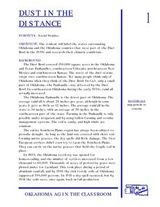
Dust In The Distance
Students are introduced to the events of the Dust Bowl. Using a map, they locate and label all of the states surrounding and including Oklahoma. After also labeling the counties in Oklahoma, they use the internet to research the...
Curated OER
The Exploration and Settlement of North America
Students locate place in Canada and explore highlights of early of early American exploration and settlement. In this North American history instructional activity, students locate provinces, major cities, and physical features...
Curated OER
Utah History & Geography
Fourth graders calculate and determine the distances between counties in Utah. Using a map of Utah, they determine the distance between three county seats, the total distance round trip, and label a map with the distances.
Curated OER
Where Do Hurricanes Happen?
In this hurricanes worksheet, learners label the 6 different regions that hurricanes and tropical cyclones occur around the world.
Curated OER
Follow the Drinking Gourd
Young scholars listen to the song "Follow the Drinking Gourd" and repeat what they have heard. They discuss the significance of the story and how it relates to Harriet Tubman and the Underground Railroad. They observe a map of areas in...
Curated OER
Comparing Ratios
For this comparing ratios worksheet, students solve and complete 3 different problems using the screens shown. First, they write a ratio that compares the shaded part to unshaded part illustrated. Then, students use the same grid to...
