Curated OER
Coordinates
In this coordinates worksheet, learners analyze two maps and identify the coordinates of ten specific locations. Students plot sixteen points on a graph and check their answers online at the end of each exercise.
Curated OER
Observing and Identifying Matter
In this observing and identifying matter worksheet, students use a cookie in a bag and list 10 different descriptions of the cookie. They draw and label their cookie and given the cookie in the bag to their teacher who mixes all the...
Curated OER
Social Studies: Lesson 2
Students explore the beginning of Communism. For this World History lesson, students exhibit their knowledge of Communism and the Marshall Plan through completion of a map activity.
Curated OER
Describing A Place - Part I The British Isles
In this describing place worksheet, students label the cardinal and ordinal directions on a compass rose using the drop-down menus. They complete a matching activity by matching an item from column C with one in A and B. They read an...
Curated OER
Family Life in a Village in Bangladesh
In this Bangladesh worksheet, students read about the lives of men and women and the weather in Bangladesh. They then take that information to create a poster. Maps are also provided.
Curated OER
Roundtable
Fifth graders apply the Five Themes of Geography as they relate to the U.S., the world, and specific places in United States history. They recognize and label geographical locations on a map of the United States.
Curated OER
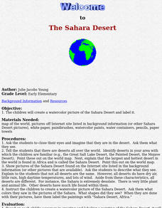
The Sahara Desert
The children will create a watercolor picture of the Sahara Desert and label it.
Curated OER
The Brief American Pageant: The Planting of the English America
A series of maps illustrate the early growth of English America, which includes the Maryland, Virginia, Carolina, and Georgia colonies. Settlements such as Jamestown, Roanoke, and Charleston are labeled on the map, allowing a teacher or...
Curated OER
The 50 States and its Holidays
Though the format of this ELL lesson is confusing (the standards listed are for plate tectonics, yet the objectives are for American geography and holidays), a teacher could glean some ideas from the main idea. Here, pupils complete a...
Curated OER
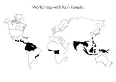
World Map With Rain Forests
In this geography worksheet, young scholars study a map of the world which shows shaded areas indicating where the rain forests are located. There are no labels for countries or continents.
Curated OER
Making Globes
Fifth graders construct and design paper mache globes. They paint and draw the continents and oceans, and label each continent and ocean.
Curated OER
Intermediate Sentence Completion 16
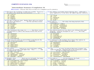
Although this worksheet is labeled for intermediate English language learners, I'd argue the vocabulary is more appropriate for advanced learners. The pupil reads each sentence and selects the appropriate word to complete the sentence....
Curated OER
World Map and Globe - Four Main Directions
Students study the four main directions on a map. In this map lesson, students locate the North and South pole, and learn the four cardinal directions. They use the compass rose on a map to help with the directions. (Map is not included...
Curated OER
Europe after World War I
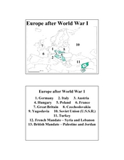
In this Europe after World War I map worksheet, students note the 11 regions of the Europe labeled on the map.
Curated OER
2 Cities: Europe's Capital Cities
In this European cities worksheet, students label the countries and then provide an alphabetical key for each country. Students then label each capital city and provide a numerical key for each city.
Curated OER
Washington
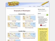
In this social studies worksheet, students label places on a map of Washington state. There are other worksheets on this link, including a scrambled places, word search and a crossword puzzle of places in Washington.
Curated OER
Direction and Angle: Positions and Directions
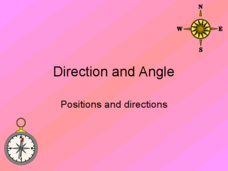
This is an interesting mix of concepts. Half of this presentation provides double-digit addition and subtraction practice and the other half has students discuss cardinal directions and right angles. Use these together, or use them on...
California Polytechnic State University
Australian Geography Unit
At the heart of this resource is a beautifully detailed PowerPoint presentation (provided in PDF form) on the overall physical geography of Australia, basic facts about the country, Aboriginal history, and Australia culture and lifestyle.
Curated OER
Instruments From Around the World
How much does the environment affect how and what man creates? Children explore the effect of the environment on primitive man as they research raw materials from a specific location. They use their findings to write a short essay about...
PBS
Make a Balloon Globe
"We've got the whole world in our hands," is what your students will be singing after completing this fun geography activity. Using the included templates for the seven continents and a balloon, they create their very own globes.
EduGAINs
Go H2O! Investigating Residential Water Systems
Before your learners excuse themselves to get a drink at the water fountain, prompt them to think about where that water comes from. A middle school science lesson encourages groups to research their community's source of drinking water,...
Curated OER
Hidalgo's Fight for the Independence of Mexico
Tenth graders study and examine the life of Miguel Hidalgo while working to identify major themes. Small groups create sequence of event chains, analyze and label maps of Hidalgo's travels, and work together to create giant chalk maps...
Curated OER
Geography and Artifacts of Mexico
Students review the structure of government in Mexico and discuss how it is different than the United States. Using artifacts, they must label and identify the city or state in which the artifact originated. They use the artifact clues...
Curated OER
Follow the Drinking Gourd
Students listen to the song "Follow the Drinking Gourd" and repeat what they have heard. They discuss the significance of the story and how it relates to Harriet Tubman and the Underground Railroad. They observe a map of areas in the...
Other popular searches
- Map Labeling
- Africa Map Labeling
- Midwest Map Labeling
- Geography Map Labeling
- Labeling a Map Continents
- Blank Labeling Maps
- Labeling Maps Pangaea
- Labeling Map Parts


