Curated OER
Louisiana
Third graders study factual information about Louisiana including the state flag, bird, tree, and important geographical points using the Internet and maps. They explain the different groups that settled the state in this mini-unit.
Curated OER
Assessing and Making Maps
Students evaluate maps using the TODALSIGs basic map analysis system, explained on the worksheet. They create a map of Alaska using TODALSIGs. Students brainstorm the elements of maps.
Curated OER
Getting to Know the Kwakiutl Indians
Third graders identify who the Kwakiutl Indians were and where they lived. They describe the way of life of the Kwakiutl and identify the natural resources used by the Kwakiutl, and describe the Kwakiutl's beliefs about nature.
Curated OER
Ancient Egypt
Seventh graders examine the cultural expressions, cultural structures, and basic needs of the ancient Egyptians. They explore Egyptian religion, government, and daily lives of the various classes and how the geographical, social, and...
Curated OER
50 States: New England States
Students discover where certain states are located and what the look like. They look for their information on a web site. Each student is assigned a state which they must research then present to the entire class.
Curated OER
Where Am I - Navigation and Satellites
Students explore geography by completing a navigation activity in class. In this satellite positioning lesson, students define terms such as orbit, satellite, GPS and triangulation. Students view diagrams of the Earth's orbit and...
Curated OER
Ecology
In this ecology worksheet, students read information about ecology and the nine ecology subdivisions and answer comprehension questions. Students answer ten questions in this matching and fill in the blank worksheet.
Curated OER
Great Lakes at Stake
Students explore conservation of the Great Lakes. In this geography and ecology lesson plan, students identify the Great Lakes on a map and view a video depicting the history and importance of these lakes. Students work in groups to...
Curated OER
Social and Cultural Issues in the Civil Rights Movement
Middle schoolers watch videos, listen to speeches and analyze the information that is presented about the civil rights movement. They examine visual art of the period.
Curated OER
Climographs
Learners identify trends and characteristics of climate zones and specific places within. Then, they graph annual climate trends (primarily Temperature and Precipitation) and create, interpret and extrapolate information based on...
Curated OER
Biomimicry, Nature: Architecture of the Future
Students explore the relationship between nature and architecture. For this cross curriculum history, culture, and architecture lesson, students observe and discuss structures visible in nature. Students view websites in which Native...
Curated OER
G'Day Mate
Students understand that Australia is the smallest continent, locate it on a map and sing about the continents. In this Australia lesson, students listen to facts about Australia and complete a book about information they have learned.
Curated OER
Science: Discovering Sharks
Students incorporate some basic information regarding ocean life and ecological conservation into their "earth watch" lives.
Curated OER
U.S. History: What Happened Here?
Students apply the global positioning system to create maps of local historical sites. By collaborating with local historical groups, they research events and relate them to broader, national history. In addition to writing essays...
Curated OER
Show Me the Way To Go Home
Learners place a pencil perpendicular to the ground and trace its shadow between 11:30 AM and 12:30 PM. They measure the length of the shadow, periodically over several hours, in either English or Metric units. Using the data, they find...
Curated OER
Marine Protected Areas
Students design a research project about a Marine Protected Area they chose. In this marine biology lesson, students gather fish count and catch data then graph them. They create an information poster about their findings.
Big Kid Science
Eclipse Classroom Activities: Cultural Significance Project
What better way to celebrate eclipses than across cultures? Explore myths of solar and lunar eclipses from ancient cultures like the Chinese, Ancient Greek, Mesoamerican, Incan, Egyptian, Ancient Babylonian, and Middle Eastern. Learners...
Curated OER
Radiation Comparison Before and After 9-11
Using the NASA website, class members try to determine if changes could be detected in cloud cover, temperature, and/or radiation measurements due to the lack of contrails that resulted from the halt in air traffic after the attacks...
Agriculture in the Classroom
Wad-a-Watershed
What kind of impact do humans have on watersheds? Find out in a lesson that defines, explores, and promotes ways to protect our watersheds. The ultimate goal of the lesson is for learners to discover how a watershed is impacted by...
Aurora Trust
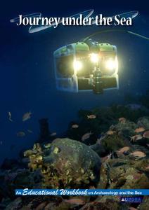
Journey Under the Sea
Discover the interesting world of maritime archaeology and explorations under the sea with this nice set of worksheets, which cover such topics as search tools and techniques of underwater archaeology, carbon dating,...
Curated OER
Australia, Oceania, and Antarctica Today
Students explore the importance of research in Antarctica, then explain how snow becomes part of the Antarctic ice cap. They explore Antarctica's harsh environment and discover how scientists drill ice cores and what information ice...
Curated OER
The Physical Geography of Australia, Oceania, and Antarctica
Students access information from the United States Geological Survey's Web site This Dynamic Earth to research the Ring of Fire. They answer four questions and then apply what they have learned to create a bulletin board display.
Curated OER
The Physical Geography of Southeast Asia
Students access information from the Destination Indonesia Web site to explore the island nation of Indonesia. They answer four questions and then write two full-page journal entries about one or more travel destinations in Indonesia.
Other popular searches
- Gis Data
- Gis Map
- Gis Software
- Gis Environment
- Gis and Gps Technology
- Gis Gps
- Gis and Remote Sensing
- Gis Data Map
- Geography, Gis
- Gis Lesson Plans
- Gps/gis
- Gis Water


