Curated OER
A "Sweet" Lesson in Economics
Students discover how to determine the flavor of a jellybean using different key documents. In this economics lesson, students discuss Virginia economics and begin an activity in which they will help decide on the what jellybean flavors...
CCEA
Home Economics: Teen Building
Learners explore the emotional and nutritional needs of teenagers in a six-lesson unit, which covers such topics as food sources, cooking skills, emotional well-being, and the positive effect of food and family occasions.
Baylor College
Mapping the Spread of HIV/AIDS
Where is HIV/AIDS most prevalent and what are the current trends regarding HIV? Have groups work together to map the world's HIV/AIDS rates, then create a class map with all the data. Lesson includes cross-disciplinary concepts including...
Curated OER
What Do Maps Show?: Lesson 1 Introduction to Maps
Students brainstorm a list of the different types of maps they have seen or used. Using the activity sheet, they look through a social studies book to find all the maps and to determine what they are used for. Using a poster, they review...
Delegation of the European Union to the United States
The European Union’s Economic and Monetary Union
What are the benefits of using the Euro, the EU's common currency? What are the challenges faced? As their examination of the European Union continues, class members investigate the impact on how the switch to the Euro impacted...
Curated OER
Way to Go! Create a Road Map Game
Learners create a travel game of one of the United States. They research a state of their choice and create a travel game using a common road map. They interpret map symbols as they calculate map mileage for their games. They create...
Tennessee State Museum
An Emancipation Proclamation Map Lesson
Did the Emancipation Proclamation free all slaves during the Civil War? Why was it written, and what were its immediate and long-term effects? After reading primary source materials, constructing political maps representing information...
Library of Congress
Marco Paul's Travels on the Erie Canal: An Educational Voyage
Following the book, Marco Paul's Travels on the Erie Canal, readers complete an activity for each chapter, take part in discussions, and respond to several questions. To show what they know, scholars create an alphabet book using primary...
Curated OER
Map It!
Fourth graders demonstrate map making skills by using the computer to create maps of the geographic features, regions, and economy for their state.
Curated OER
First You Take an Ecumene
Although this was written regarding Canadian agriculture, it can be used in any agriculture or environmental science class. Learners evaluate agricultural and economic activity maps and consider land use competition. Activities that get...
Federal Reserve Bank
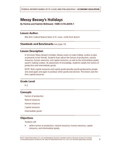
Messy Bessey's Holidays
Teach your class some fairly complex terms—factors of production, human resources, capital resources, natural resources, and intermediate goods—with a storybook (Messy Bessey's Holidays), plenty of visuals and handouts, and related...
Curated OER
Where We Live
Students forecast future population growth of the U.S. Virgin Islands. In this U.S. Census lesson plan, students explain the factors that influence population density on the U.S. Virgin Islands, including geography and economic activity.
Curated OER
Oil: The Problem or Solution to the World's Economic Future
Learners map the major oil producing and consuming countries and regions. They identify current and future topographic and political problems that could affect the production and transportation of oil.
Curated OER
The Branding of America (And Your State)
Students investigate about the origins of some major U.S. brands. They explore local products that stimulate the economy. Students create a map showing where those products originate. Students discover the products that their local area...
Curated OER
A world of oil
Students practice in analyzing spatial data in maps and graphic presentations while studying the distribution of fossil fuel resources. They study, analyze, and map the distribution of fossil fuels on blank maps. Students discuss gas...
National Endowment for the Humanities
Lesson 3: On the Road with Marco Polo: From Hormuz to Kashgar
Young explorers examine the route that Marco Polo and his father traveled to reach China. They examine online maps of the Silk Road and harsh terrain of Afghanistan to determine challenges that may have been encountered during travel.
Curated OER
Mapmaker, Mapmaker, Make Me a Map!
Students evaluate the different types of historical and geographical information that one can gather through close study of historical maps from the 16th through the 19th centuries. They create their own maps.
Smithsonian Institution
A Ticket to Philly—In 1769: Thinking about Cities, Then and Now
While cities had only a small fraction of the population in colonial America, they played a significant role in pre-revolutionary years, and this was certainly true for the largest city in the North American colonies: Philadelphia. Your...
National Park Service
Leave it to Beavers
Many people know cats mark their territories by rubbing the back of their necks to leave a scent, but not many people know beavers also leave a scent to mark their territories. During the first activity of two, scholars use their noses...
Curated OER
Call to Arms: A Service Project
Sick of selling candy and washing cars? How about hosting a Digital Day or a Learning Lunch? The suggestions here make fund raising fun and rewarding. Raise money to preserve important maps and other primary source documents.
Curated OER
Mapping Community Values
Students discuss the origin of various maps focusing on the values behind them. Students also explore how human needs and geography influence community settlement patterns. Students extend learning by creating and mapping their own ideal...
Curated OER
Kinds of Maps
In this map worksheet, students match a set of descriptions with the names of different types of maps and answer true/false questions and short answer questions about using maps.
Curated OER
Science Inquiry Lesson: Mapping Project
Students explore the methods of creating maps. They create a map of Animas River Park using a compass and measuring tape, develop a single map from the team map sections, and devise another map of the Animas River Park using a GPS unit.


