Texas State Energy Conservation Office
Investigation: Concept Mapping Fuels
After reading an article, "Fuels for Everything," collaborative groups create a concept map poster of the transportation and non-transportation fuels. This makes a strong introduction to the different types of fuels used for transportion...
Kate Stickley
Reading the World: Latitude and Longitude Lesson latitude and longitude, maps, coordinates on a map, prime meridian, reading maps, equator, globes
Find five activities all about longitude and latitude! Use oranges to show the equator and prime meridian, plot birthdays on a map using coordinates, and plan a dream vacation.
PBS
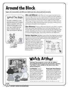
Around the Block
Arthur and his friends help children explore the concepts of family, community, and diversity in a fun series of activities. From performing peer interviews to mapping out the different places students have lived or visited, this...
Institute for Geophysics
Understanding Maps of Earth
Here is your go-to student resource on primary geography concepts, including facts about the surface of the earth and its hemispheres, latitude and longitude, globes, types of maps, and identifying continents and oceans.
Novelinks
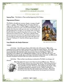
The Hobbit: Concept/Vocabulary Analysis
Considering using Tolkien's The Hobbit for book circles or whole-class reading? Check out this packet that provides an overview of the novel, some interesting background materials, and links to additional resources.
Curated OER
Storyboards: The Director's Map to a Video Project
Class groups collaborate to produce the storyboard for their video project. After determining the sequence of scenes, the camera angles, and characters in each scene, each group member is assigned a number of scenes to illustrate. When...
Curated OER
Convergence with The Cay: Exploring Geographic Concepts Wrapped in a Story
Here's an awesome unit that uses The Cay as the anchor text. The 16-page packet is loaded with teaching ideas, activities, and suggested adjustments.
Rainforest Alliance
Knowing the Essential Elements of a Habitat
To gain insight into the many different types of habitats, individuals must first get to know their own. Here, scholars explore their school environment, draw a map, compare and contrast their surroundings to larger ones. They then...
Curated OER
Designing a Hiking Trail
Put your students' map skills to the test with this engaging cross-curricular project. Given the task of developing new hiking trails for their local community, young cartographers must map out beginner and intermediate...
BrainPOP
Latitude and Longitude Differentiated Lesson Plan
Scholars warm-up their map skills with a discussion using location words to describe familiar places. An engaging video informs class members about latitude and longitude. Three leveled activities extend the learning experience for...
Baylor College
Pre-Assessment Activity: What Do You Know About Microbes?
In an introductory lesson, youngsters take a pre-assessment quiz, get a grasp of a gram of mass, and then estimate the mass of microorganisms that live within a human body. Using Glo Germ™, a material that allows you to simulate the...
101 Questions
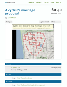
A Cyclist's Marriage Proposal
One cyclist goes to great lengths to make his proposal! Your classes must figure out just what length that is. Using a map with a bike route that spells out Marry Me, learners calculate the total distance of the ride. They base their...
Baylor College
Microbes and Disease
Discuss how diseases have impacted human history. Divide your class into groups and assign each group one of the following: tuberculosis, malaria, plague, cholera, smallpox, and AIDS. They read up on, complete a concept map, and present...
California Academy of Science
Kinesthetic Astronomy: Earth's Rotation
After completing the activity, "Kinesthetic Astronomy: The Meaning of a Year," zoom in on Earth's rotation using the same simulation setup and this outline. Each class member dons a map of the Western Hemisphere and plays the part of...
Rainforest Alliance
Protecting the Critical Habitat of the Manatee and Loggerhead Turtle
Explore ocean habitats with a lesson that showcases the home of manatees and loggerhead turtles in Belize. Here, pupils compare and contrast the homes of ocean animals to those of humans, listen to an original short story about...
Smarter Balanced
American West in the 1800s
To establish a context for an assessment or a study of pioneers and the American frontier in the 1800s, groups examine photos and record observations about clothing, housing, and travel.
DocsTeach
Lewis and Clark's Expedition to the Complex West
Lewis and Clark's famous expedition is a prime example of the United States' westward expansion. Aspiring historians examine maps from Lewis and Clark's journey, as well as discuss their interactions with Native American tribes. The...
Forest Foundation
Forest Watersheds
Where does the water we use come from? To understand the concept of a watershed, class members study the water cycle and then engage in an activity that simulates a watershed.
Virginia Repertory Theatre
The Town Mouse and the Country Mouse
Accompany the story, Town Mouse Country Mouse by Jan Brett with an assortment of activities designed to reinforce concepts covering story structure, comprehension, grammar, and social studies. Here, scholars identify the difference...
Curated OER
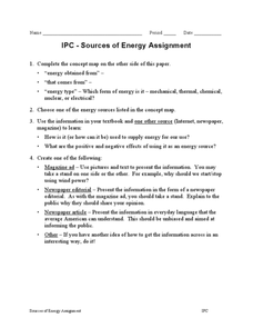
IPC-Sources of Energy Assignment
In this sources of energy worksheet, students complete a concept map and they choose one of the sources of energy in the concept map to research. They create a magazine ad, a newspaper editorial, a newspaper article or any other creative...
Smarter Balanced
Growth and Expansion of America
Despite the difficulty of travel, the US expanded significantly between the 1800s and the early 1900s. To prepare for a performance task assessment on the rapid expansion of the US in the 1800s, class members engage in a...
Curated OER
The Class Trip
Mrs. Moore's class is trying to earn money for a trip to the science museum, but how much more do they need? Solve this problem with your own class as they develop their ability to model real-life situations algebraically. As an added...
It's About Time
Taking a Ride on a Lithospheric Plate
Assist your pupils and broaden their horizons with several activities that determine the exact positioning of various communities over the globe. Pupils use data from the Global Positioning System to determine the position and rate of...
Computer Science Unplugged
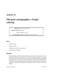
The Poor Cartographer—Graph Coloring
Color the town red. Demonstrate the concept of graph theory with a task that involves determining the least number of colors needed to color a map so that neighboring countries are not represented by the same color. Pupils...


