Curated OER
Mapping Ancient Coastlines
Most of this lesson is spent working on the "Bathymetry Worksheet." It includes a graph of the changes in sea level over the past 150,000 years and a bathymetric map of changes in an imaginary coastline over time. Participants answer...
PBS
Coastline Change
Continental drift happens over millions of years, but new perspective shows much faster changes. An informative resource offers a short term perspective using a series of satellite images. Viewers observe major changes to a coastline in...
Curated OER
Shifting Coastlines
Students study North Carolina's changing coastline during the Paleoindian and Archaic periods and determine the positions of the coastline at different times and decide what types of archaeological information has been lost due to rising...
Curated OER
Biomes: Coastlines and Seas
Students study the different types of coastlines and their territories. In this marine coasts instructional activity students identify life forms that are in the coastal regions.
Curated OER
Fourth Grade Science
In this science worksheet, 4th graders answer multiple choice questions about coastlines, electric cars, the food chain, and more. Students complete 25 questions.
Curated OER
Concept Webs for the Components of a Coastline
Learners describe the components of a coastline. In this lesson on coasts, students brainstorm the various features of a coastline.
Curated OER
Hurricane Watch: How Scientist Analyze Their Effects on Coastlines
Eighth graders are able to evaluate the forces that shape the lithosphere. They explore background information on hurricanes by completing a webquest and answering questions. Students present their reports to the class. The class...
Curated OER
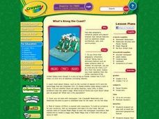
What's Along the Coast?
Students research an area with at least one dominant geographical feature. Then they display their findings in a realistic 3-dimensional presentation. Students also prepare ancillary material to support their project. Finally, they chart...
Curated OER
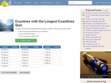
Countries w/ Longest Coastlines Quiz
In this online interactive geography quiz worksheet, students respond to 20 identification questions about world countries with the longest coastlines. Students have 4 minutes to complete the quiz.
Curated OER
Coasts and Reefs: Shallow Marine Processes
A more thorough presentation on coastal systems would be difficult to find! Detailed diagrams illuminate the offshore, shoreface, foreshore, and backshore zones of beach. The sources and movement of sediments along the coastline are...
Curated OER
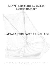
Captain John Smith's Shallop
Young explorers, all aboard the shallop to discover how early European explorers would navigate the American coastline to find resources, map terrain, and trade with Native American tribes.
Curated OER
On the Gulf: Coastlines in Danger
Students study the Mississippi Rover and how it has changed over time. In this environment lesson plan students research and summarize things about the ecosystem of the river.
Curated OER
Conductivity - Pass the Buoy and Pepper, Please
Buoys around our coastlines are equipped with sensory devices which monitor temperature, salinity, and water pressure. Emerging earth scientists examine some of this data and relate salinity to the electrical conductivity of the surface...
Channel Islands Film
Island Rotation: Lesson Plan 1
How do scientists provide evidence to support the theories they put forth? What clues do they put together to create these theories? After watching West of the West's documentary Island Rotation class members engage in a series of...
BBC
Coasts
Youngsters study the variety of ways that coastlines can be eroded. They do this by accessing a website, embedded in the plan, and answering questions found on the pages. This activity is meant to be done individually, so everyone in the...
Curated OER
The Work of Waves and Wind
This is not revolutionary, but it is informative. Earth science viewers in grades 7-12 get carried away with wave and wind erosion. They view diagrams of how waves impact ocean shorelines. They see examples of the different types of sand...
Curated OER
Geography of China (Tibet)
Sixth graders study the geography of Tibet. They create maps of Tibet. Students predict population, land area, water area and coastline length of the United States and Tibet. Students compare and contrast the day-to-day lives of people...
WindWise Education
What Factors Influence Offshore Wind?
What is that out in the water on the horizon? Teams work together to study the coastline using maps to determine the best and worst locations to place an offshore wind farm. The teams then build a scale model wind farm to see what it...
Curated OER
What Happens When Sea Level Rises or Falls
Students examine the impact of sea level on land formations. In this geography and map activity, students construct a contour map model illustrating how much of the clay "coastline" is covered as water is added. Metric measurement is...
Curated OER
Can You SEA Walls?
Learners explore how wave energy that is generated and transferred in the ocean. They explore the aspects of a wave and how its energy affects the ecology of the seashore. Students engage in an activity that uses the nature of science...
Curated OER
Greece
In this comprehension worksheet on Greece, learners read the article presented and then answer the questions that follow. There are 12 short answer questions to complete about Greece, where it is located, the people, celebrations, and...
Curated OER
Across the Landscape
Students create a unique, stunning display of the Earth's landforms. They discuss the many different types of the Earth's landforms such as deserts, mountains, oceans, plateaus, coastlines, and marshlands. Students discuss what...
Channel Islands Film
Island Rotation: Lesson Plan 3
How far have California's Channel islands moved? What was the rate of this movement? Class members first examine data that shows the age of the Hawaiian island chain and the average speed of the Pacific Plate. They then watch West of the...
Curated OER
Draw A Coastline
Middle schoolers identify, locate and draw at least ten different geographical features on a map. Using the map, they must make it to scale and include their own legend and compass rose. They share their map with the class and answer...
Other popular searches
- Marine Coastlines
- Types of Coastlines
- Human Impact on Coastlines
- Coastlines and Beaches
- Ecosystems & Coastlines
- Geography Coastlines
- Australian 4 Coastlines
- Australian Coastlines
- Geography Coastlines


