Curated OER
Orienteering: Map Skills
Students use a map to locate six specific landmarks on a course using a map. They identify how maps can help us and write a paragraph describing how to get from one landmark to another on the map.
Curated OER
Topographic Mapping Skills
In this geography instructional activity, students read an excerpt about topographic maps and why they are useful for various jobs. They also respond to eleven questions that follow related to the excerpt and locating specific map points...
Curated OER
Australia Map Skills
In this Australia map worksheet, students research, find and label the following cities: Canberra, Sydney, Darwin, Brisbane, Adelaide, Hobart, Melbourne and Path.
Curated OER
Orienteering: Map Skills
Young scholars discover orienteering. In this orienteering instructional activity, students search for six specific landmarks. Young scholars brainstorm how maps and landmarks are helpful.
Curated OER
Choropleth Mapping Skills
In this geography worksheet, students identify and describe how to apply choropleth mapping skills. They examine the map given and convert it into a choropleth map through coloring. Then students use those colors to shade in their key...
Curated OER
Map Skills
For this map skills worksheet, students research and label the states in Australia and add in the major cities, oceans and seas.
NASA
Outline Maps
Don't miss this gold mine of blank maps for your next geography lesson! Regions include traditional continents such as Asia, Europe, and Africa, as well as other major world areas such as the Pacific Rim and the Middle East.
Curriculum Corner
Earth Day Book
This Earth Day, celebrate our beautiful planet with an activity book that challenges scholars to show off their map skills, complete a crossword puzzle, write acrostic poems, alphabetize, and reflect on their personal Earth-friendly habits.
Curriculum Project
Comprehension and Discussion Activities for the Movie Rabbit-Proof Fence
Lead discussion and thoughtful analysis as pupils view Rabbit Proof Fence, a drama based on true story about three aboriginal girls who ran away from Western Australia to return to their Aboriginal families in 1931. Here you'll...
World Maps Online
Introduction to the World Map
Students identify the differences between maps and globes. For this map skills instructional activity, students are shown a globe and a map and recognize the differences. Students use post-it notes to locate several locations on the...
National Geographic
Australia, Antarctica, and Oceana
Go on a traveling adventure throughout Australia, Oceana, and Antarctica! This textbook excerpt offers a full unit of study that can easily be supplemented by extra projects or research materials. Learners study maps, read about...
Curated OER
Australia Map Resource Sheet
In this Australia map resource worksheet, students use the map of Australia to supplement their study of the country. They see a map labeled with Australian cities, and the surrounding countries and water bodies.
Curated OER
Math with Maps and Globes
Young scholars round out their math skills with these ‘round the world' ideas. In this math and geography lesson, students try out time zone sticks, a polar race, and tic-tac-globe to engage them in learning more about globes and the...
Curated OER
Australia
In this map of Australia worksheet, students research and study a map of Australia. Students label Australia's regions, major states and important landmarks.
Curated OER
BOLTSS Map
In this geography worksheet, learners identify the six features always used on maps. They identify each of these features by the acronym BOLTSS. Students examine the Melbourne Cricket Ground shown and respond to the 4 questions that follow.
Curated OER
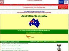
Australian Geography
In this map reading worksheet, students label a map of Australia by adding the names of states and cities. They answer eight questions about the map.
Curated OER
Africa Capitals Map Quiz
In this online interactive geography quiz worksheet, students examine the map that includes 53 African countries. Students match the names of the countries to the appropriate locations.
Curated OER
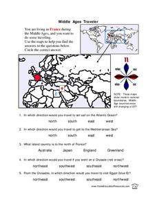
Middle Ages Traveler
In this map worksheet, young scholars are given three maps of France to use to answer multiple choice questions. Students complete an activity from the perspective of a Middle Ages traveler.
Curated OER
Geography Worksheet
In this geography skills worksheet, students respond to 14 short answer questions by using maps and atlases. The maps and atlases are not included.
Curated OER
Continents and Oceans
In this geography worksheet, students read a paragraph and learn about the seven continents and five oceans of the world. Students study a map of the world and answer 12 short answer questions. This is an online interactive worksheet.
Curated OER
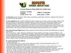
Lesson Plan on Map Skills for South Asia
Seventh graders observe and discuss an overhead transparency map of South Asia. In small groups, they label a blank map of South Asia, and listen to a lecture on the realm.
Curated OER
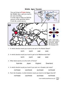
Middle Ages Traveler
In these Middle Ages worksheets, young scholars use the maps to help them find the answers to the questions that help them understand the directions of north, south, east and west. Students also color another map of France according the...
Curated OER
Cultural Mapping
Students are introduced to the cultural diversity in Australia. Using new vocabulary, they define multiculturalism and explore their own cultural backgrounds. In groups, they complete a series of worksheets to develop a better sense of...
Curriculum Corner
Australian Christmas
Where is Australia? How is an Australian Christmas from other Christmases around the world? Learners participate in a mini-research project where they discover what an Australian Christmas is like.


