DocsTeach
Red Record of Lynching Map Analysis
Long before the civil rights movement, leaders were working to secure equal rights. An informative activity explains the 1922 anti-lynching campaign with a map. Scholars analyze the map, complete a worksheet, and participate in group...
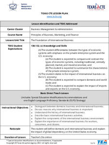
Texas Education Agency (TEA)
Foundation of International Business
Scholars work in teams to research the geography, economic conditions, and cultural factors associated with conducting business in another country. They create a PowerPoint to show what they've learned, and then design a brochure with...
Anti-Defamation League
"What is it Like to be an Outsider?”: Building Empathy for the Experiences of Immigrants
This lesson highlights the struggles of immigrants and the importance of showing empathy. Beginning with a read-aloud of a book in another language and a poem, scholars take part in a thoughtful discussion. Then, the class examines a...
Curated OER
Trade in Precontact Alaska
Students explore the geography of Alaska and its effect on trade. In this ancient Alaska lesson, students participate in a simulation that requires them to trade with those in the territory and outside of it.
Curated OER
MAISA and the REMC Association of Michigan
Students complete online research to study geography's impact on weather. In this geography and weather lesson, students research weather in their city for ten days using an online website. Students bookmark the site, enter data into a...
Curated OER
Athens Versus Sparta
Pupils examine the characteristics of the Greek city-states, Athens and Sparta. They compare and contrast the city-states and compose an essay which includes any similarities and differences of Athens and Sparta.
Curated OER
Rivers Run Through It
Using a relief map of New York State, learners answer questions about the distance between different cities, identify bodies of water, and more. First, they discuss vocabulary related to the Hudson River area. Then, they complete a...
Curated OER
Mapping Where Animals Live
What type of reptiles live in New York State? This lesson gets the class thinking about what factors determine where particular animals live. They analyze the Hudson Valley environment, identify specific reptile and amphibian...
Curated OER
Weather Pals
Students study maps of the United States to locate weather pals from a list of schools. They communicate with Weather Pal schools through the use of closed circuit TV. Using weather data collected in their area, they exchange the...
Curated OER
Native American History
Fourth graders use a previous and current map of the state of Michigan to compare cities and roads. They look for names that come from the Native American culture. They participate in a class discussion to compare findings.
Curated OER
Traveling with Flat Stanley
students use the internet to gather geographical data about a state of their choice. Using new vocabulary, they describe the features present in the state, its climate and attractions. They develop a PowerPoint presentation to share...
Curated OER
Washington Acrostic Poem
In this acrostic poem worksheet, students write a poem about the state of Washington. Students use the letters in WASHINGTON to begin each new line of the poem.
K-State Research and Extensions
Water
How are maps like fish? They both have scales. The chapter includes six different activities at three different levels. Scholars complete activities using natural resources, learn how to read a map, see how to make a compass rosette,...
Mr. Nussbaum
Abraham Lincoln Reading Comprehension—The Middle Years (Part 1)
Learn more about Honest Abe with an informative passage that details his life chronologically. As learners read sections of the text, they answer multiple choice questions that draw on their ability to recall details from the passage.
Curated OER
Landmarks of the Underground Railroad
Students explore Civil Rights by reading several books in class. In this Underground Railroad lesson, students discuss The Story of Henry Box Brown and identify the location and functionality of the Underground Railroad. Students answer...
Curated OER
Geography of the United States
Students examine the population growth of the United States. In this Geography lesson, students construct a map of the fifty states. Students create a graph of the population of the USA.
Curated OER
Social Studies: Regions of the United States
Third graders create Powerpoint presentations of various geographic regions of the United States. They focus on the Northeast, Southeast, and Midwest regions. Students combine their individual slides into a class presentation.
Curated OER
Geography: US States and Capitals Picture/Word #4- Trace the Words
In this geography activity, 3rd graders trace sentences about the capital cities of 5 states. They write sentences about capitals about Topeka, Baton Rouge, and Annapolis.
Curated OER
Geography: US States and Capitals Pictures/Words #2
In this geography worksheet, 3rd graders trace sentences about the capital cities of 5 states. They write sentences about capitals including Hartford, Denver, and Dover.
Curated OER
Geography and Its Five Themes
Geography is not limited to just learning about the Earth and its physical features.
T. Smith Publishing
48 Contiguous States
What do your pupils know about the United States? This resource asks learners to respond to 10 questions about certain states and landmarks. Useful for a geography lesson and to help familiarize your learners with the continent. An...
Curated OER
The Physical Geography of Australia, Oceania, and Antarctica
Students access information from the United States Geological Survey's Web site This Dynamic Earth to research the Ring of Fire. They answer four questions and then apply what they have learned to create a bulletin board display.
Curated OER
United States Map - Lesson 9
Learners explore the concept of cardinal directions. In this geography lesson, students identify the compass rose on a large U. S. map and then discuss the cardinal directions.
Curated OER
Capital Cities Word Search 1
In this United States capital cities word search worksheet, students search the puzzle for 12 capital cities within the United States.
Other popular searches
- State Political Maps
- State of Georgia Maps
- State Outline Maps
- State and Local Maps
- State Outlines Maps


